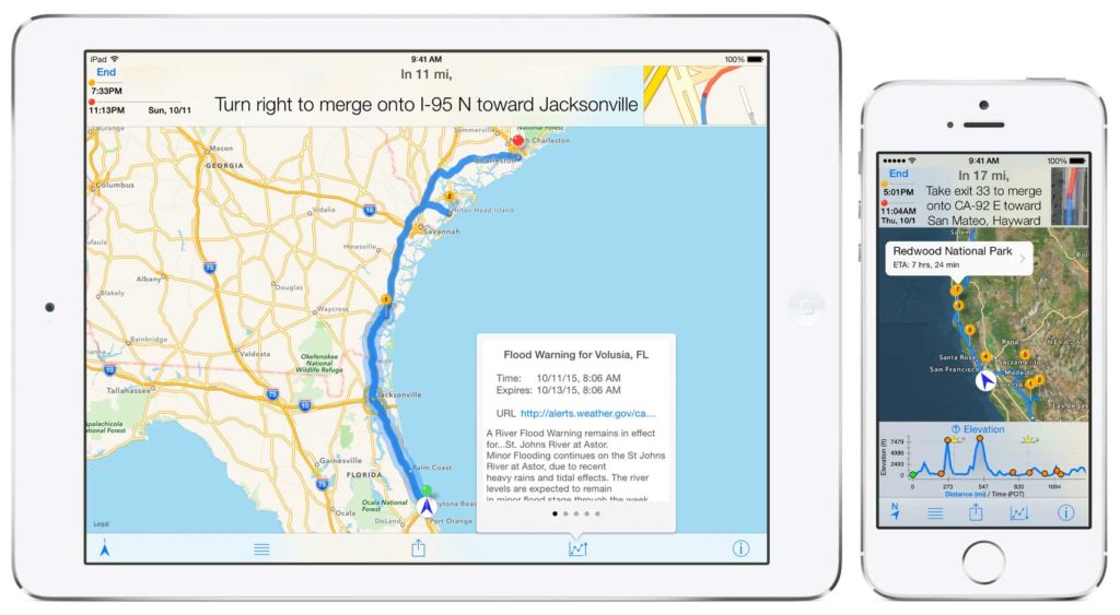
inRoute App for Trip Planning and More
 The new inRoute 5.1 update adds seven custom route types based on the weather, elevation, or curviness of routes. For example, a family planning their summer road trip can create routes with the lowest temperatures or least precipitation; travelers towing a trailer may favor routes with the least elevation gain for a safer, easier drive; and motorcyclists and car enthusiasts can choose routes with the most curves. With the ability to mix and match several route types at different stages of a journey according to the user’s specifications, the possibilities are endless.
Previously featured on the TODAY show and by Apple as a Best New App in Navigation, recent updates to inRoute have added a voice navigation system that automatically checks your route for severe weather, the ability to create and optimize routes with up to 100 locations, and more, making it capable of tackling even the most epic road trips.inRoute is a free download with two purchase levels available: inRoute Premium for $11.99 includes all features for routes with up to 25 locations, and inRoute Pro for $2.99 monthly or $24.99 yearly, which includes all features for routes with up to 100 locations. Developed for iPads or iPhones running iOS 8 or iOS 9.
- Voice guided navigation of up to 100 locations with automatic severe weather alerts (alerts are currently available in U.S. and UK areas)
- Easy reordering of route waypoints, automatically for fastest time or done manually
- Create custom routes based on weather, elevation and curviness, or build your own route from available alternates on each leg of a route
- Interactive charts showing route elevation, curviness, weather (temperature, humidity, precipitation, wind speed/direction, severe weather alerts), and sunrise/sunset times
- Search along a route—the whole route, every x miles/hours, or the next x miles/hours from a place—to find gas, hotels, campgrounds or places to eat close to a route
- Save your favorite routes and places, sync between devices, organize into folders, print via Airprint, and share with family and friends
- Easily add places to the map using a Dropped pin, Search, or Contacts; import addresses from webpages; or import from TXT, CSV, KML or GPX files
- Export to GPS devices and apps compatible with GPX files
- Routes are stored on your device so you can access them even if you lose connection
Stay tuned as we will test the features and see how the app works as we ride around and use it on home devices to plan trips.
