17 days OR to Colorado and back
#11
 07-19-2014, 11:08 AM

Join Date: Apr 2014
Location: Oregon
Posts: 87
Likes: 0
Received 0 Likes
on
0 Posts
#12
07-19-2014, 11:11 AM
Join Date: Apr 2014
Location: Oregon
Posts: 87
Likes: 0
Received 0 Likes
on
0 Posts
OR to Colorado and back – 17 days in June 2014
Here is day 5 to 7
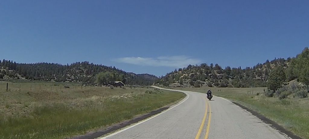
This segment has us leaving Las Vegas after putting a new Tour Pak mount and relaxing a bit (can you relax in Vegas?) before starting our 2-up trip. For days 5-10 we will visit Zion, the Grand Escalante-Staircase, Bryce Canyon, Bridges, Mexican Hat, Monument Valley and then on to Albuquerque, NM to visit friends.
Day 5/6/7 of 17
Rachel to Las Vegas, NV., Via SR 375, SR 318, US 93, US 15, gas in Hiko, NV 10 miles South of SR 318 cutoff) – 150 miles, Interstate, old paved highways
Elevation: 2,001 ft. to 3,898 ft.
…and
Las Vegas, NV to Springdale, UT (Zion), Via US 15, SR 9 – 160 miles, Interstate, paved highways.
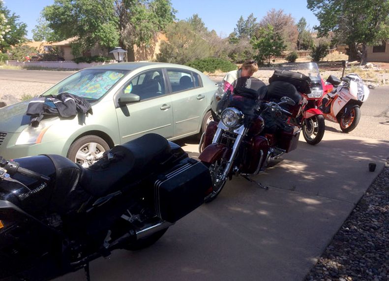
I say goodbye to the Little A’Le’Inn and head for Vegas. What happens here stays here so I won’t get into it. But we do fix the Tour Pak mount and get Linda some cool gear at Red Rock Harley and It’s on to Zion Nation Park.
I’ve posted the Google Maps link for the next few days of the ride on day 6/7 on http://www.motoforever.com/?p=229
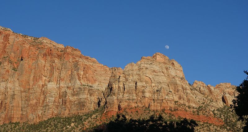
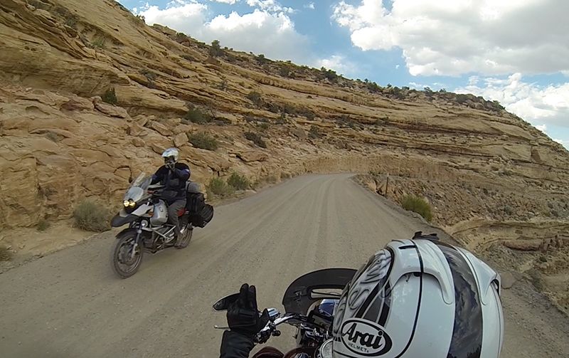
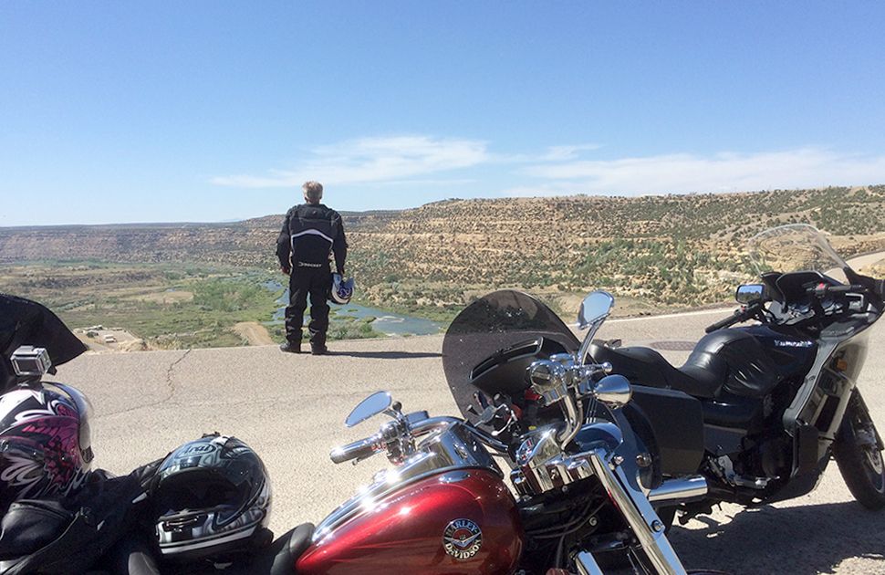
June in Vegas equals 100 degrees, so that’s how we start out. We head up US 15 past the Nascar track and point it toward Utah. Lots of construction on this road, but it doesn’t really slow us down. We get to St. George fairly fast. We were here a couple years ago, so don’t take time to hang out or see anything. We really want to get to Zion early and take our time at the park. As you get close to Zion, the views are amazing. The canyons get bigger heading to the east. The anticipation builds along with it. Then all of a sudden you are in Springdale, UT (Zion’s entrance). We are in so much awe of the surroundings that we forget we are on a moto ride. Just soaking it in.
Springdale is a fairly uptown place.
Nice restaurants, expensive hotels, lots of people and lots of things to do and see. We stay at the Canyon Ranch motel, excellent value and bike friendly parking. The motel is strategically placed on a bus stop (you need to take the bus to see Zion) and is also close to food and ice cream.
We stay in Springdale for 2 nights to see the sights, do some hiking and start our first leg together very relaxed. It gives us a chance to unpack, make sure we have our act together, play with the GoPro camera and generally use the first couple days as a practice run. Remember this is our first touring trip together and Linda’s first moto trip longer than a couple of days.
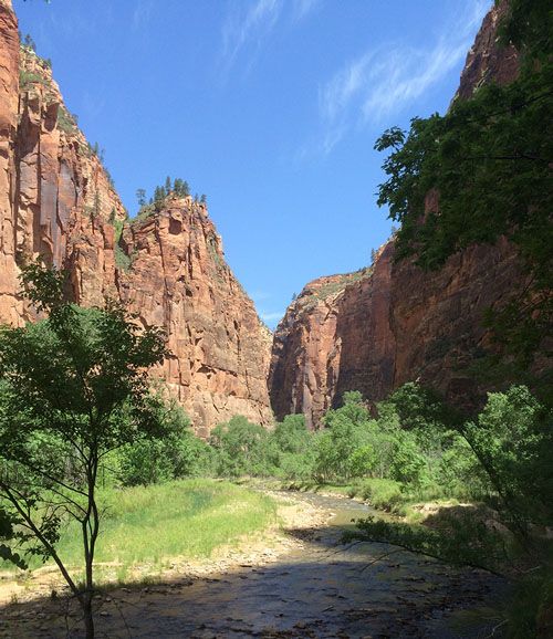
Zion is a great stopover. I met a few other bikers travelling and staying here for a stopover. There is a twisty (real twisty) road that goes up the canyon wall. We take it for the canyon overlook view. We do this ride twice… once during our time at the park and once as we leave toward Bryce Canyon. Linda gets more of the view since I am trying to stay on the road.
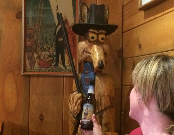
Wildcat ******* is great for their food and beer…
Next update is over the Grand Staircase-Escalante! And on to Mexican Hat thru the Moki Dugway.
Here is day 5 to 7
This segment has us leaving Las Vegas after putting a new Tour Pak mount and relaxing a bit (can you relax in Vegas?) before starting our 2-up trip. For days 5-10 we will visit Zion, the Grand Escalante-Staircase, Bryce Canyon, Bridges, Mexican Hat, Monument Valley and then on to Albuquerque, NM to visit friends.
Day 5/6/7 of 17
Rachel to Las Vegas, NV., Via SR 375, SR 318, US 93, US 15, gas in Hiko, NV 10 miles South of SR 318 cutoff) – 150 miles, Interstate, old paved highways
Elevation: 2,001 ft. to 3,898 ft.
…and
Las Vegas, NV to Springdale, UT (Zion), Via US 15, SR 9 – 160 miles, Interstate, paved highways.
I say goodbye to the Little A’Le’Inn and head for Vegas. What happens here stays here so I won’t get into it. But we do fix the Tour Pak mount and get Linda some cool gear at Red Rock Harley and It’s on to Zion Nation Park.
I’ve posted the Google Maps link for the next few days of the ride on day 6/7 on http://www.motoforever.com/?p=229
June in Vegas equals 100 degrees, so that’s how we start out. We head up US 15 past the Nascar track and point it toward Utah. Lots of construction on this road, but it doesn’t really slow us down. We get to St. George fairly fast. We were here a couple years ago, so don’t take time to hang out or see anything. We really want to get to Zion early and take our time at the park. As you get close to Zion, the views are amazing. The canyons get bigger heading to the east. The anticipation builds along with it. Then all of a sudden you are in Springdale, UT (Zion’s entrance). We are in so much awe of the surroundings that we forget we are on a moto ride. Just soaking it in.

Springdale is a fairly uptown place.

Nice restaurants, expensive hotels, lots of people and lots of things to do and see. We stay at the Canyon Ranch motel, excellent value and bike friendly parking. The motel is strategically placed on a bus stop (you need to take the bus to see Zion) and is also close to food and ice cream.
We stay in Springdale for 2 nights to see the sights, do some hiking and start our first leg together very relaxed. It gives us a chance to unpack, make sure we have our act together, play with the GoPro camera and generally use the first couple days as a practice run. Remember this is our first touring trip together and Linda’s first moto trip longer than a couple of days.

Zion is a great stopover. I met a few other bikers travelling and staying here for a stopover. There is a twisty (real twisty) road that goes up the canyon wall. We take it for the canyon overlook view. We do this ride twice… once during our time at the park and once as we leave toward Bryce Canyon. Linda gets more of the view since I am trying to stay on the road.

Wildcat ******* is great for their food and beer…

Next update is over the Grand Staircase-Escalante! And on to Mexican Hat thru the Moki Dugway.
#13
07-21-2014, 11:06 PM
Join Date: Apr 2014
Location: Oregon
Posts: 87
Likes: 0
Received 0 Likes
on
0 Posts
OR to Colorado and back – 17 days in June 2014
Here is day 8 to 10 (also posted on http://www.motoforever.com/?p=248)
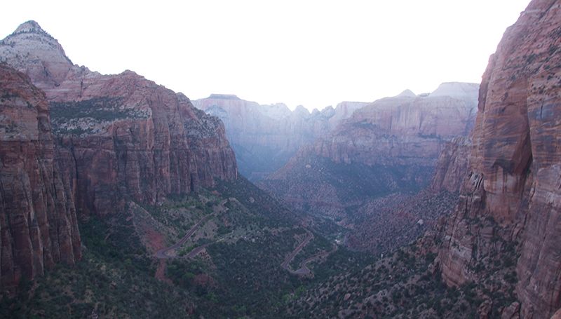
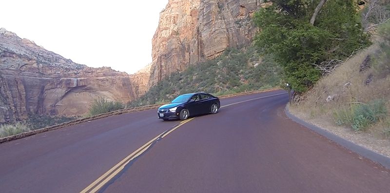
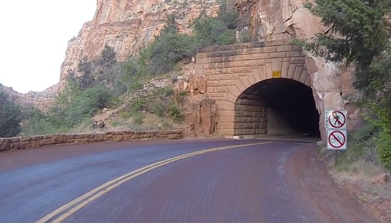
We are leaving Zion and heading into the Grand Staircase-Escalante. The road out of Zion on SR 12 is twisty as it goes up the canyon to the overlook. You’ll go through a 2-mile tunnel. At the top, I recommend doing the 1-mile hike to the canyon overlook. It’s a fantastic view and you get to see the switchback road that you just rode up. We had to stop before entering the tunnel for about 15 minutes! Time to stop the bike, take off the helmet and talk with neighbors for a bit. Apparently they do one-way traffic when there are oversized loads going through.
Leaving Zion toward the tunnel
Zion Tunnel, the views end for 2 miles.
Day 8 of 17
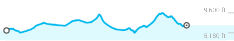
Springdale to Torrey, UT, Via US 89, SR 12 (Grand Escalante-Staircase), SR 24 – 200 miles, Hills, curves, canyons, elevation changes, scenic
Elevation: 5,180 ft. to 9,600 ft.
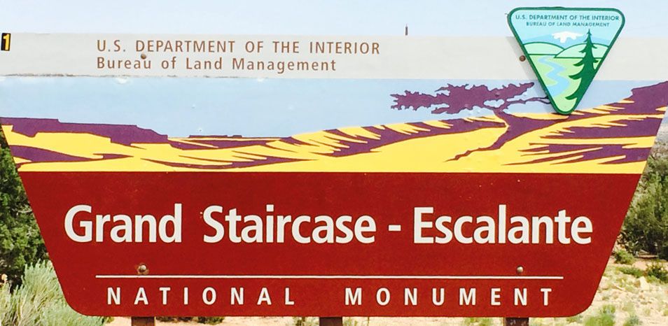
Welcome to the Grand Staircase-Escalante, baby!
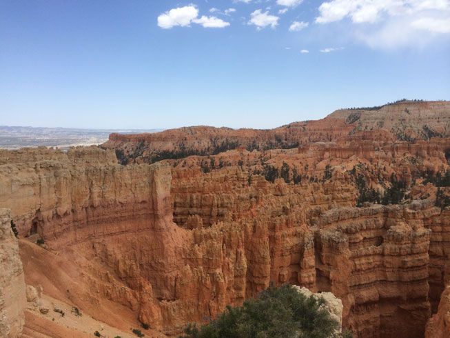
This was an amazing day. I’ve read about this ride over SR 12 to Torrey, but had no idea how amazing the experience would be when actually riding around it. Wow, Linda and I were both excited and in awe with the scenery, the fresh air, the views, the stops, the elevation and scenery changes. We head east on SR 12, which, for us, was great. Some say to go both directions. I can see why, I believe the views are different depending on if you are going east or west. Lots of scenic curves include canyons, mountains, desert, cliffs, and vistas… From the west, you start out going through Red Canyon with its cliffs and curves. There are many people around this area and it feels pretty touristy. Next up is Bryce Canyon. We topped off the gas while there. It’s really touristy here too, but we met some people on bikes on a long tour/journey. They’d been on the road already for a few weeks. Its always nice to connect and chat with fellow bike riders.
Bryce Canyon from drive up overlook.
After Bryce Canyon, the road seems to get more moto friendly . The curves and mild elevation changes are fun to ride. At around the 60 mile mark, Hwy 12 starts heading northward.
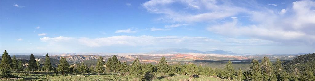
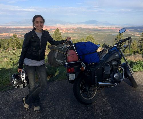
We stopped occasionally for pics, so plan your time with that in mind. But we also stopped at Bryce Canyon (off the highway) and did a jaunt off SR12 on Burr Trail Rd. which cuts off at Boulder, UT and had lunch at Bryce and Dinner at Boulder. We wanted to stop at the Anasazi State Park Museum outside of Boulder, but choose dinner instead. The Anasazi museum was closed by the time we arrived. No worries, we’ll have plenty of Anasazi things to see and do down the road. Make sure to stop at the Larb Hollow Overlook (around mile 108). We did and met Mel on her Honda 450. She was riding solo from Tennessee to Yosemite, camping along the way and having her own adventure! She was an inspiration to meet. It’s so nice to see young people with the adventure and resourcefulness to make it cross country on a 35 year old bike! She had pliers and a knife in her pocket!
From Larb Hollow Overlook
Adventure Mel
Check the map for all the things to see here and choose what you like. Don’t worry if you miss anything, you’ll need to come back again anyway…
Day 9 of 17
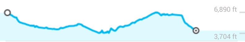
Torrey to Mexican Hat, UT Via SR 24, SR 95, SR 261, SR 163, with an excursion thru Bridges National Monument – 200 miles, Hills, curves, desert, canyons, elevation changes, scenic
Elevation: 3,704 ft. to 6,890 ft.
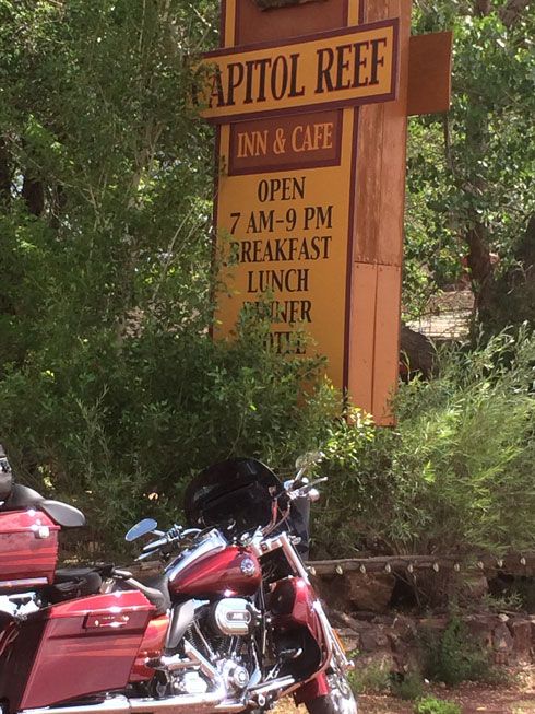
Eat at the Capital Reef Inn and Café for breakfast and you’ll be glad you did. They have a nice gift shop there too. But the food is great and we found a couple of other bikers there as well.
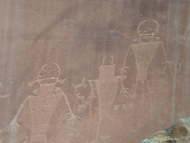
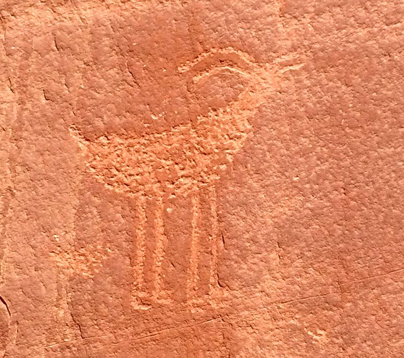
From Torrey, you head east on SR 24 and find yourself at Capital Reef National Park. Good thing we bought the lifetime senior pass for $10 at our first National Park. Go to the visitors center, it is a good place to start, the rangers there are very helpful. We ran into a trio from Germany. They rented Harleys in San Francisco and were riding the west! One of them spoke English so we talked for a bit. Capital Reef is full of Anasazi petroglyphs that are right on along the highway.
Petroglyphs at Capital Reef
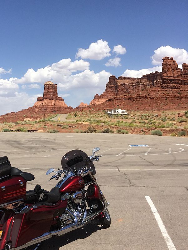
SR 24 from Torrey is has lots of curves, canyons, and is fun to ride. The scenery is amazing too. We head south on SR 95 at Hanksville where you get gas before you head into the desert toward Mexican Hat. Lamar is nice and helpful at the gas stop and meets people from all over the world at his station.
SR 95 south is pretty uneventful, but we wanted to make it to Mexican Hat for dinner and will stay there overnight. SR 95 to Mexican Hat takes you thru Glen Canyon National Recreation Area and Natural Bridges National Monument. Beautiful areas. Bridges is a 1hr detour off the road, but since we are way out here, we do it. It’s really much the same as we’ve been seeing, but it does break up this segment a bit and is a nice waystop.
Rest Stop at Hite near Lake Powell (north)
From Bridges, you are getting close to the Moki Dugway. We can’t wait! Head south off SR 95 on SR 261 toward Mexican Hat and around 25 miles in, you’ll see the gravel switchback sign and there’s no turning back! Just kidding. It’s pretty cool. I did this in my car and wanted to say that I’ve done it on my bike too. The road is well maintained.
Moki Dugway wave is a little closer to the vest… (it was graded nicely in June)
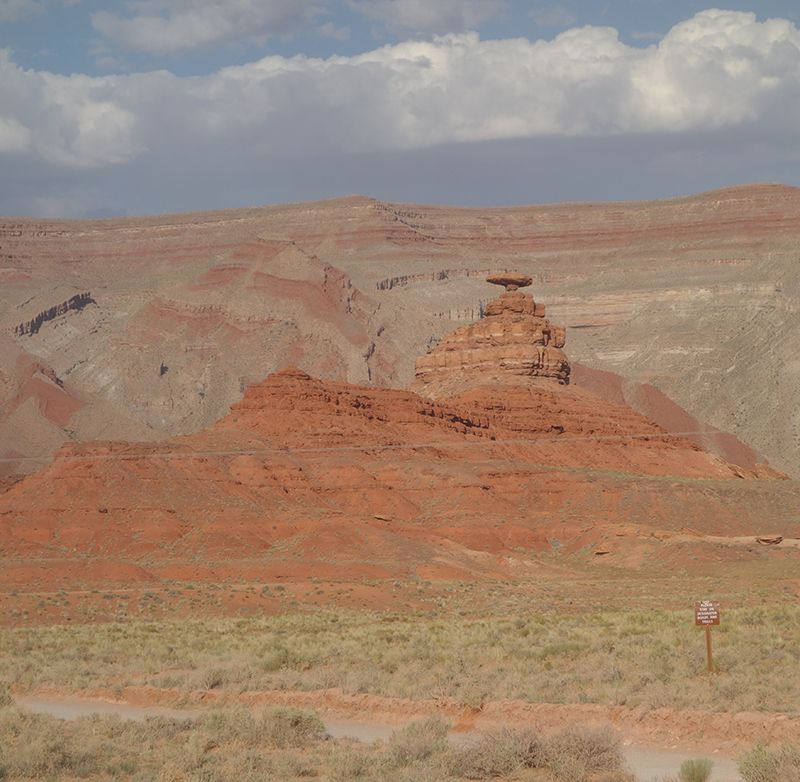
Mexican Hat
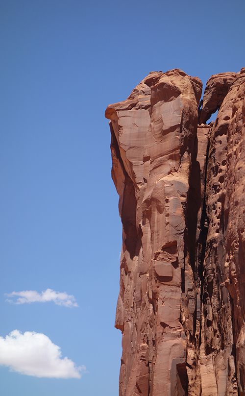
Just to remind you how these cliffs and canyons were created in the first place…
Day 10 of 17
Mexican Hat, UT to Chinle, AZ Via SR 163, US 191, US 160, Indian Rte 7– 160 miles, Desert, curves, very windy, scenic
Elevation: 4,094 ft. to 5,784 ft.
We hit the road and head for Monument Valley at a decently early time. We try to avoid the afternoon winds that have been kicking in and also try to beat the heat of the day. What a view as we go down the hill toward Monument Valley. We see a bunch of people jumping up and down in the middle of Hwy US 163 so I decide to stop and see if they need help. When I get there and ask, they are just happy to be there and taking pictures from the middle of the Hwy! Apparently getting that picture is more important than getting hit by a passing car! All in good fun, no harm no foul.
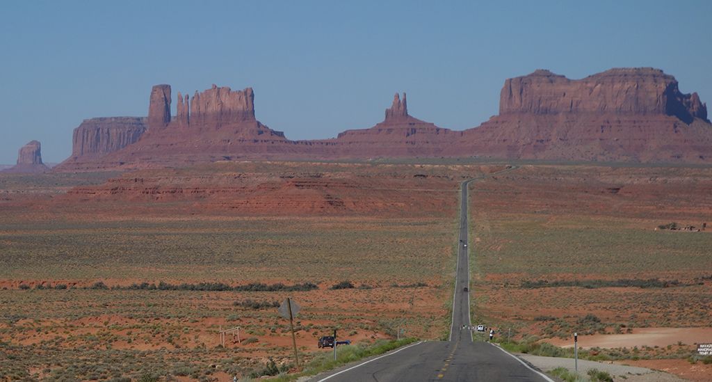
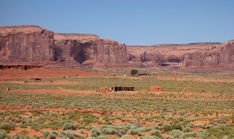
At Monument Valley, get the private jeep tour. It’s well worth it. You get to go deeper into the area and a little history and color at the same time. Our guide grew up there and came back as an adult. His family lives there on the Monument land as well as in their Navaho town. By the way, they don’t call themselves Navaho. They are in their language Di-ne (dee-nay). Get there early as the wind always picks up in the afternoon and that means lots of dust.
Petroglyphs
Adobe Hut Dwellings
Roadrunner
The artists viewpoint
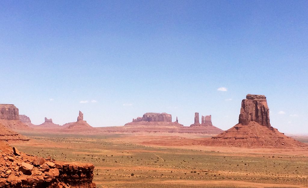
Today, by the end of our jeep tour, the dust and wind start getting a much worse than expected. We decide to have lunch at the park and decide what to do next. By lunch, there are literally two dozen bikes coming in to get out of the wind. I hear many of them are turning around and heading back. The wind is supposed to gust at 45 with 25+ winds blowing. That’s just a bit more than I’d like to see 2-up. Local guys advise us to head north and away from the wind when it gets this bad. We agree and choose to backtrack to Mexican Hat on US 163. Then it’s down US 191 to Chinle, which will add an extra hour drive time, but we decide it’s better to make it later than not at all. This route is less windy, but even so, the wind and very dusty and tiring to ride in. My wife tucks in behind me when the wind really blows and she is not up to taking pictures while riding. No pics of the wind or dust, but you get the picture.
Today, we left Mexican Hat around 8 am, did a 3-hour jeep tour, had lunch at Monument Valley, detoured back through Mexican Hat and made it to Chinle for dinner. Not a bad day considering the wind issues. We decide to meet up with friends in Albuquerque for a BBQ tomorrow. So its gas, food, supplies (water) and back to the hotel in Chinle, AZ. There will be no visiting Canyon de Chelly this trip.
Tomorrow we’ll arrive in Albuquerque, say hi to old friends and get reinforcements as we ride on to Durango and Southwestern Colorado. The Million Dollar Highway! Another day and I can’t wait… again!
View the entire post on http://www.motoforever.com
Here is day 8 to 10 (also posted on http://www.motoforever.com/?p=248)
We are leaving Zion and heading into the Grand Staircase-Escalante. The road out of Zion on SR 12 is twisty as it goes up the canyon to the overlook. You’ll go through a 2-mile tunnel. At the top, I recommend doing the 1-mile hike to the canyon overlook. It’s a fantastic view and you get to see the switchback road that you just rode up. We had to stop before entering the tunnel for about 15 minutes! Time to stop the bike, take off the helmet and talk with neighbors for a bit. Apparently they do one-way traffic when there are oversized loads going through.
Leaving Zion toward the tunnel

Zion Tunnel, the views end for 2 miles.

Day 8 of 17
Springdale to Torrey, UT, Via US 89, SR 12 (Grand Escalante-Staircase), SR 24 – 200 miles, Hills, curves, canyons, elevation changes, scenic
Elevation: 5,180 ft. to 9,600 ft.

Welcome to the Grand Staircase-Escalante, baby!

This was an amazing day. I’ve read about this ride over SR 12 to Torrey, but had no idea how amazing the experience would be when actually riding around it. Wow, Linda and I were both excited and in awe with the scenery, the fresh air, the views, the stops, the elevation and scenery changes. We head east on SR 12, which, for us, was great. Some say to go both directions. I can see why, I believe the views are different depending on if you are going east or west. Lots of scenic curves include canyons, mountains, desert, cliffs, and vistas… From the west, you start out going through Red Canyon with its cliffs and curves. There are many people around this area and it feels pretty touristy. Next up is Bryce Canyon. We topped off the gas while there. It’s really touristy here too, but we met some people on bikes on a long tour/journey. They’d been on the road already for a few weeks. Its always nice to connect and chat with fellow bike riders.
Bryce Canyon from drive up overlook.

After Bryce Canyon, the road seems to get more moto friendly . The curves and mild elevation changes are fun to ride. At around the 60 mile mark, Hwy 12 starts heading northward.
We stopped occasionally for pics, so plan your time with that in mind. But we also stopped at Bryce Canyon (off the highway) and did a jaunt off SR12 on Burr Trail Rd. which cuts off at Boulder, UT and had lunch at Bryce and Dinner at Boulder. We wanted to stop at the Anasazi State Park Museum outside of Boulder, but choose dinner instead. The Anasazi museum was closed by the time we arrived. No worries, we’ll have plenty of Anasazi things to see and do down the road. Make sure to stop at the Larb Hollow Overlook (around mile 108). We did and met Mel on her Honda 450. She was riding solo from Tennessee to Yosemite, camping along the way and having her own adventure! She was an inspiration to meet. It’s so nice to see young people with the adventure and resourcefulness to make it cross country on a 35 year old bike! She had pliers and a knife in her pocket!
From Larb Hollow Overlook

Adventure Mel

Check the map for all the things to see here and choose what you like. Don’t worry if you miss anything, you’ll need to come back again anyway…
Day 9 of 17
Torrey to Mexican Hat, UT Via SR 24, SR 95, SR 261, SR 163, with an excursion thru Bridges National Monument – 200 miles, Hills, curves, desert, canyons, elevation changes, scenic
Elevation: 3,704 ft. to 6,890 ft.

Eat at the Capital Reef Inn and Café for breakfast and you’ll be glad you did. They have a nice gift shop there too. But the food is great and we found a couple of other bikers there as well.

From Torrey, you head east on SR 24 and find yourself at Capital Reef National Park. Good thing we bought the lifetime senior pass for $10 at our first National Park. Go to the visitors center, it is a good place to start, the rangers there are very helpful. We ran into a trio from Germany. They rented Harleys in San Francisco and were riding the west! One of them spoke English so we talked for a bit. Capital Reef is full of Anasazi petroglyphs that are right on along the highway.
Petroglyphs at Capital Reef

SR 24 from Torrey is has lots of curves, canyons, and is fun to ride. The scenery is amazing too. We head south on SR 95 at Hanksville where you get gas before you head into the desert toward Mexican Hat. Lamar is nice and helpful at the gas stop and meets people from all over the world at his station.
SR 95 south is pretty uneventful, but we wanted to make it to Mexican Hat for dinner and will stay there overnight. SR 95 to Mexican Hat takes you thru Glen Canyon National Recreation Area and Natural Bridges National Monument. Beautiful areas. Bridges is a 1hr detour off the road, but since we are way out here, we do it. It’s really much the same as we’ve been seeing, but it does break up this segment a bit and is a nice waystop.
Rest Stop at Hite near Lake Powell (north)

From Bridges, you are getting close to the Moki Dugway. We can’t wait! Head south off SR 95 on SR 261 toward Mexican Hat and around 25 miles in, you’ll see the gravel switchback sign and there’s no turning back! Just kidding. It’s pretty cool. I did this in my car and wanted to say that I’ve done it on my bike too. The road is well maintained.
Moki Dugway wave is a little closer to the vest… (it was graded nicely in June)

Mexican Hat

Just to remind you how these cliffs and canyons were created in the first place…

Day 10 of 17
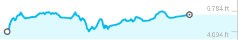
Mexican Hat, UT to Chinle, AZ Via SR 163, US 191, US 160, Indian Rte 7– 160 miles, Desert, curves, very windy, scenic
Elevation: 4,094 ft. to 5,784 ft.

We hit the road and head for Monument Valley at a decently early time. We try to avoid the afternoon winds that have been kicking in and also try to beat the heat of the day. What a view as we go down the hill toward Monument Valley. We see a bunch of people jumping up and down in the middle of Hwy US 163 so I decide to stop and see if they need help. When I get there and ask, they are just happy to be there and taking pictures from the middle of the Hwy! Apparently getting that picture is more important than getting hit by a passing car! All in good fun, no harm no foul.

At Monument Valley, get the private jeep tour. It’s well worth it. You get to go deeper into the area and a little history and color at the same time. Our guide grew up there and came back as an adult. His family lives there on the Monument land as well as in their Navaho town. By the way, they don’t call themselves Navaho. They are in their language Di-ne (dee-nay). Get there early as the wind always picks up in the afternoon and that means lots of dust.
Petroglyphs

Adobe Hut Dwellings

Roadrunner

The artists viewpoint

Today, by the end of our jeep tour, the dust and wind start getting a much worse than expected. We decide to have lunch at the park and decide what to do next. By lunch, there are literally two dozen bikes coming in to get out of the wind. I hear many of them are turning around and heading back. The wind is supposed to gust at 45 with 25+ winds blowing. That’s just a bit more than I’d like to see 2-up. Local guys advise us to head north and away from the wind when it gets this bad. We agree and choose to backtrack to Mexican Hat on US 163. Then it’s down US 191 to Chinle, which will add an extra hour drive time, but we decide it’s better to make it later than not at all. This route is less windy, but even so, the wind and very dusty and tiring to ride in. My wife tucks in behind me when the wind really blows and she is not up to taking pictures while riding. No pics of the wind or dust, but you get the picture.
Today, we left Mexican Hat around 8 am, did a 3-hour jeep tour, had lunch at Monument Valley, detoured back through Mexican Hat and made it to Chinle for dinner. Not a bad day considering the wind issues. We decide to meet up with friends in Albuquerque for a BBQ tomorrow. So its gas, food, supplies (water) and back to the hotel in Chinle, AZ. There will be no visiting Canyon de Chelly this trip.
Tomorrow we’ll arrive in Albuquerque, say hi to old friends and get reinforcements as we ride on to Durango and Southwestern Colorado. The Million Dollar Highway! Another day and I can’t wait… again!
View the entire post on http://www.motoforever.com
#14
08-01-2014, 02:55 PM
Join Date: Apr 2014
Location: Oregon
Posts: 87
Likes: 0
Received 0 Likes
on
0 Posts
OR to Colorado and back – 17 days in June 2014
Here is day 11 to 14
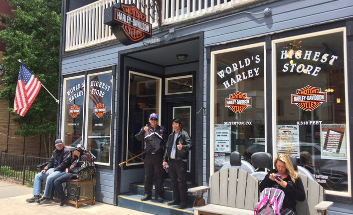
This segment includes a little bit of everything including, Interstate, mountains, switchbacks, valley curves, and of course lots of scenery. We start eastbound on Route 66 for a stop in Albuquerque, NM, but the real highlight is Highway 550 from Durango, Colorado through the Rocky Mountains. You can expect weather changes as you ride up past 12,000 ft. and we are going beyond that. We visit Silverton Harley (the highest Harley Store in the world), stop in Telluride and back to Cortez, CO where we stay as we visit Mesa Verde National Park.
I’ve posted a Google map of this segment on www.motoforever.com/?p=311
Day 11 of 17
Chinle, AZ Via SR 163, US 191, US 160, Indian Rte 7– 160 miles, Desert, curves, very windy, scenic
Elevation: 4,094 ft. to 5,784 ft.
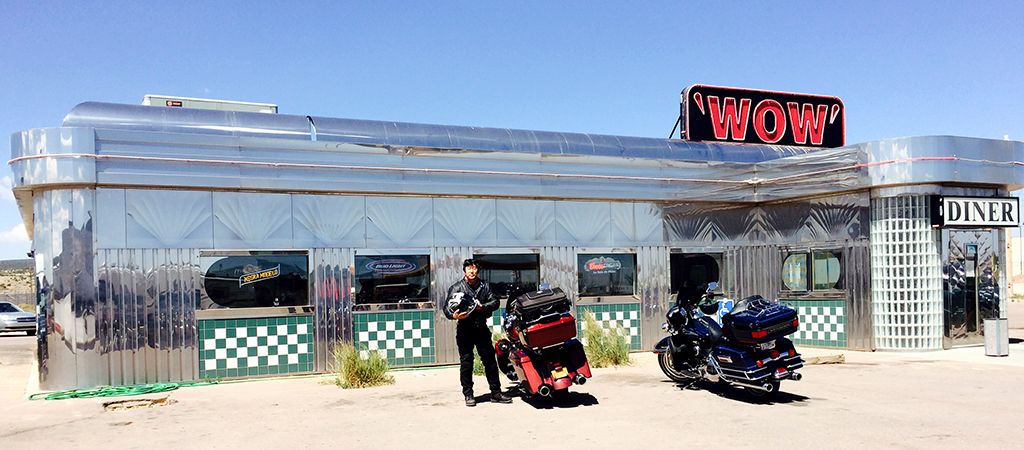
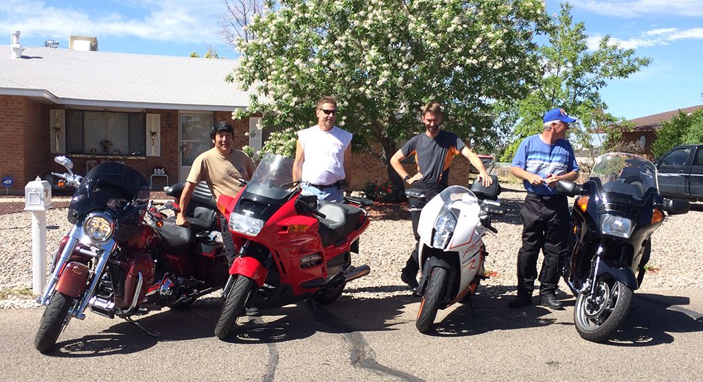
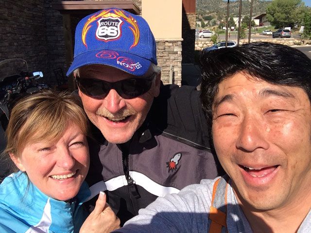
The roads and the weather is great in June. But the wind is still gusting on US-40 to Albuquerque, but it is going in our direction so we don’t mind the extra good gas mileage ☺. The cliffs in the distance remind me of the movie CARS and I imagine riding the side roads instead of this perfectly straight US 40 that replaced much of the original Route 66. We have a great time staying in Rio Rancho with good friends and enjoying their wonderful hospitality and barbeque! It is such a treat to stay with good friends when you’re out on the open roads. They opened their home with warm beds and a nice warm shower. We talk old times, bikes, and catch up long into the evening. The next day starts with a nice breakfast; and more friends quickly join us. They bring their bikes and will ride with us for a bit as we head for Colorado.
Diner on Route 66
Our fantastic hosts and friends in New Mexico
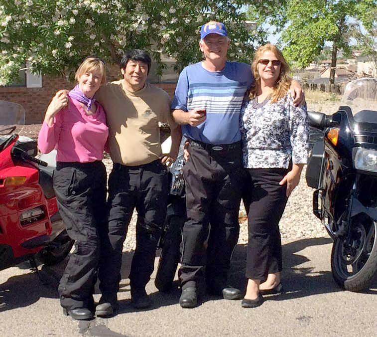
Getting the bikes ready
Day 12 of 17
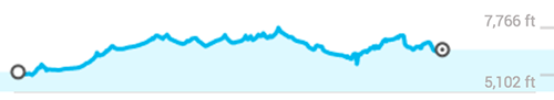
Rio Rancho, NM to Durango, CO US 550, SR 537, US 64, SR 539, SR 511, SR 172, US 160 – 245 miles – Interstate, B paved highways (tar snakes), curves, scenic, desert hills
Elevation: 5,102 ft. to 7,766 ft.
SR 550 is the straight shot from Rio Rancho NM to Durango, CO. It is also the road that we’ll take into the Rockies and becomes the Million Dollar Highway. We stop in Cuba, NM for an amazing New Mexican food lunch. As we leave Cuba, we take a side trip on NM 537 through the Jicarilla Apache and Southern Ute Indian Reservations. We see many oil pumps and drilling operations along the fairly good paved highways. There is very little traffic on this route and we get to stretch our legs and have some fun.
But really, we are just biding our time getting to Durango, CO where we begin our ride up the Million Dollar Highway. We’ve been anticipating this portion of our trip for the last few days and it’s getting exciting.
Our Albuquerque Posse!
NM 537 heading across the reservation toward Durango
Navaho Lake Dam view
Day 13 of 17
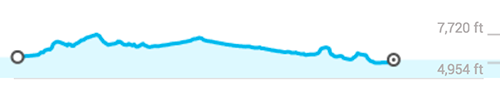
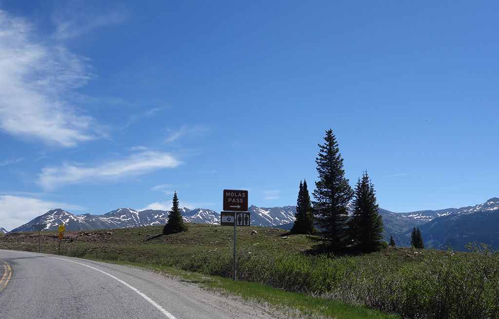
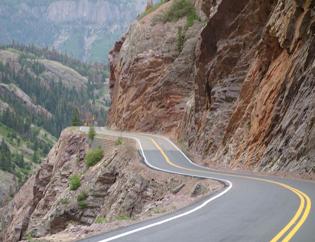
Durango to Cortez, CO via US 550, Million $ Highway, US 62, US 145 – 225 miles – Mountain curves, high elevation changes, very scenic
Elevation: 6,129 ft. to 11,093 ft.
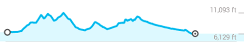
Pictures can only begin to describe the experience. My personal impression of this ride is that everything was just a bit more… More smiles, more expansive views, more extreme elevation riding, more temperature changes as we go up and down the mountain, more trees, more beautiful views, more expensive ranches, more bikers. Not the most, but more. It is an amazing experience that you’ll want to soak in and enjoy.
Getting ready to hit Highway 550
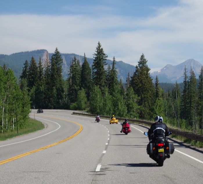
Starting out you'll find many other bikers on the same mission for the day!
Heading into altitude
Curvy parts on Hwy 550
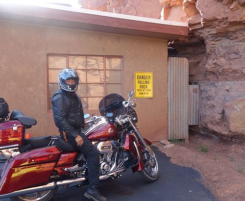
Silverton Harley. Can't resist buying a t-shirt!
PICTURES
More pictures on http://www.motoforever.com/?p=379
Day 14 of 17
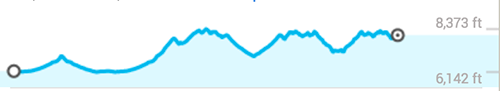
Cortez, CO and Mesa Verde NP via US 160 – 82 miles RT – Mountain curves, very scenic
Elevation: 6,142 ft. to 8,373 ft.
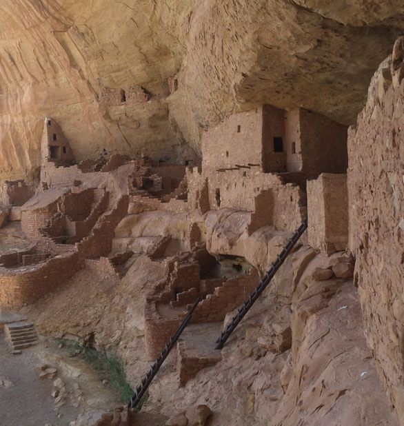
Linda and I have always been interested in the Anasazi ruins and remember seeing pictures of the cliff dwellings at Mesa Verde. We decide to spend a full day at the park. In person, the cliff dwellings are even more amazing and the tour is an absolute must. You’ll want to head for the visitors center first thing in the morning and sign up for the tours.
You’ll be pressed trying to see the whole park in a day, but if you start early, you’ll be able to see most of it including a tour. The rangers recommend at least two days, and if you really want to see everything, I would agree. One full day was prefect for us. We chose the tour to the long house; which includes a tram ride, a short walking tour, and stops to see two more cliff dwellings. We had lunch in one area of the park and visited the museum clear at the other end.
We stayed in Cortez, CO the night before and after our Mesa Verde visit. This allows us to leave some of our stuff at the hotel and to lighten our load to optimize for the Mesa Verde side trip.
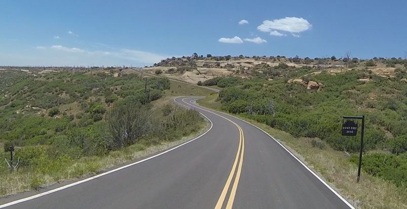
Cortez, CO, is 10 miles from the park. But the ride doesn’t stop there. There’s another 40 miles or so of great twisty mountain roads throughout the park. The roads ride along the ridges so you have fantastic views.
While in Cortez, make sure to eat at the Main Street Brewery and get a plate of the Green Chile Fries… You’ll be glad you did.
Mesa Verde on the long house tour
Driving around Mesa Verde
Cortez, Colorado likes bikes
Next up… we head for Arches National Park
Here is day 11 to 14
This segment includes a little bit of everything including, Interstate, mountains, switchbacks, valley curves, and of course lots of scenery. We start eastbound on Route 66 for a stop in Albuquerque, NM, but the real highlight is Highway 550 from Durango, Colorado through the Rocky Mountains. You can expect weather changes as you ride up past 12,000 ft. and we are going beyond that. We visit Silverton Harley (the highest Harley Store in the world), stop in Telluride and back to Cortez, CO where we stay as we visit Mesa Verde National Park.
I’ve posted a Google map of this segment on www.motoforever.com/?p=311
Day 11 of 17
Chinle, AZ Via SR 163, US 191, US 160, Indian Rte 7– 160 miles, Desert, curves, very windy, scenic
Elevation: 4,094 ft. to 5,784 ft.

The roads and the weather is great in June. But the wind is still gusting on US-40 to Albuquerque, but it is going in our direction so we don’t mind the extra good gas mileage ☺. The cliffs in the distance remind me of the movie CARS and I imagine riding the side roads instead of this perfectly straight US 40 that replaced much of the original Route 66. We have a great time staying in Rio Rancho with good friends and enjoying their wonderful hospitality and barbeque! It is such a treat to stay with good friends when you’re out on the open roads. They opened their home with warm beds and a nice warm shower. We talk old times, bikes, and catch up long into the evening. The next day starts with a nice breakfast; and more friends quickly join us. They bring their bikes and will ride with us for a bit as we head for Colorado.
Diner on Route 66

Our fantastic hosts and friends in New Mexico

Getting the bikes ready

Day 12 of 17
Rio Rancho, NM to Durango, CO US 550, SR 537, US 64, SR 539, SR 511, SR 172, US 160 – 245 miles – Interstate, B paved highways (tar snakes), curves, scenic, desert hills
Elevation: 5,102 ft. to 7,766 ft.

SR 550 is the straight shot from Rio Rancho NM to Durango, CO. It is also the road that we’ll take into the Rockies and becomes the Million Dollar Highway. We stop in Cuba, NM for an amazing New Mexican food lunch. As we leave Cuba, we take a side trip on NM 537 through the Jicarilla Apache and Southern Ute Indian Reservations. We see many oil pumps and drilling operations along the fairly good paved highways. There is very little traffic on this route and we get to stretch our legs and have some fun.
But really, we are just biding our time getting to Durango, CO where we begin our ride up the Million Dollar Highway. We’ve been anticipating this portion of our trip for the last few days and it’s getting exciting.
Our Albuquerque Posse!

NM 537 heading across the reservation toward Durango

Navaho Lake Dam view

Day 13 of 17
Durango to Cortez, CO via US 550, Million $ Highway, US 62, US 145 – 225 miles – Mountain curves, high elevation changes, very scenic
Elevation: 6,129 ft. to 11,093 ft.

Pictures can only begin to describe the experience. My personal impression of this ride is that everything was just a bit more… More smiles, more expansive views, more extreme elevation riding, more temperature changes as we go up and down the mountain, more trees, more beautiful views, more expensive ranches, more bikers. Not the most, but more. It is an amazing experience that you’ll want to soak in and enjoy.
Getting ready to hit Highway 550

Starting out you'll find many other bikers on the same mission for the day!

Heading into altitude

Curvy parts on Hwy 550

Silverton Harley. Can't resist buying a t-shirt!

PICTURES
More pictures on http://www.motoforever.com/?p=379
Day 14 of 17
Cortez, CO and Mesa Verde NP via US 160 – 82 miles RT – Mountain curves, very scenic
Elevation: 6,142 ft. to 8,373 ft.

Linda and I have always been interested in the Anasazi ruins and remember seeing pictures of the cliff dwellings at Mesa Verde. We decide to spend a full day at the park. In person, the cliff dwellings are even more amazing and the tour is an absolute must. You’ll want to head for the visitors center first thing in the morning and sign up for the tours.
You’ll be pressed trying to see the whole park in a day, but if you start early, you’ll be able to see most of it including a tour. The rangers recommend at least two days, and if you really want to see everything, I would agree. One full day was prefect for us. We chose the tour to the long house; which includes a tram ride, a short walking tour, and stops to see two more cliff dwellings. We had lunch in one area of the park and visited the museum clear at the other end.
We stayed in Cortez, CO the night before and after our Mesa Verde visit. This allows us to leave some of our stuff at the hotel and to lighten our load to optimize for the Mesa Verde side trip.
Cortez, CO, is 10 miles from the park. But the ride doesn’t stop there. There’s another 40 miles or so of great twisty mountain roads throughout the park. The roads ride along the ridges so you have fantastic views.
While in Cortez, make sure to eat at the Main Street Brewery and get a plate of the Green Chile Fries… You’ll be glad you did.
Mesa Verde on the long house tour

Driving around Mesa Verde

Cortez, Colorado likes bikes

Next up… we head for Arches National Park
#15
08-01-2014, 03:01 PM
Join Date: Apr 2014
Location: Oregon
Posts: 87
Likes: 0
Received 0 Likes
on
0 Posts
#17
08-01-2014, 04:02 PM
Join Date: Apr 2014
Location: Oregon
Posts: 87
Likes: 0
Received 0 Likes
on
0 Posts
#19
08-01-2014, 05:53 PM
Join Date: Apr 2014
Location: Oregon
Posts: 87
Likes: 0
Received 0 Likes
on
0 Posts
I agree Kneesinthebreeze, Colorado roads are biker heaven. The Durango portion was really a ride of a lifetime. Next time, we'll do both the east and west side of 550 loops and on to Colorado Springs. I can't wait to get back too!
#20
08-01-2014, 07:48 PM
Road Master
Join Date: Sep 2012
Location: Corp of Discovery trail, Missouri
Posts: 875
Likes: 0
Received 10 Likes
on
10 Posts
Next time also try hwy 6 off of I-70 to hwy 119 north to Nederland. a nice little town in the mountains. At Nederland hit 72 north to 7 hwy to Estes Park. Once in Rocky Mountain National Park take hwy 34 to the Alpine Lodge. Absolutely breath taking views the whole way.