Canyons of Colorado
#1
 09-03-2018, 05:18 PM

For the Labor Day weekend I decided to tour my state of Colorado. I loaded up my Electra Glide and started out toward the west. Here's a GPS map of my route:
https://spotwalla.com/tripViewer.php...=0&showAll=yes
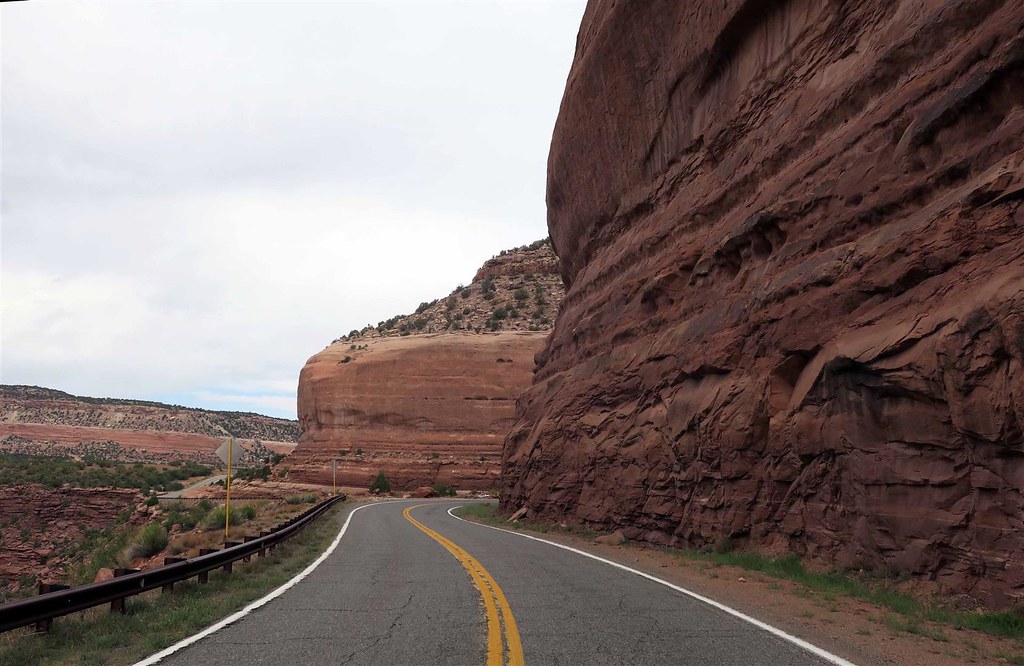
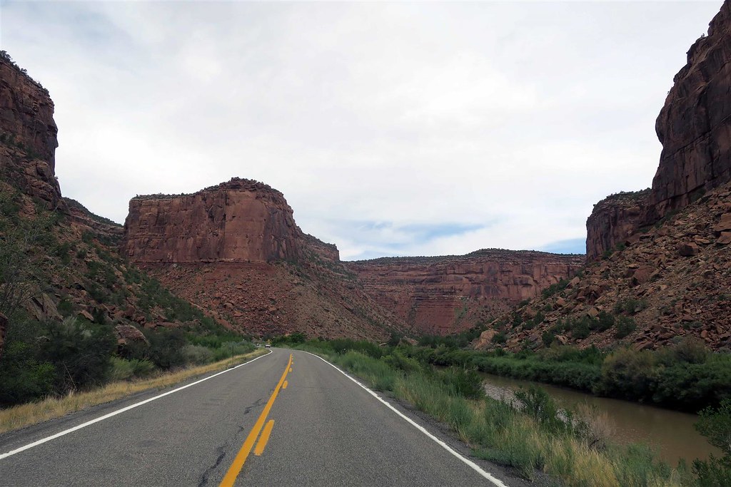
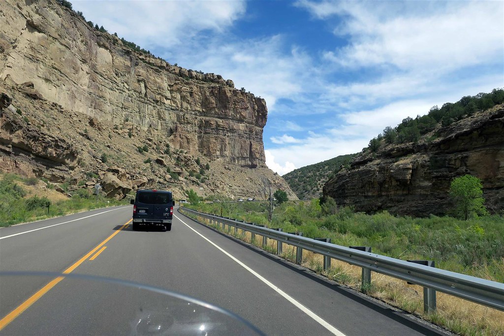
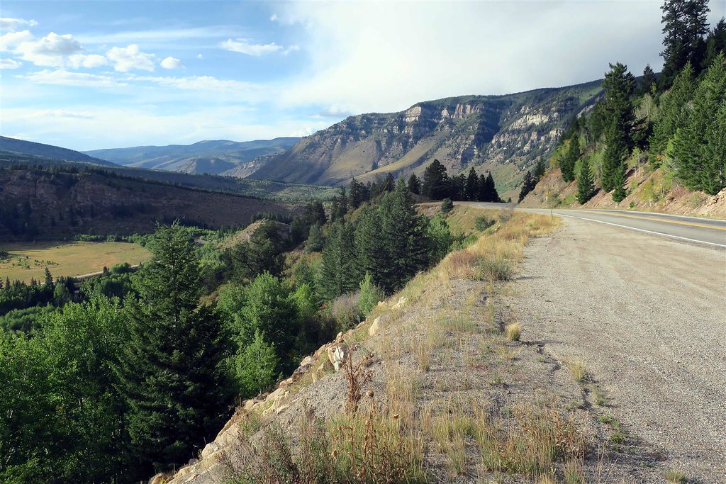
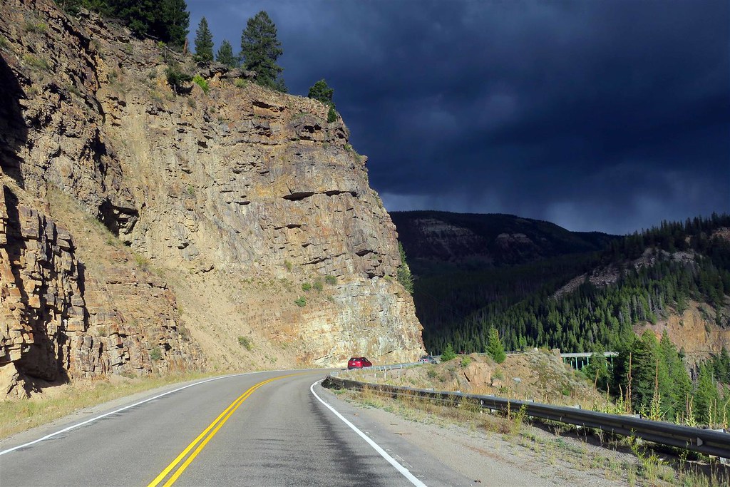
The first leg of my trip is on what I believe is the most underrated motorcycle highway in Colorado, highway 140. After arriving at the town of Dove Creek I turn north onto 141.
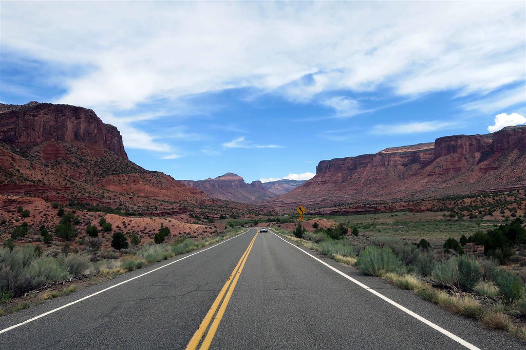
At Slickrock Hill I looked out over Disappointment Valley.
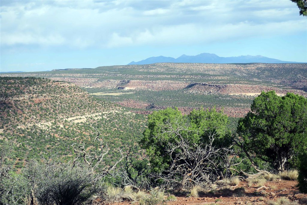
It's an interesting story how Disappointment Valley got it's name. In 1776 two Spaniards by the name of Escalante and Dominguez explored the four corners area. They were planning on finding a path from Santa Fe New Mexico to the Pacific Ocean. They fell far short of their goal. They had two Indian guides. These Indian guides were abused and when one of them was beaten both Indians decided the hell with this and they abandoned the expedition team. After that Escalante and Dominguez had a very difficult time finding their way through the mountains and canyons. When they came to this valley they thought the traveling would be easier but they were unable to find food. Lost and hungry they had to eat a pack mule to stay alive. Because of the bad turn of events here they decided to name the valley Disappointment Valley and that was surely an understatement. The expedition then headed back to Santa Fe.

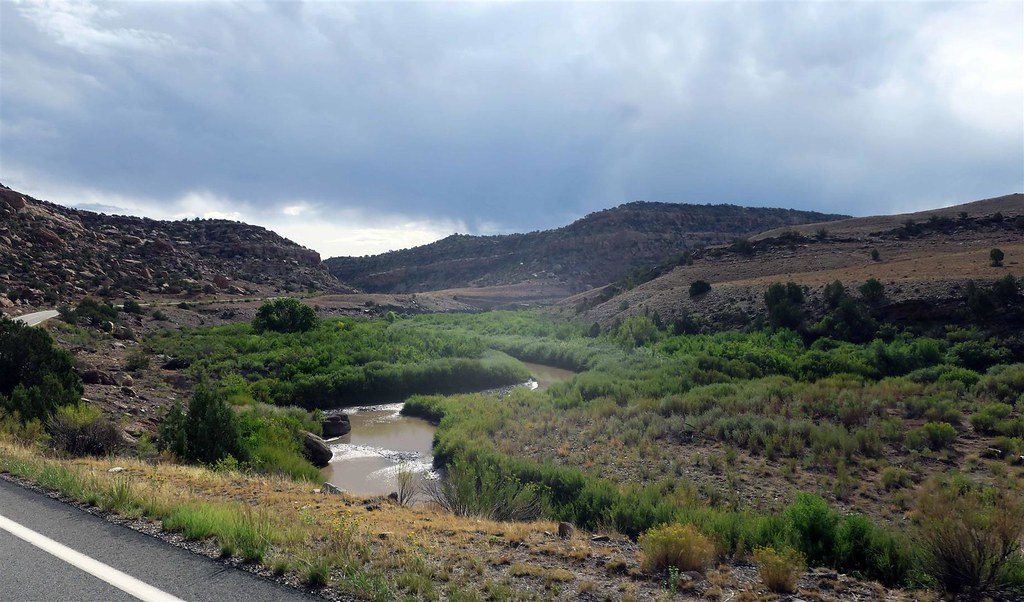
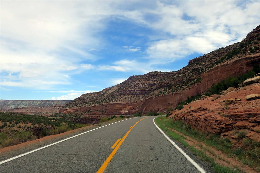
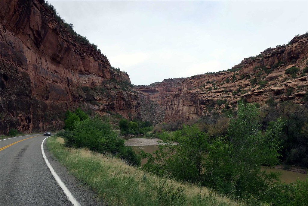
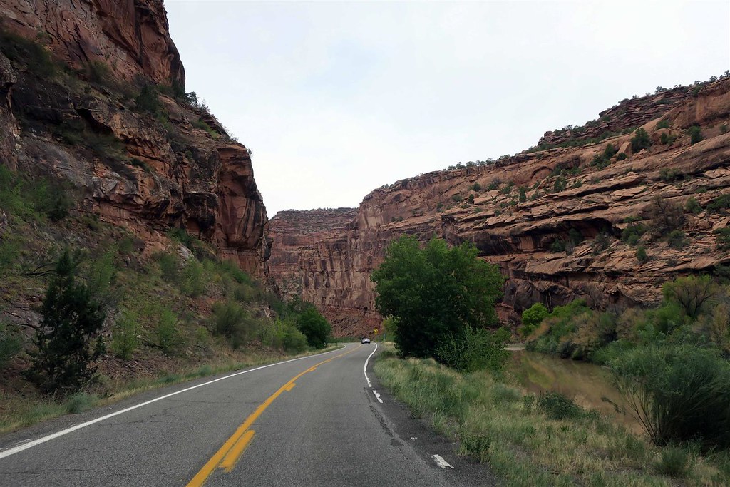
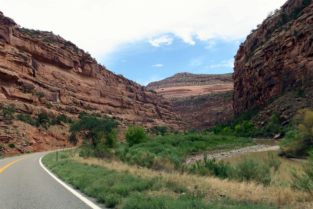
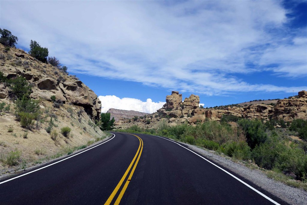
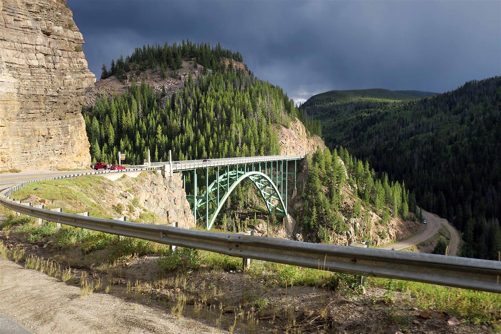
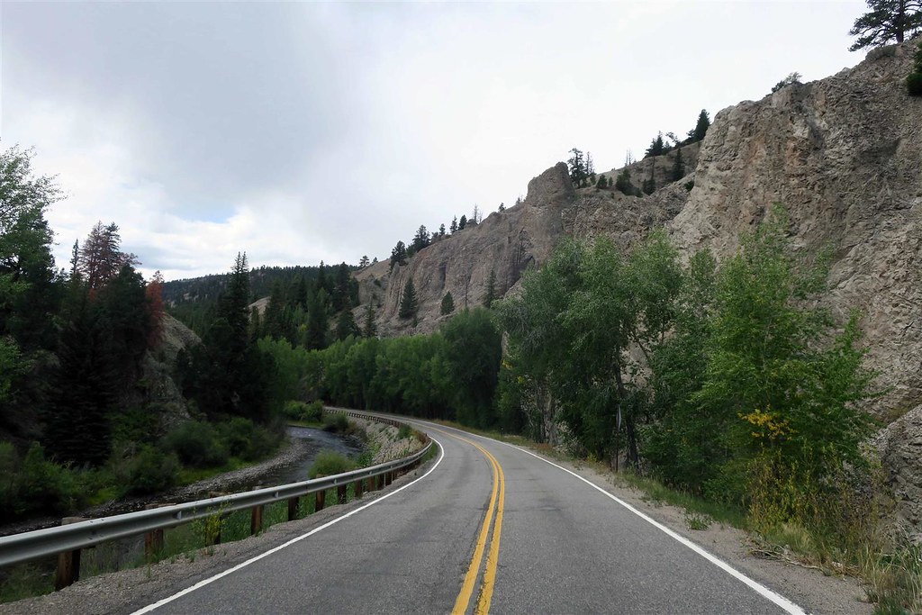
Highway 141 then goes through a canyon that is formed by the San Miguel River.
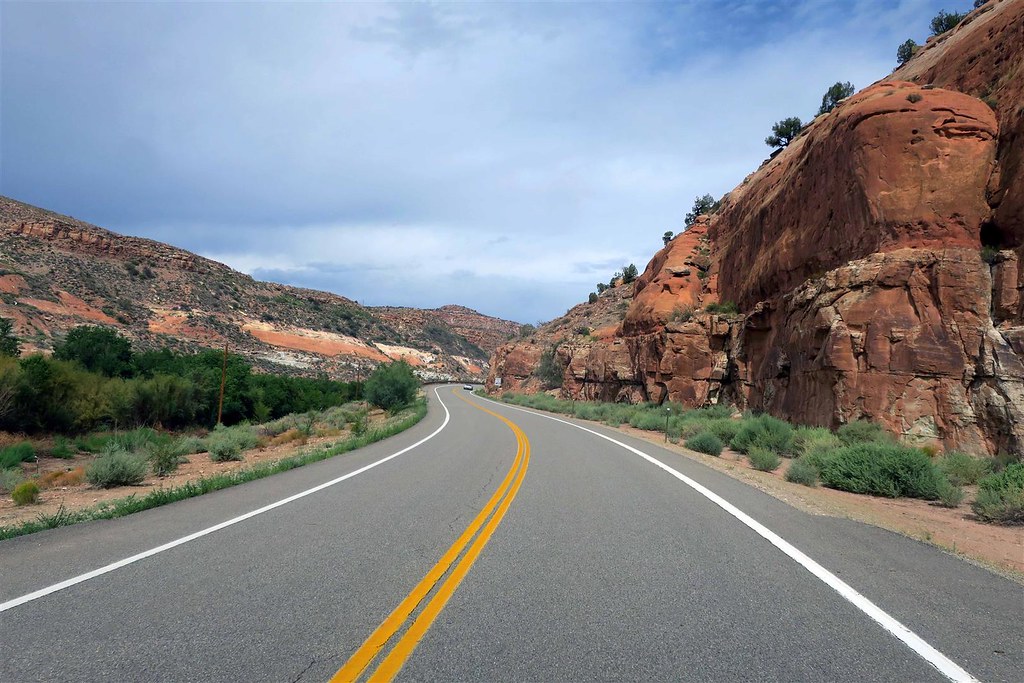
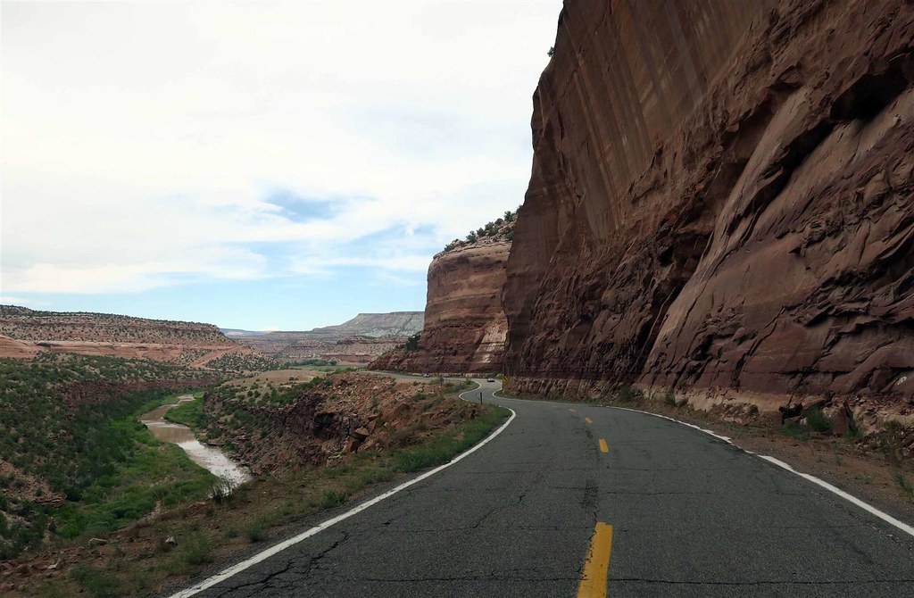
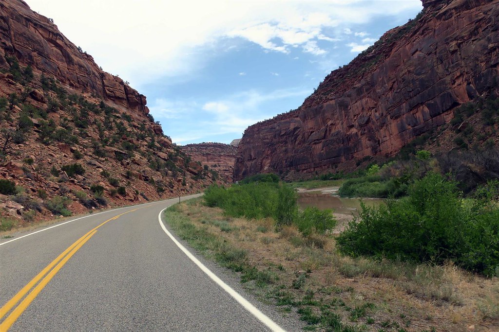
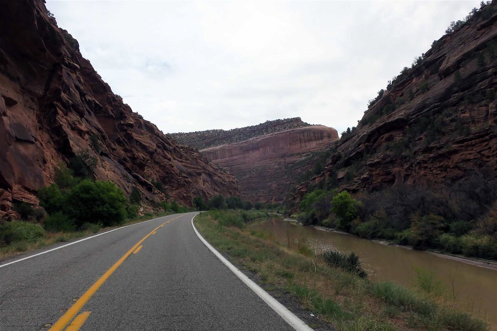
The San Miguel River dumps into the Dolores river and canyon grows deeper.
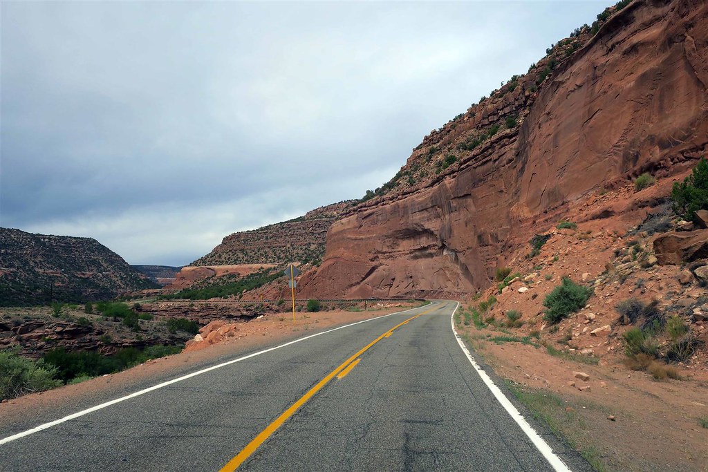

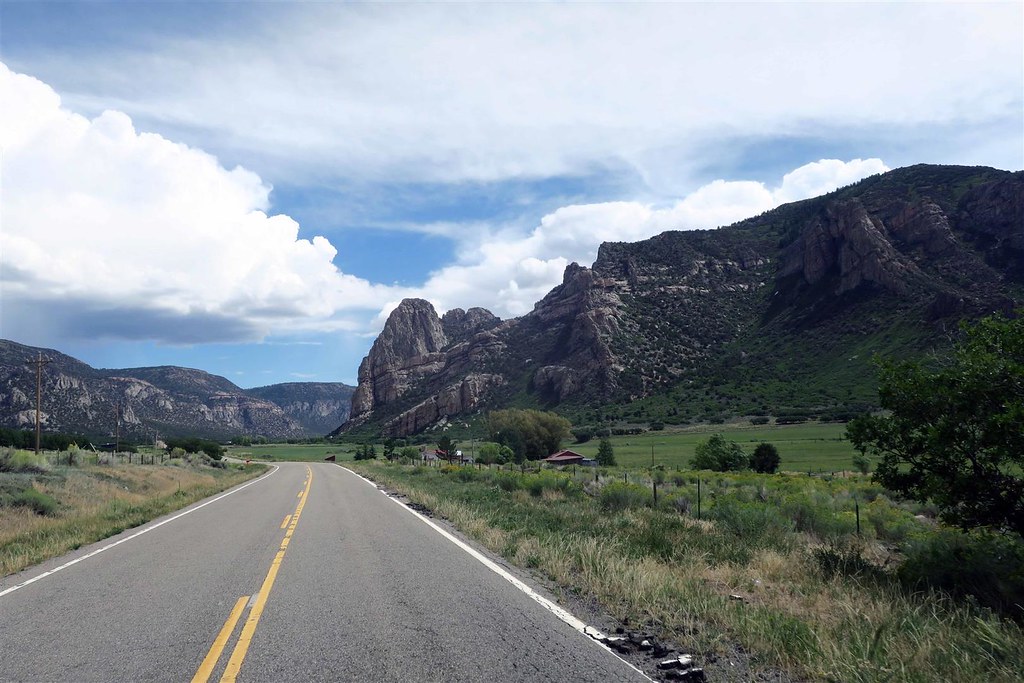
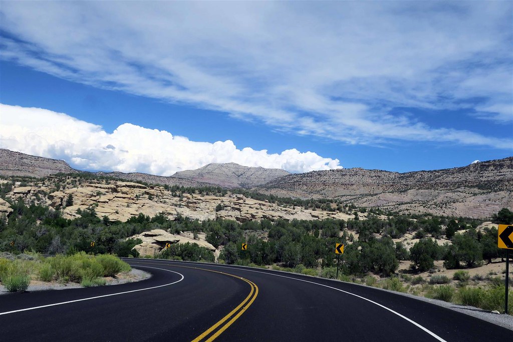
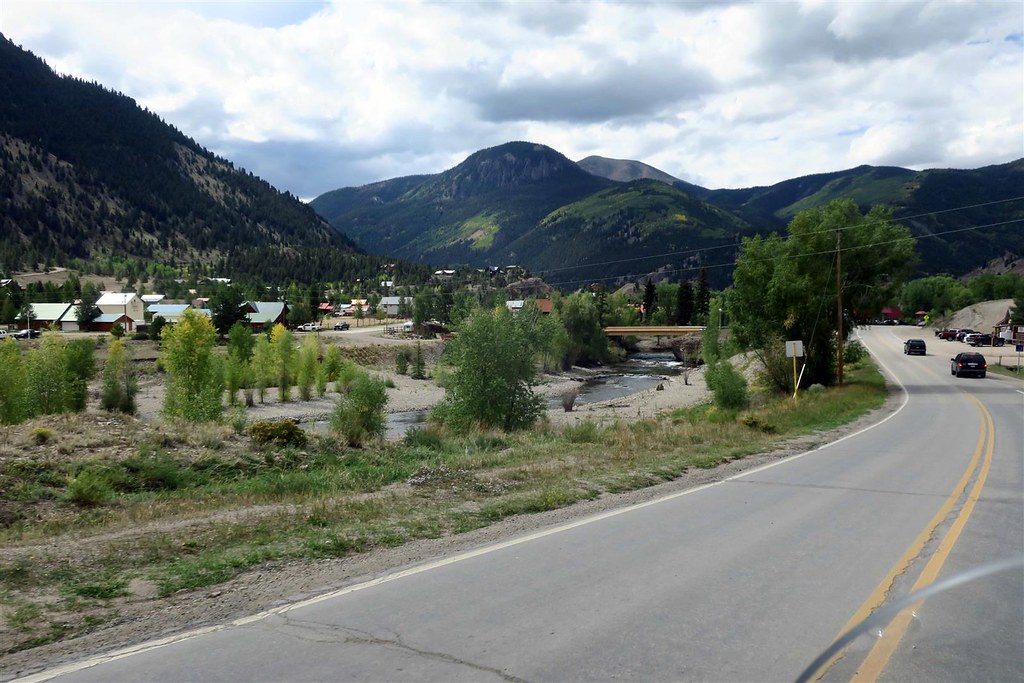
At the town of Gateway Highway 141 turns to the north-east. This is now the Unaweep Canyon.
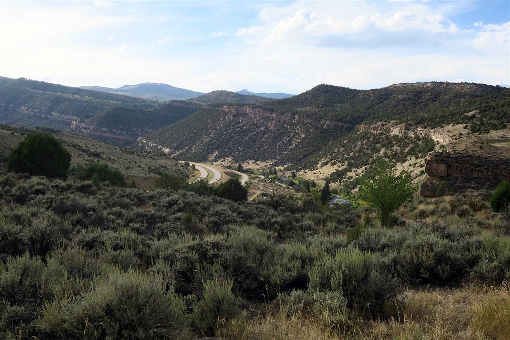
I no longer see red sandstone. This canyon has granite walls.
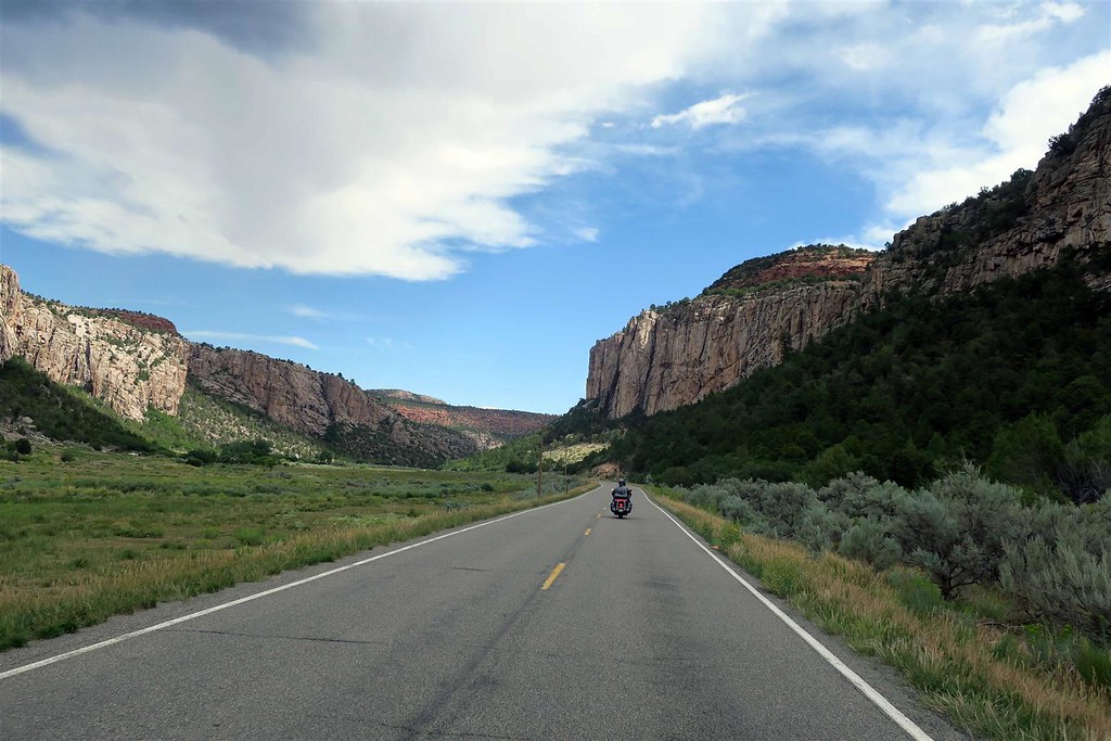
I arrive at Grand Junction Colorado but I don't stop. I get on the interstate heading east. Actually this section heads northeast.
I still have a lot of ground to cover but I need to organize my pictures. (actually I need a break from organizing my pictures and writing)
To be continued ...
https://spotwalla.com/tripViewer.php...=0&showAll=yes
The first leg of my trip is on what I believe is the most underrated motorcycle highway in Colorado, highway 140. After arriving at the town of Dove Creek I turn north onto 141.
At Slickrock Hill I looked out over Disappointment Valley.
It's an interesting story how Disappointment Valley got it's name. In 1776 two Spaniards by the name of Escalante and Dominguez explored the four corners area. They were planning on finding a path from Santa Fe New Mexico to the Pacific Ocean. They fell far short of their goal. They had two Indian guides. These Indian guides were abused and when one of them was beaten both Indians decided the hell with this and they abandoned the expedition team. After that Escalante and Dominguez had a very difficult time finding their way through the mountains and canyons. When they came to this valley they thought the traveling would be easier but they were unable to find food. Lost and hungry they had to eat a pack mule to stay alive. Because of the bad turn of events here they decided to name the valley Disappointment Valley and that was surely an understatement. The expedition then headed back to Santa Fe.
Highway 141 then goes through a canyon that is formed by the San Miguel River.
The San Miguel River dumps into the Dolores river and canyon grows deeper.
At the town of Gateway Highway 141 turns to the north-east. This is now the Unaweep Canyon.
I no longer see red sandstone. This canyon has granite walls.
I arrive at Grand Junction Colorado but I don't stop. I get on the interstate heading east. Actually this section heads northeast.
I still have a lot of ground to cover but I need to organize my pictures. (actually I need a break from organizing my pictures and writing)
To be continued ...
#2
09-03-2018, 05:36 PM

Wow man very cool!
I love riding the canyons in Colorado. Minus the dumb***** that drive here. Those are some nice pics. I will make that ride soon.
Check out my first video...Evergreen to Morrison. I know its a lil shakey but I did it with my phone after I got the FP3 hooked up. Notice the Fuzz at the end getting somebody speeding. Don’t speed thru Morrison.
I love riding the canyons in Colorado. Minus the dumb***** that drive here. Those are some nice pics. I will make that ride soon.
#4
09-03-2018, 09:40 PM
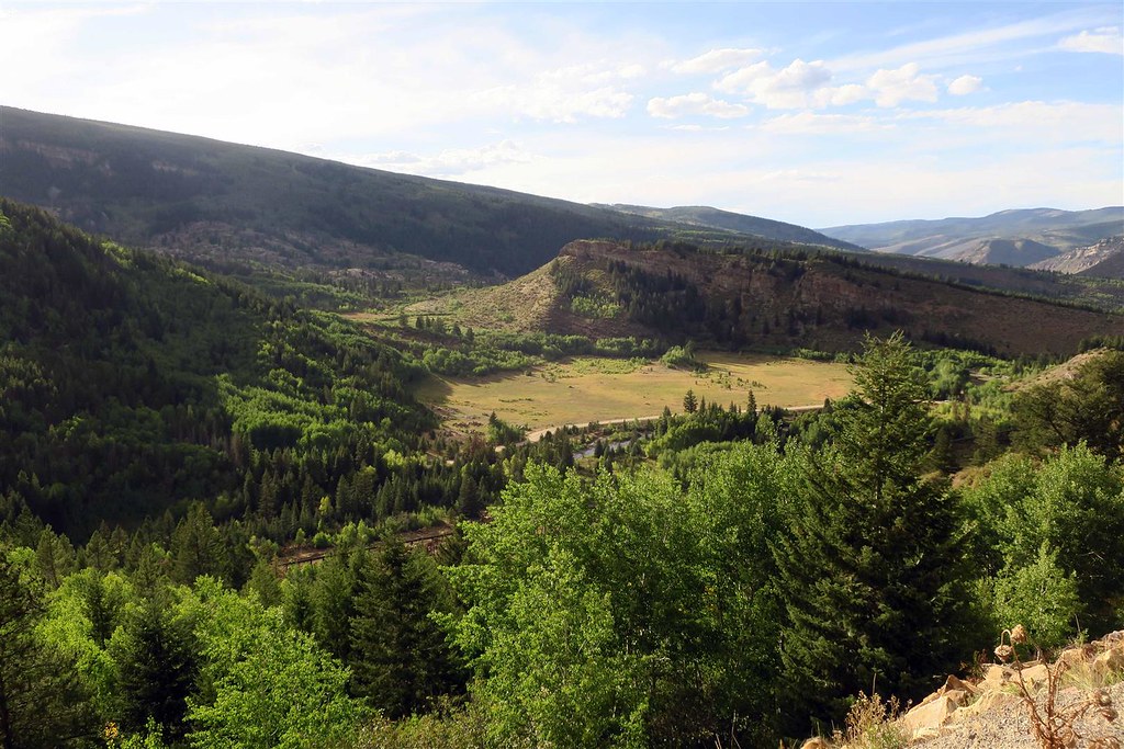
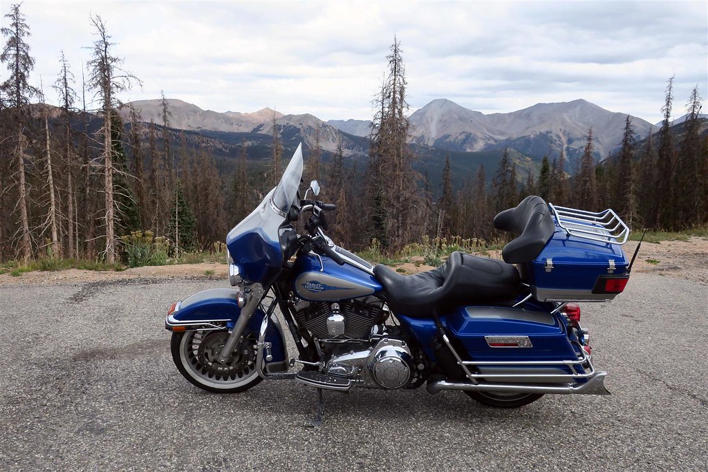
At Grand Junction Colorado I head east onto interstate 70. I have a Butler Motorcycle Map of Colorado. I often uses these maps to find the best motorcycle roads. The map shows highway 65 is a great scenic road with lots of curves heading up Grand Mesa. I decide to take it.
This is Plateau Canyon.
So in western Colorado we have Grand Mesa and the city of Grand Junction. Why are so many things around here named "Grand"? Before Colorado was a state the river that flowed through this area was called the Grand River. The town of Grand Junction was where the Grand River junctioned with the Gunnison River. When Colorado was admitted as a state in 1876 we petitioned to rename the river the Colorado river. This made sense since it was often confused with the Rio Grande which also originated in Colorado. The river has been called the Colorado River ever since.
From highway 65 I turned onto a small road called 45 1/2 road. If I would have stayed on the interstate I would have been far past Rifle CO by now but this route is much more enjoyable.
After riding on Interstate 70 for half an hour I turn off at Rifle and head north. At Craig I go east on Highway 40 to Steamboat Springs. It's getting late and it looks like rain. Where do I stay for the night? Usually I ride until dinner time and then look for a motel but this is Labor Day weekend. I knew I had to find a room in advance. The day before leaving I searched the internet for a place to stay. Steamboat springs has expensive motels. I ended up making reservations in Leadville Colorado.
I turned south. I've gone over 500 miles and I still have a ways to go to get to my motel.
#5
09-03-2018, 09:40 PM
I ride on highway 131 to Interstate 70.
Here's the view looking down onto the Interstate.
I'm not on the interstate for long before exiting onto highway 24.
This is the view looking down onto Eagle River.
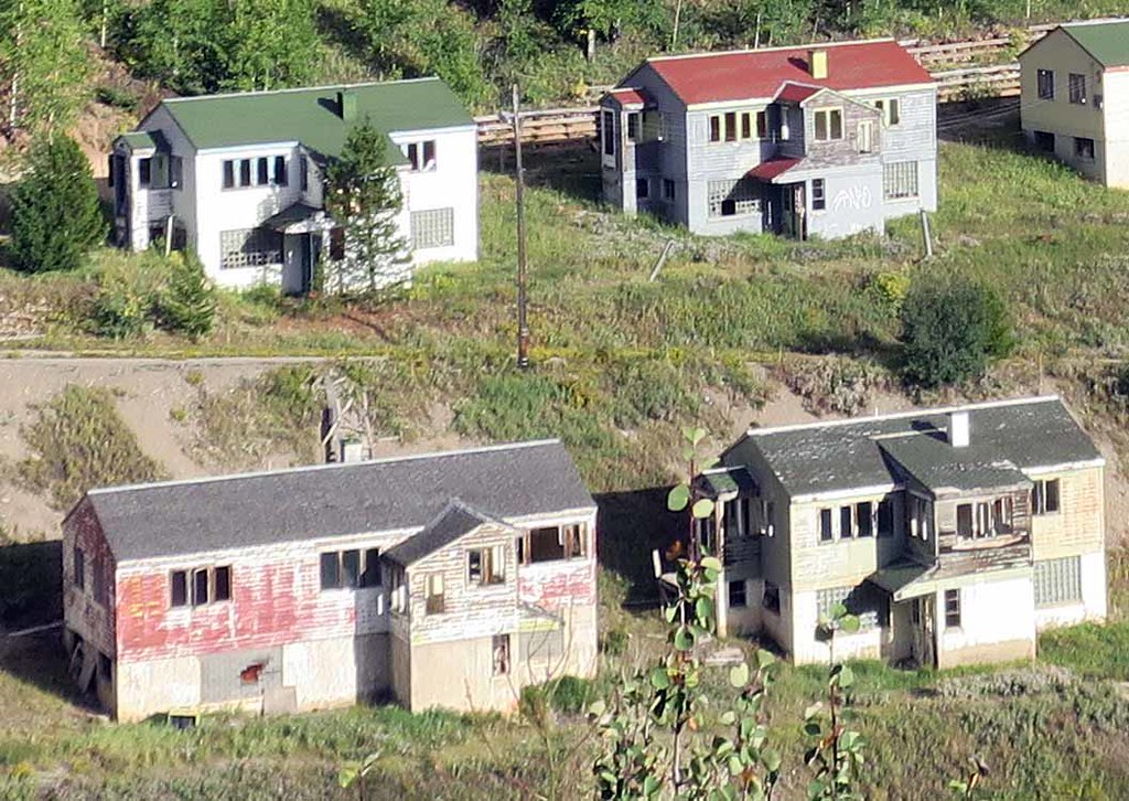
While riding on highway 24 I come across this eerie 20th century ghost town. Riding and jeep'n in Colorado I often come across ghost towns from 100 years ago but I found this place especially eerie, I think because it was abandoned more recently.
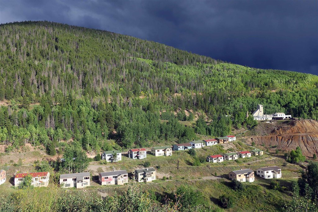
This mining town is Gilman Colorado. In 1984 it was ordered abandoned by the EPA because of toxic pollutants. It was then declared a superfund and they tried to clean it up.
Storm clouds are rolling in. I stop to put on my rain gear.
This is the highway 24 bridge over the Eagle River.
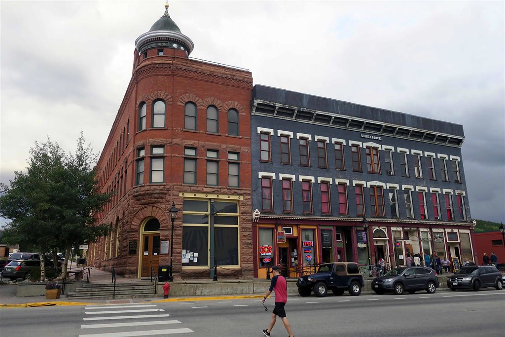
The rain comes down but not for long. I then roll into Leadville where I have a motel reservation.
This is a cool little mining town.
To be continued ...
Here's the view looking down onto the Interstate.
I'm not on the interstate for long before exiting onto highway 24.
This is the view looking down onto Eagle River.
While riding on highway 24 I come across this eerie 20th century ghost town. Riding and jeep'n in Colorado I often come across ghost towns from 100 years ago but I found this place especially eerie, I think because it was abandoned more recently.
This mining town is Gilman Colorado. In 1984 it was ordered abandoned by the EPA because of toxic pollutants. It was then declared a superfund and they tried to clean it up.
Storm clouds are rolling in. I stop to put on my rain gear.
This is the highway 24 bridge over the Eagle River.
The rain comes down but not for long. I then roll into Leadville where I have a motel reservation.
This is a cool little mining town.
To be continued ...
#6
09-04-2018, 07:26 AM
After awakening in my motel room in Leadville I have breakfast at the Golden Burro Cafe and head south on highway 24.
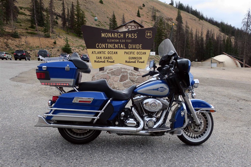
I then go east on highway 50 to Monarch pass.
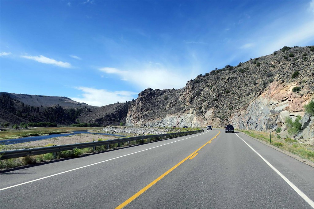
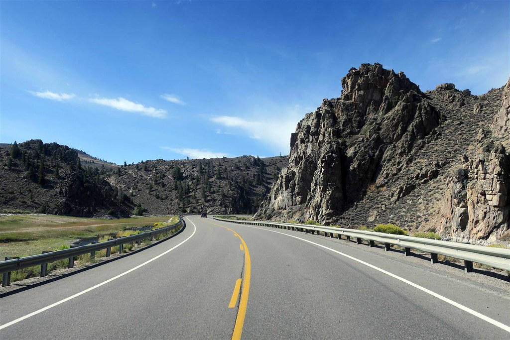
I continue west on highway 50.
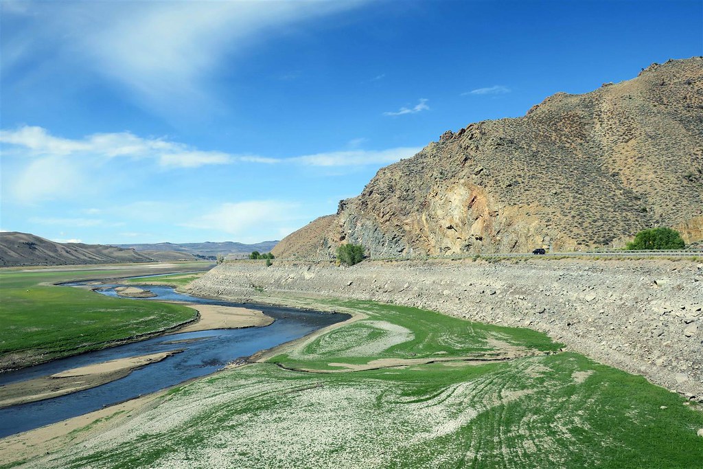
This next picture should be the Blue Mesa Reservoir but the water levels are extremely low due to a drought.
I head south on highway 149

This is lake City.
I turn west onto highway 160. Earlier this summer a semi driver lost his life on Wolf Creek Pass. This is a steep, winding mountain pass. There are 2 emergency truck ramps that he didn't use. I don't know if he didn't realize he was having brake problems or, more likely he just came into this hairpin turn much too fast. He smashed into the barriers that normally protect cars and trucks from going over the ledge. Today the overlook parking area was closed while they made repairs to the wall.
I took the following picture from a previous trip.

I continued on highway 160 to my home in Durango.
On this trip I rode 932 miles over two days.
The End.
I then go east on highway 50 to Monarch pass.
I continue west on highway 50.
This next picture should be the Blue Mesa Reservoir but the water levels are extremely low due to a drought.
I head south on highway 149
This is lake City.
I turn west onto highway 160. Earlier this summer a semi driver lost his life on Wolf Creek Pass. This is a steep, winding mountain pass. There are 2 emergency truck ramps that he didn't use. I don't know if he didn't realize he was having brake problems or, more likely he just came into this hairpin turn much too fast. He smashed into the barriers that normally protect cars and trucks from going over the ledge. Today the overlook parking area was closed while they made repairs to the wall.
I took the following picture from a previous trip.
I continued on highway 160 to my home in Durango.
On this trip I rode 932 miles over two days.
The End.

Thread
Thread Starter
Forum
Replies
Last Post