Touring Smoky Mountains, Myrtle Beach and the remainder of the US
#21
 05-06-2017, 01:41 PM

Day 12 � Wednesday 26th
I was slightly behind schedule and was hoping to get caught up. After checking the weather in the morning I realized that wasn�t going to happen. There was a storm to the west. NOAA has a great weather app for smartphones. There was no avoiding this storm. The best I could do was to ride west to Cape Girardeau, MO. Then the storm would hit in the evening. The rain would end by morning. Night is the best time for rain so this won�t wreck my plans even though I won�t make as much progress as I would have liked.
First I had to stop at the Harley shop in Evansville IN. I�ve been having trouble getting my gas cap open. My Electra Glide has a key lock for the gas and sometimes it�s so hard to open I think I�m going to break my key before it opens. Maybe some graphite lube would fix it but I replaced it with a push button latch.
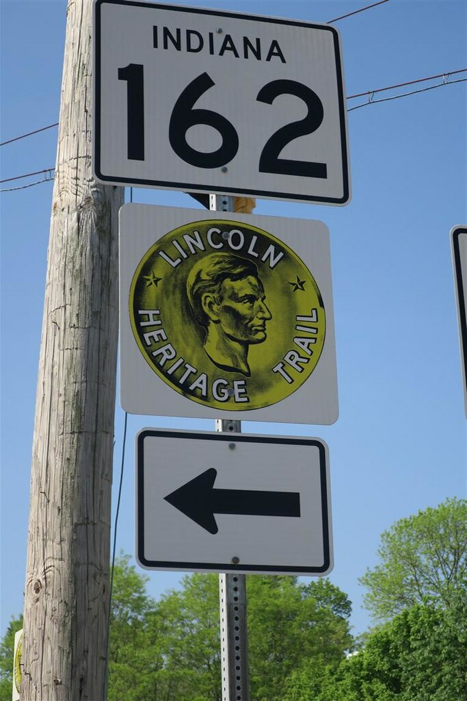
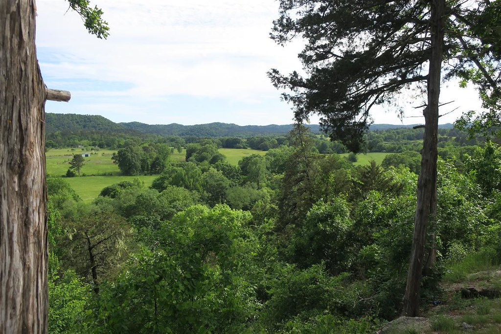
I knew I couldn�t go too far west or I would run into the storm. With plenty of time and little ground to cover I turned off the Interstate with plans to meander south and west. Then I came upon the Lincoln Heritage Scenic route and followed that most the day.
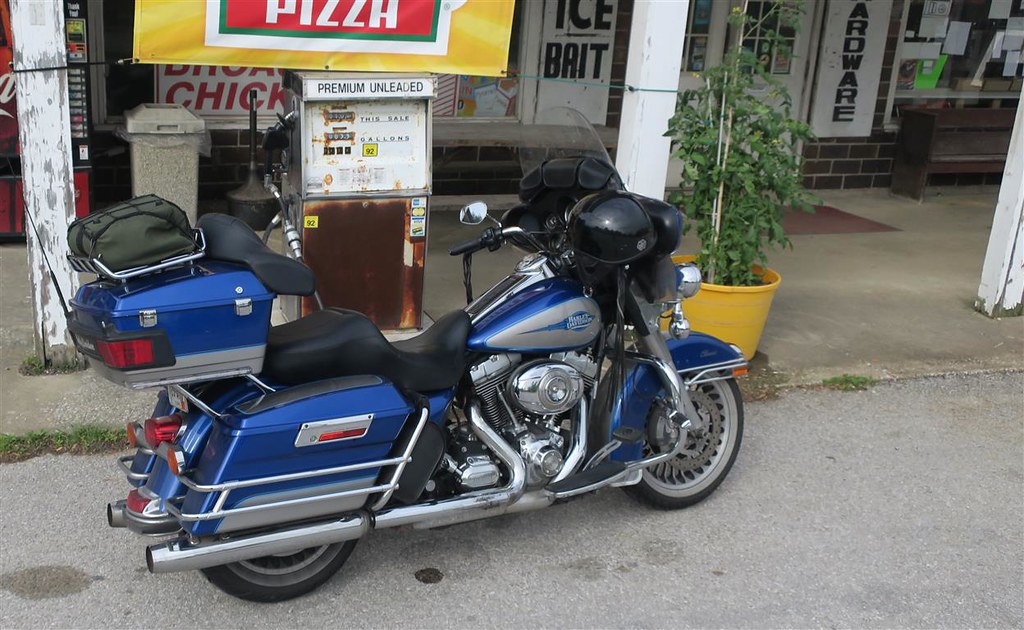
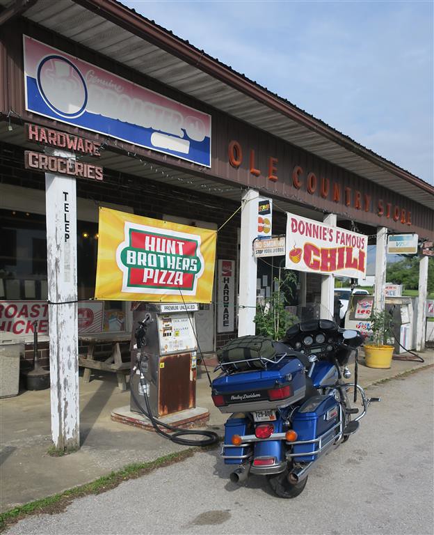
I was running low on gas so I stopped at an �Ole Country Store� with an old, very rusty gas pump out front. I made sure the pump didn�t say something ridiculous like 75 cents per gallon. I didn�t want to embarrass myself by trying to get gas out of an antique pump that was only out for display.
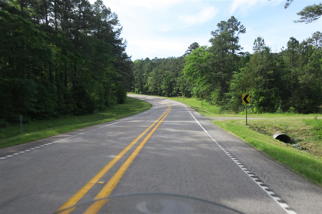
This was a very pleasant highway.

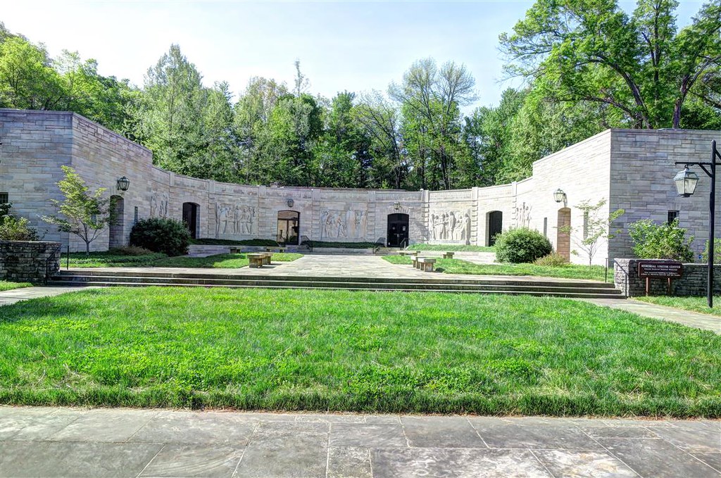
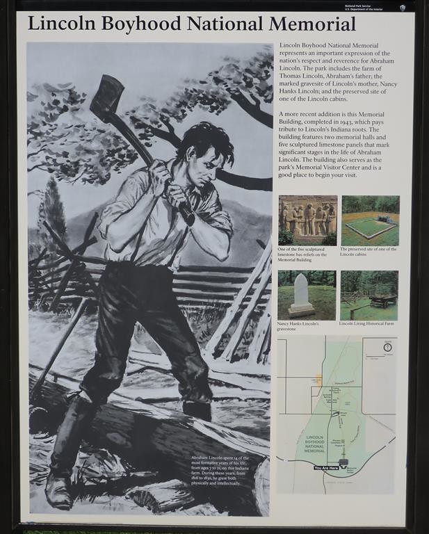
While still in Indiana I stopped at the Lincoln Boyhood National Memorial. It�s a park where a farm used to be where Abraham Lincoln lived from age 7 to 21.
I then continued on the Lincoln Heritage Scenic route through southern Indiana and Illinois.

At 5:30 I checked into a motel at Cape Girardeau, MO. It was just in time. After checking into the motel the storm really got started. I could hear the thunder and rain from my room.
To be continued �
I was slightly behind schedule and was hoping to get caught up. After checking the weather in the morning I realized that wasn�t going to happen. There was a storm to the west. NOAA has a great weather app for smartphones. There was no avoiding this storm. The best I could do was to ride west to Cape Girardeau, MO. Then the storm would hit in the evening. The rain would end by morning. Night is the best time for rain so this won�t wreck my plans even though I won�t make as much progress as I would have liked.
First I had to stop at the Harley shop in Evansville IN. I�ve been having trouble getting my gas cap open. My Electra Glide has a key lock for the gas and sometimes it�s so hard to open I think I�m going to break my key before it opens. Maybe some graphite lube would fix it but I replaced it with a push button latch.
I knew I couldn�t go too far west or I would run into the storm. With plenty of time and little ground to cover I turned off the Interstate with plans to meander south and west. Then I came upon the Lincoln Heritage Scenic route and followed that most the day.
I was running low on gas so I stopped at an �Ole Country Store� with an old, very rusty gas pump out front. I made sure the pump didn�t say something ridiculous like 75 cents per gallon. I didn�t want to embarrass myself by trying to get gas out of an antique pump that was only out for display.
This was a very pleasant highway.
While still in Indiana I stopped at the Lincoln Boyhood National Memorial. It�s a park where a farm used to be where Abraham Lincoln lived from age 7 to 21.
I then continued on the Lincoln Heritage Scenic route through southern Indiana and Illinois.
At 5:30 I checked into a motel at Cape Girardeau, MO. It was just in time. After checking into the motel the storm really got started. I could hear the thunder and rain from my room.
To be continued �
#22
05-07-2017, 08:42 AM
Day 13 – Thursday 27th
I headed out from Cape Girardeau, MO and was able to see the effects of the storm. The fields were turned into large lakes. It was even worse in northern Arkansas. Many of the secondary roads were underwater. Rivers such as the Current River were flooded well over the banks. Some places the water went over 2 miles past the normal river banks. I made it a point to check the weather but never thought of checking the government sites to make sure the roads would not be under water. It all worked out. I didn’t have any water crossings in my path.
I went through Little Rock Arkansas and continued southwest. This allowed me to come back north in the Ouachita National Forest. I went to Hot Springs AR and then west on highway 270. At Y City (yes that’s the full name of the city, I am not abbreviating) I headed north on highway 71. This was a nice drive. I saw it as a scenic route on my Harley Atlas. At Fort Smith I got onto Interstate 40 heading west.
Just west of Oklahoma City I stopped for the night.
To be continued …
#23
05-07-2017, 08:50 AM
Day 14 – Friday 28th
I went through Oklahoma, the Texas panhandle and continues west into New Mexico. On Interstate 40 east of Albuquerque it started to snow. Yes, snow at the end of April in New Mexico. It was really coming down. I pulled over into a truck stop.
In the truck stop I pulled out my smart phone for a weather update. A couple asked me where I was headed. I told them Durango Colorado. They said they came from that way and “it get’s worse, much worse”. The NOAA app on my smartphone confirmed it’s going to get worse. Should I stay the night? No. It looks like tomorrow will be more wintery.
So I continue into Albuquerque and turn north, then onto highway 550. It snows most of the time. Sometimes it lets up and sometimes sleet comes down. This is so unusual for New Mexico. Sometimes we get a late snow in Durango but New Mexico usually gets very little snow, and snow in late April is extremely rare.
There are sections that it stops snowing and I stop to take a couple of pictures.
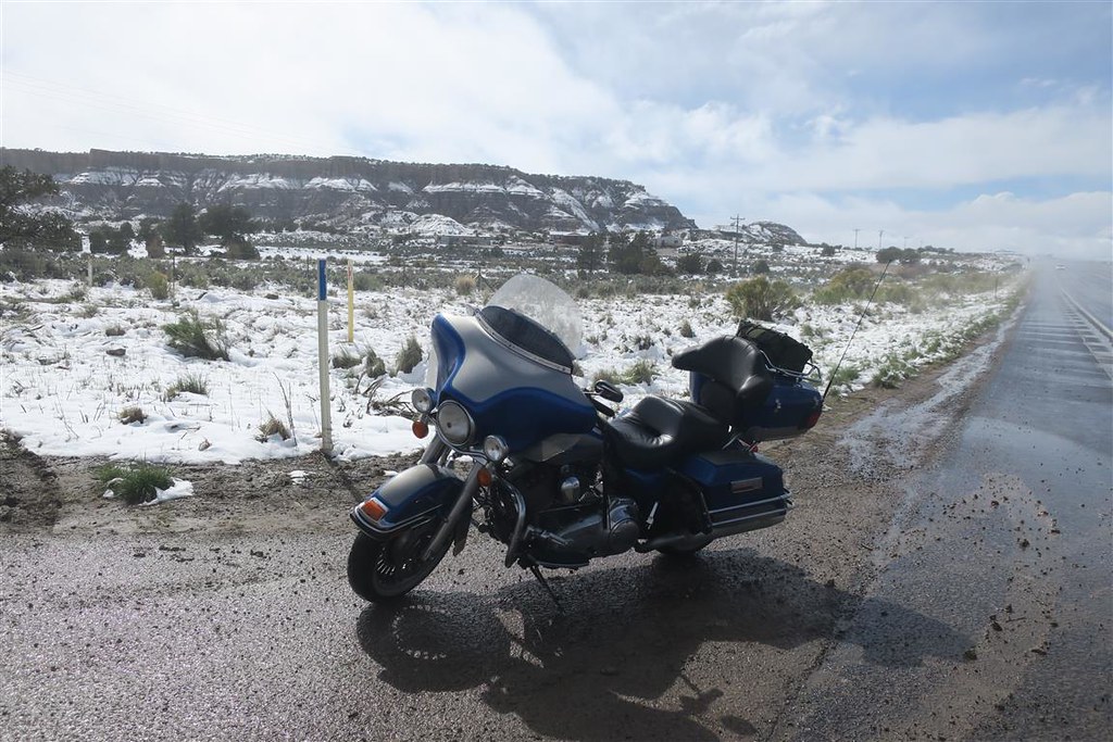
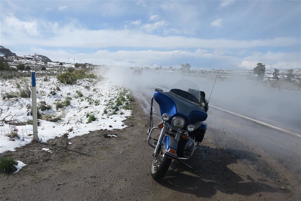
Sometimes sleet comes down, sometimes snow. Visibility is usually a problem.
In Aztec NM it’s really coming down. There is two inches of snow on the ground. I follow the car tire tracks to get better traction. Aztec is only 40 miles from my home. I have a friend here but I decide to ride on since tomorrow won’t be any better.
When I cross the state line into Colorado the weather clears up. I ride into Durango and into my driveway. This has turned out to be quite a motorcycle adventure with many ups and downs. Overall I had a great time. It was very enjoyable.
The End
I went through Oklahoma, the Texas panhandle and continues west into New Mexico. On Interstate 40 east of Albuquerque it started to snow. Yes, snow at the end of April in New Mexico. It was really coming down. I pulled over into a truck stop.
In the truck stop I pulled out my smart phone for a weather update. A couple asked me where I was headed. I told them Durango Colorado. They said they came from that way and “it get’s worse, much worse”. The NOAA app on my smartphone confirmed it’s going to get worse. Should I stay the night? No. It looks like tomorrow will be more wintery.
So I continue into Albuquerque and turn north, then onto highway 550. It snows most of the time. Sometimes it lets up and sometimes sleet comes down. This is so unusual for New Mexico. Sometimes we get a late snow in Durango but New Mexico usually gets very little snow, and snow in late April is extremely rare.
There are sections that it stops snowing and I stop to take a couple of pictures.
Sometimes sleet comes down, sometimes snow. Visibility is usually a problem.
In Aztec NM it’s really coming down. There is two inches of snow on the ground. I follow the car tire tracks to get better traction. Aztec is only 40 miles from my home. I have a friend here but I decide to ride on since tomorrow won’t be any better.
When I cross the state line into Colorado the weather clears up. I ride into Durango and into my driveway. This has turned out to be quite a motorcycle adventure with many ups and downs. Overall I had a great time. It was very enjoyable.
The End
Last edited by Durango Dave; 05-07-2017 at 09:13 AM.
#24
05-07-2017, 08:53 AM
I rode 7379 miles over 14 days during my trip.
That averages out to 527 miles per day.
I used 203 gallons and got 36.35 MPG.
Normally I get 40 MPG for local travel.
My mileage goes down at higher speeds on the interstate.
Once again here's a map of my trip:
https://spotwalla.com/tripViewer.php...=10&showAll=no
That averages out to 527 miles per day.
I used 203 gallons and got 36.35 MPG.
Normally I get 40 MPG for local travel.
My mileage goes down at higher speeds on the interstate.
Once again here's a map of my trip:
https://spotwalla.com/tripViewer.php...=10&showAll=no
Last edited by Durango Dave; 05-07-2017 at 09:08 AM.
The following users liked this post:
Spy11 (05-07-2017)
#25
05-07-2017, 09:15 AM

My compliments on your trip, the great pics and commentary. I, like yourself, ride alone on my long trips (3 x cross continent) ... none of my buds can afford the time committment. I recognize many of the places you passed thru but I must say the New Mexico heat last summer was much better than the snow you had to endure! I've also experienced the dreaded "Lo" warning on my fuel a few times. Bless HD for making that "reserve" adequate enough (39+ miles) to get to the next gas station. (I remember having to get gas at a lonely bar in south central Montana that only carried regular from a rusty pump for atvs. But I was thankful to get it for sure)
#26
05-08-2017, 11:03 PM
Extreme HDF Member


Thread
Thread Starter
Forum
Replies
Last Post
Mike_M
Road Trips
6
07-06-2012 06:41 PM

