Touring Smoky Mountains, Myrtle Beach and the remainder of the US
So I set out from Durango CO to see Myrtle Beach SC, the Smoky Mountains and much of the rest of the south and the east. After this trip I will have taken my current cycle to all lower 48 states. Next year I plan on going to Alaska.
I rode this trip solo. I always ride alone, especially long distance touring. I often like to cover a lot of miles and if you�re in a group it's hard to get a consensus.
I have my whole trip scheduled out but I don�t make any motel reservations. I never like to commit myself to being anywhere even though I may have been able to get better rates.
Here�s a link to the route I took: https://spotwalla.com/tripViewer.php...=10&showAll=no
It uses all the Google Map functions so you can zoom in or out, pan and change to satellite view.
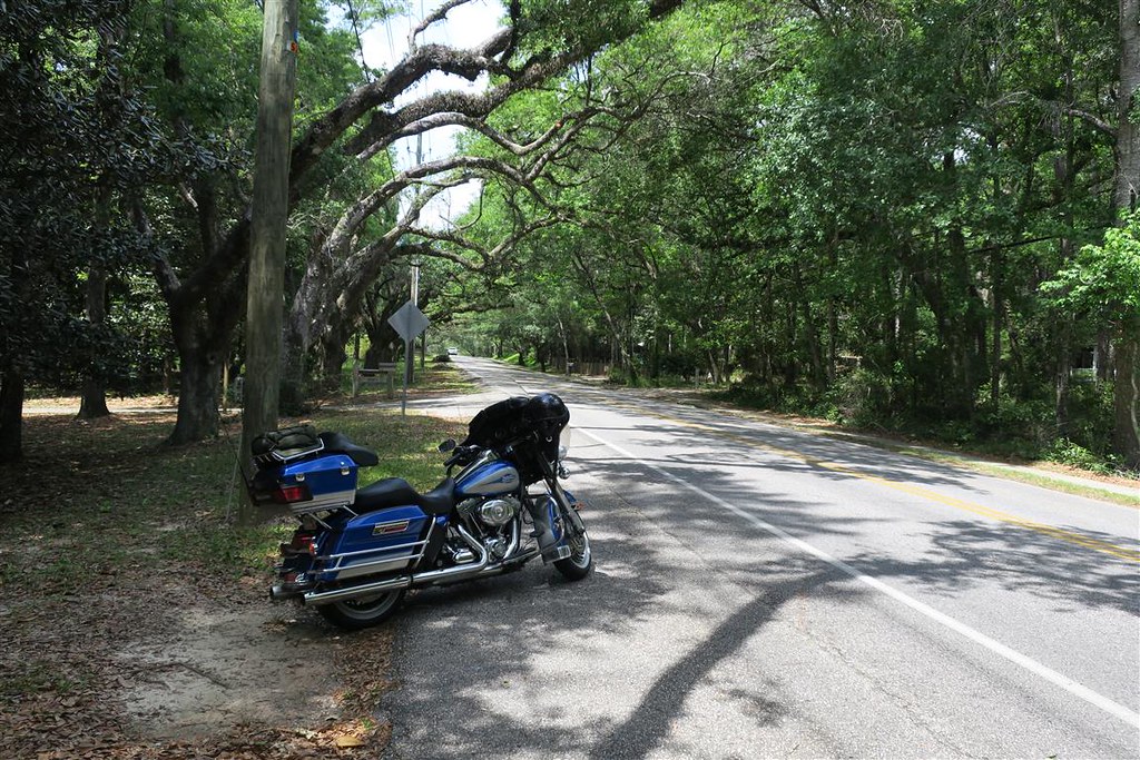
After breakfast I headed out at 6:15 am. It was freezing at 32� Fahrenheit but I layered up. I left Durango and headed south on highway 550 to Albuquerque NM. I continued south to El Paso TX. From there I headed east on Interstate 10. I�ve been shedding layers. It�s gone from freezing temps when I left to 89� on Interstate 10. I exited off the Interstate to take highway 118 through the Davis Mountains. This side route was well worth it. It wasn�t really out of the way, it�s just not as fast as the interstate. I very much enjoyed this route.
These were some great motorcycle roads even though I was taking pictures at the milder sections.
After the Davis Mountains I got on highway 90 east. My plan was to follow highway 90 or Interstate 10 all the way to Florida. In many places highway 90 merged with I 10.
I stopped for dinner at the 12 Gauge Restaurant in Marathon. I asked for a table but was told the first table wouldn�t be available for 45 minutes but I could sit at in the bar. I went into the bar. Even there all seats were taken and a couple people were standing around waiting for a table. I wasn�t going to wait around 45 minutes just to get a table so I left. When I was outside and crossing the street the waiter caught up with me and told me he should be able to find a table for me. He then gave me a table near the band that was playing. I usually don�t care for country music but I did enjoy listening to these guys. When in Texas do as the Texans.
As I headed out of town on highway 90 I noticed my tank was getting under half full. I�ll have to start looking for gas. The sun was setting behind me. My rear view mirrors were almost perfectly set to watch the bright orange sunset. After the sun was below the horizon I tried to be extra cautious of deer. They seem to be more active at twilight. I kept riding and wondering where that next gas station might be. I get to the �town� of Dryden Texas but there isn�t a gas station open. The next town is Comstock but the sign says that won�t be for 27 miles. How far can I go before running out of gas? My trip meter says I can go 33 miles before I run out. If I can trust that I can go only five miles past Comstock. That�s too close for comfort. This is one desolate stretch of Texas. The low fuel light comes on. I keep an eye on my trip meter counting the miles until I run out of gas. When my trip meter says I only have 10 miles of gas left it stops showing me a mileage. Instead it just says �LO�. There is no sign of a town and I see very few cars. What if there is no gas station in Comstock that can sell gas at night? All I know is I can�t drive past Comstock unless I fill up. Finally, I see the sign for Comstock. They have one unattended place that sells gas and only one gas pump.
After filling up I can enjoy the ride again. My route is following just north of our border with Mexico. I ride over a low long bridge and later figure out it�s the Amistad Reservoir created by damming up the Rio Grande River. I usually don�t like riding at night because I can�t see much more than the roadway that my headlights shine on. I pull into Del Rio Texas for the night.
During this first day I have traveled 940 miles over 16 hours and 15 minutes.
To be continued �
After getting up I have breakfast at the IHOP in Del Reo and leave town at 8:45. I continue on highway 90 east to San Antonio. From there get on I 10 to Houston. Texas is one big state. I stay on Interstates to make good time but I�m always looking for scenic routes. I have several scenic highways planed for my trip. When I get into Louisiana I turn off onto highway 14. My Harley map says this is a scenic route. It�s not bad but I really don�t think it�s worth it. The road goes through lots of small towns where the speed limit is 35. I don�t really regret this route but I don�t think I would take it again. I come across a disabled pickup on the side of the road. The drive shaft broke and I let the driver use my phone. Once he is able to get ahold of someone that can bring a trailer to help I head out. I continue to follow highway 14. Before getting to New Orleans I turn south to Houma LA. I get a motel near several restaurants. I haven�t made any reservations on this trip but it�s been working out. I�m trying to make good time but I don�t want� to commit to a reservation I can�t keep.
Today I travel 690 miles over 12 hours.
To be continued �
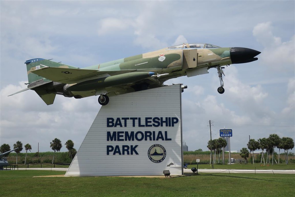
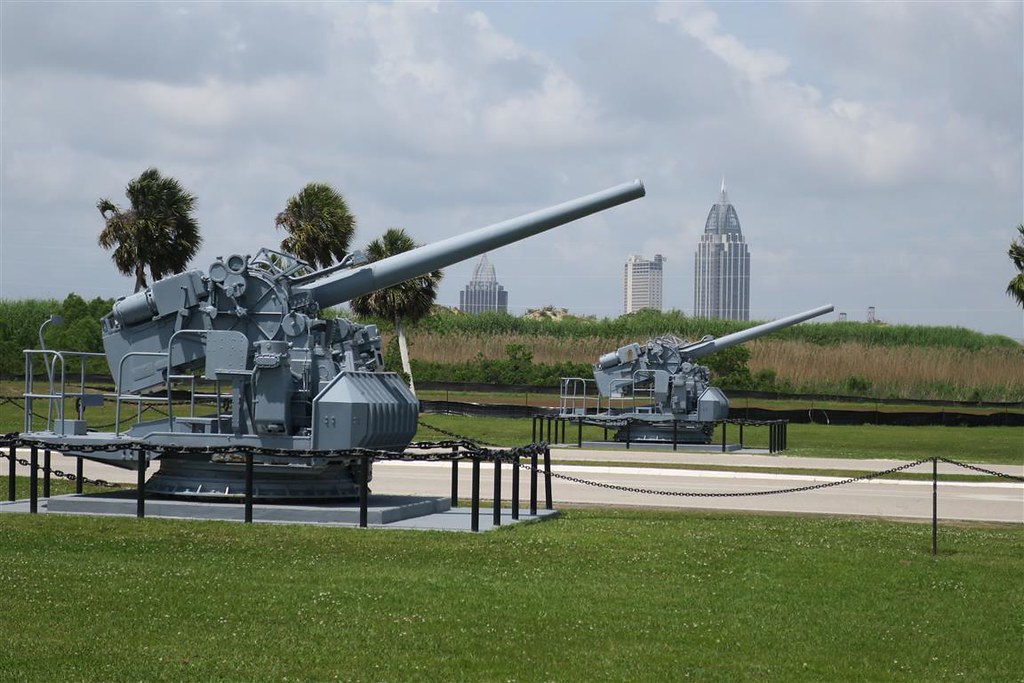
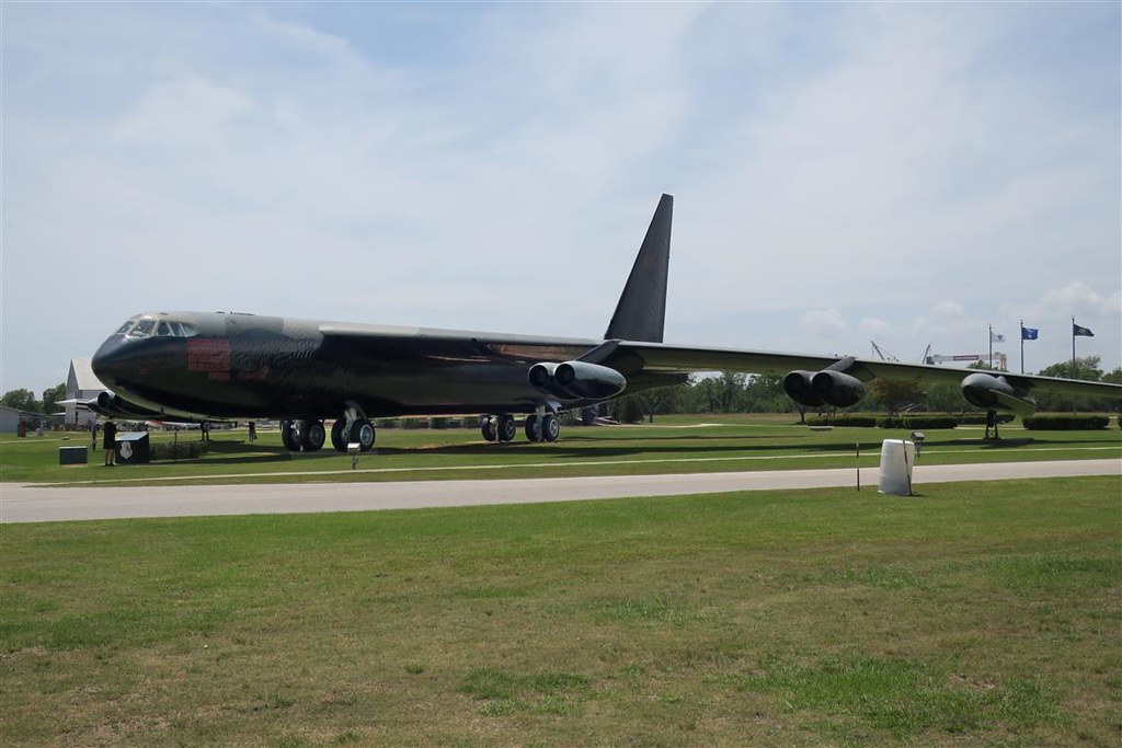
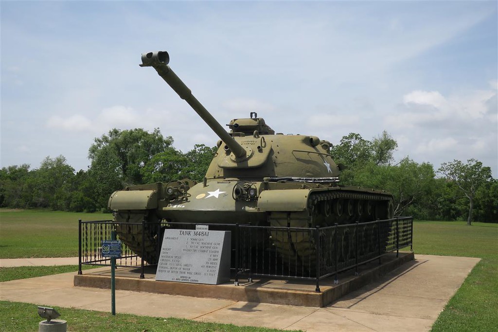
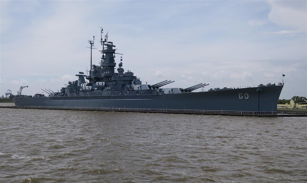
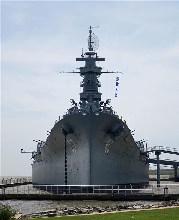
From Houma I head out by 9 am. I go through New Orleans and go over a bridge over Lake Pontchartrain. Then I head east on Interstate 10. As I am passing Mobile Alabama I see a battleship and military planes and decide to stop. This is Battleship Memorial Park and was well worth the stop. I enjoy looking at military equipment.
Day 03 -030 F-4 Phantom
Day 03 -090 B-52D Stratofortress
Day 03 -038 M48A1 Tank
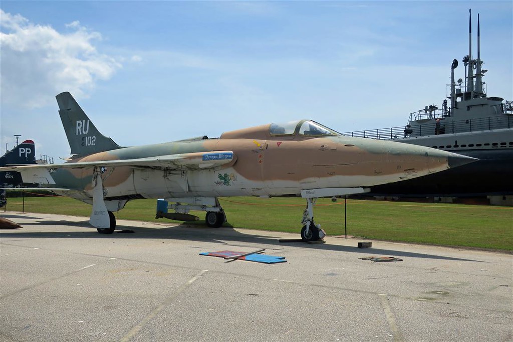
F-105 Thurnderchief
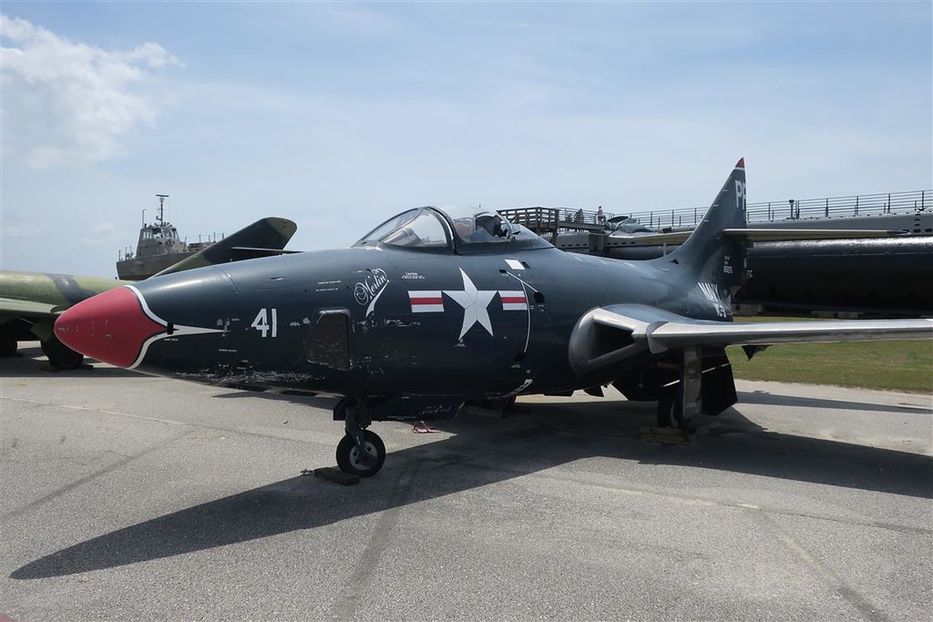
Day 03 -053 F-9F-5P Panther
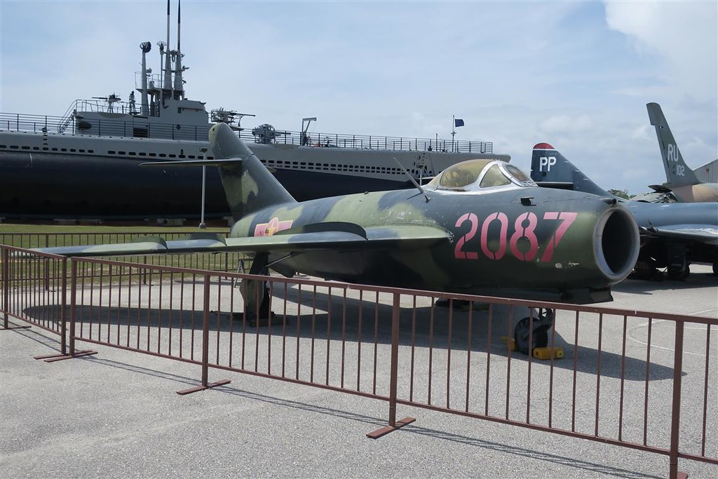
MIG-17A Fresco from USSR
USS Alabama
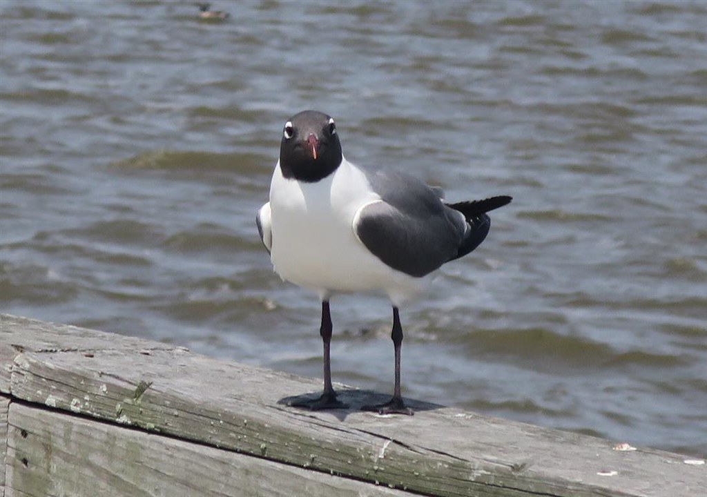
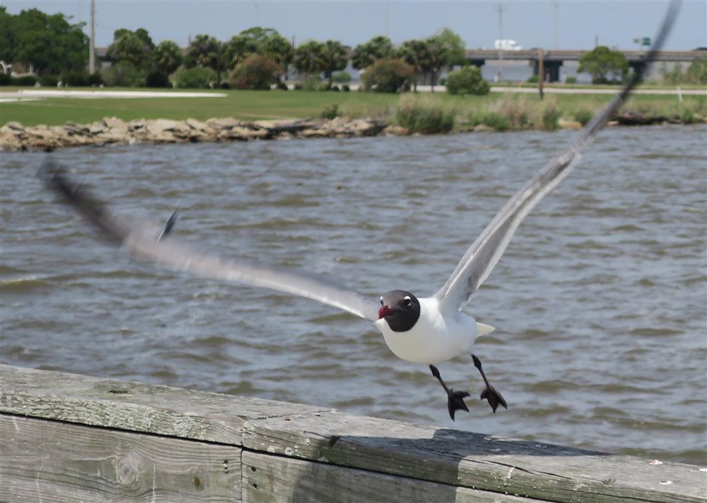
a Laughing Gull
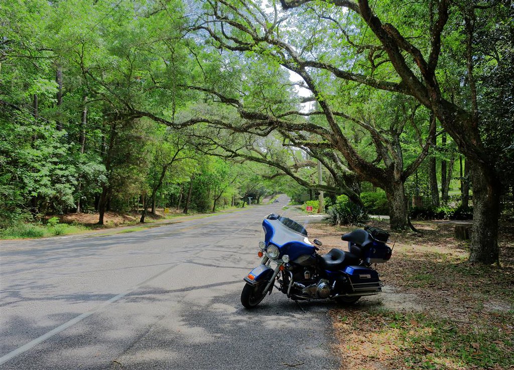
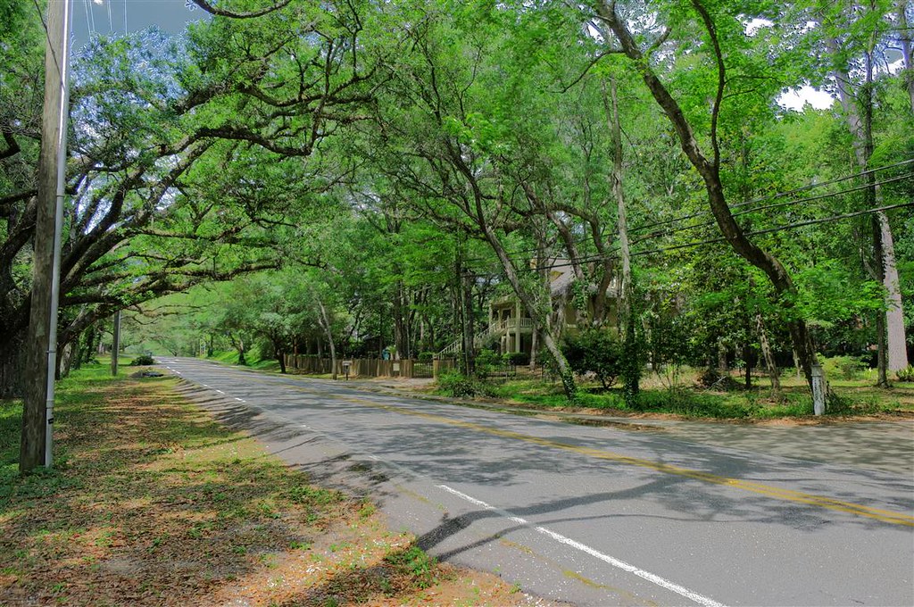
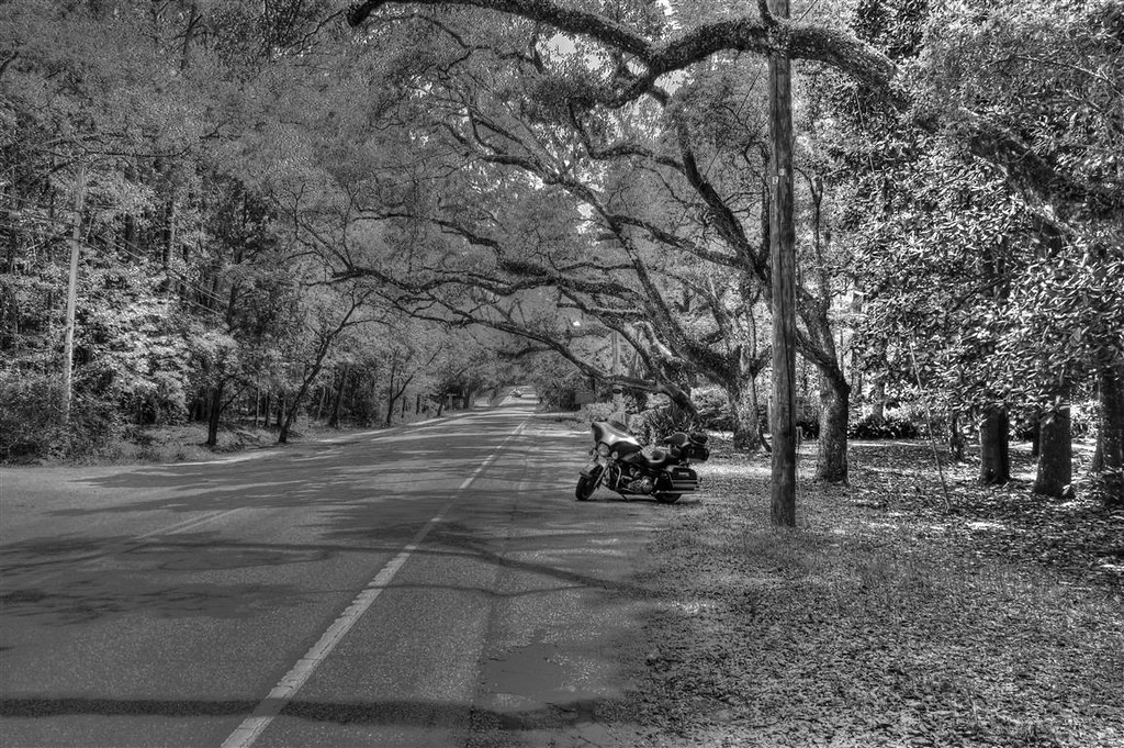
Just after passing Mobile AL I head south on highway 98 and follow the coast. This is another scenic route. It�s slower than the one I took in Louisiana but this one is well worth it.
These next pictures are taken on the east side of Mobile bay.
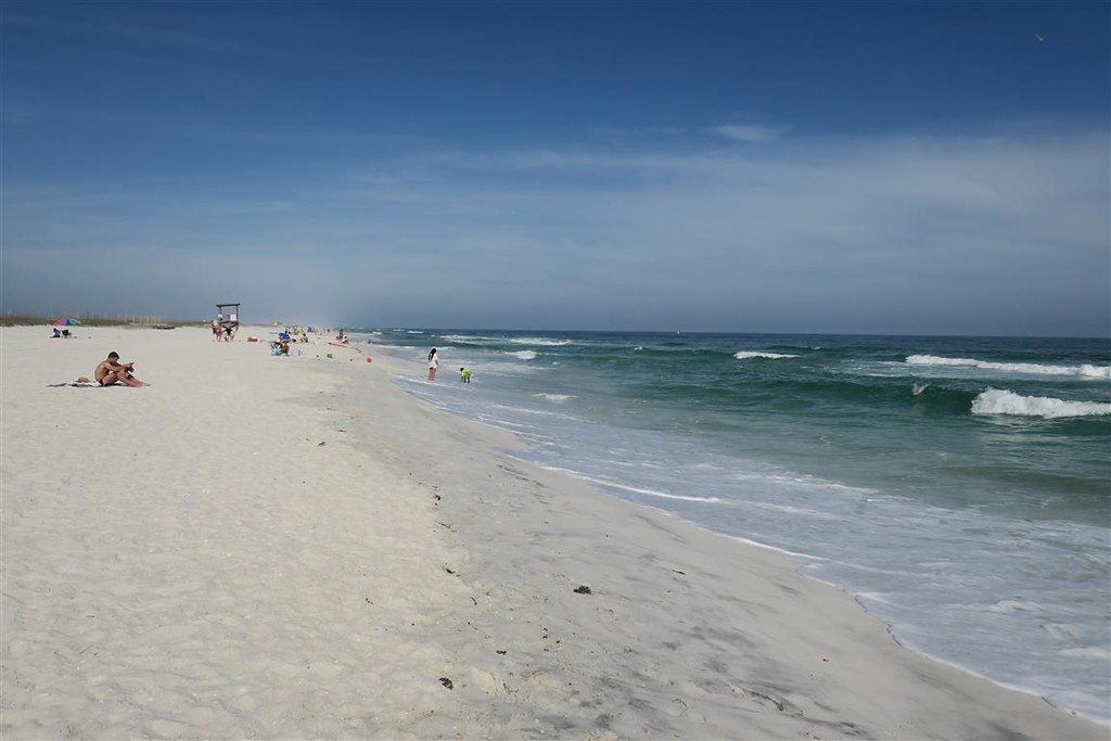
At Pensacola FL I take the toll bridge to Pensacola Beach and then follow the narrow island. This is the Gulf Islands National Seashore.
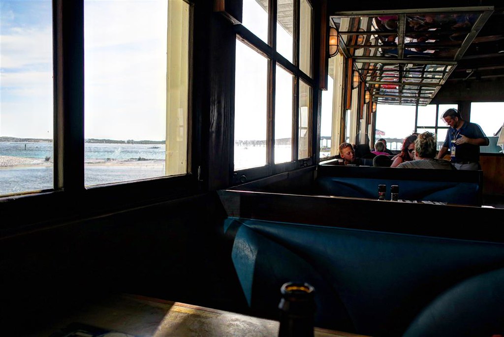
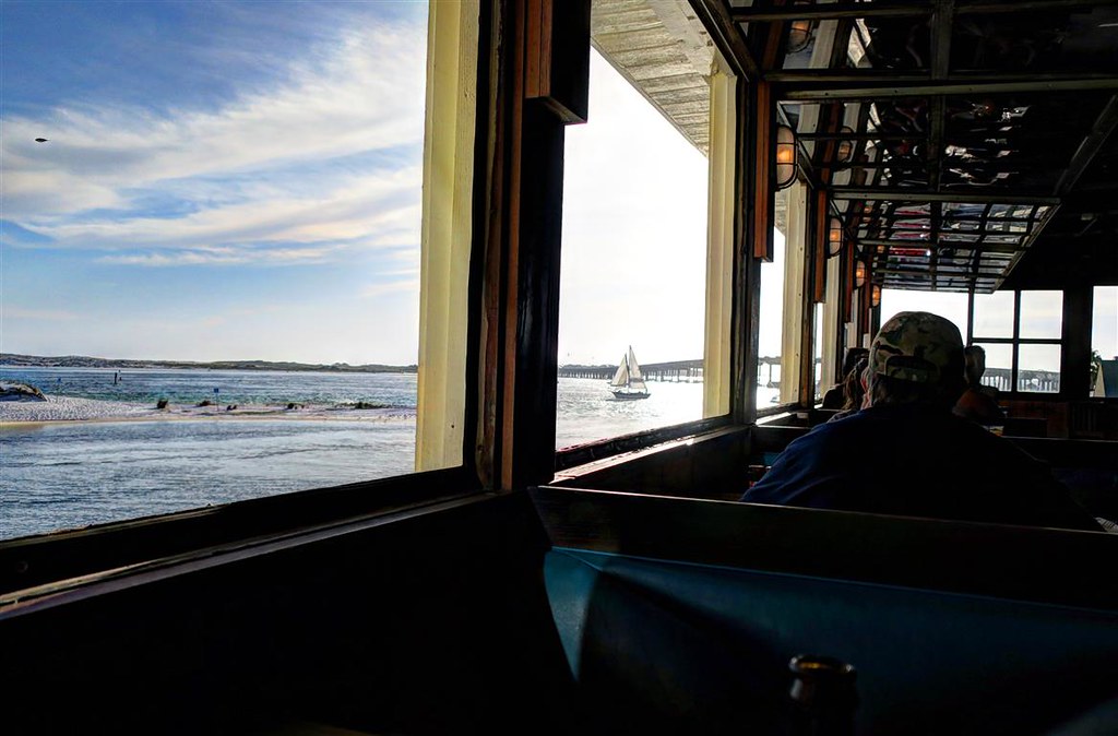
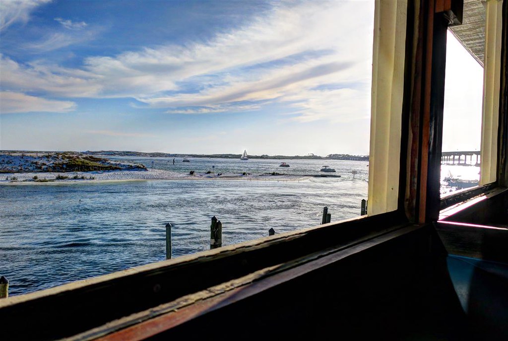
Looking for a place for dinner I stop at Jimmy Buffett's Margaritaville Restaurant in Destin Florida.
I have a nice view of the boats coming in and out.
I leave Marianna Florida and take the Interstate east to Jacksonville. Then I took I 295 to catch I 95 north. On the overpass as I was turning onto I 95 I looked down at I 295 that I just came off of. The west bound lane just had a rollover accident. Two teen aged girls were opening the doors of the car that was sitting, upside down in the middle of the Interstate. These girls were not passengers in the car that just rolled over. They must have been in the car just behind the car that rolled over. I found it odd that the first responders were two teen aged girls.
Near Savannah Georgia it started to rain hard with little warning. I took the next exit with plans to put on my rain gear. I stopped at a fireworks retailer that was out of business. Standing under the overhang I noticed the rain was already getting lighter. After a slight delay I headed back out again. Before long the rain completely stopped and I dried off.
I turned off the interstate onto highway 17. This is the scenic route to Myrtle Beach SC. Looking up ahead the visibility was only about a quarter mile. It looked like a curtain of water falling from the storm clouds. I rode into a downpour. This was worse than the last time. The rain was so hard it was difficult to see. When the car in front of me hit deep water it would splash high to the right. I took the left side of the lane to avoid hydroplaning. I needed to pull over but there wasn�t much of a shoulder. This was the scenic route but I had a hard enough time watching the road. Then I saw a sign saying I was entering the town of Jacksonboro. I should be able to find a safe place to pull over. I saw a gas station with an overhang protecting cars from the rain. I could pull over there but the rain was letting up already. I could see a patch of blue sky up ahead so I decided to ride on without stopping. The rain became lighter but it did not stop for a while. After it stopped the ground was dry. This was odd. These downpours were very local. I decided if it was going to rain again I would not stop. The clouds were moving very slowly. If I were to stop, I could wait for 2 hours or I could ride for another 15 minutes and get out of it.
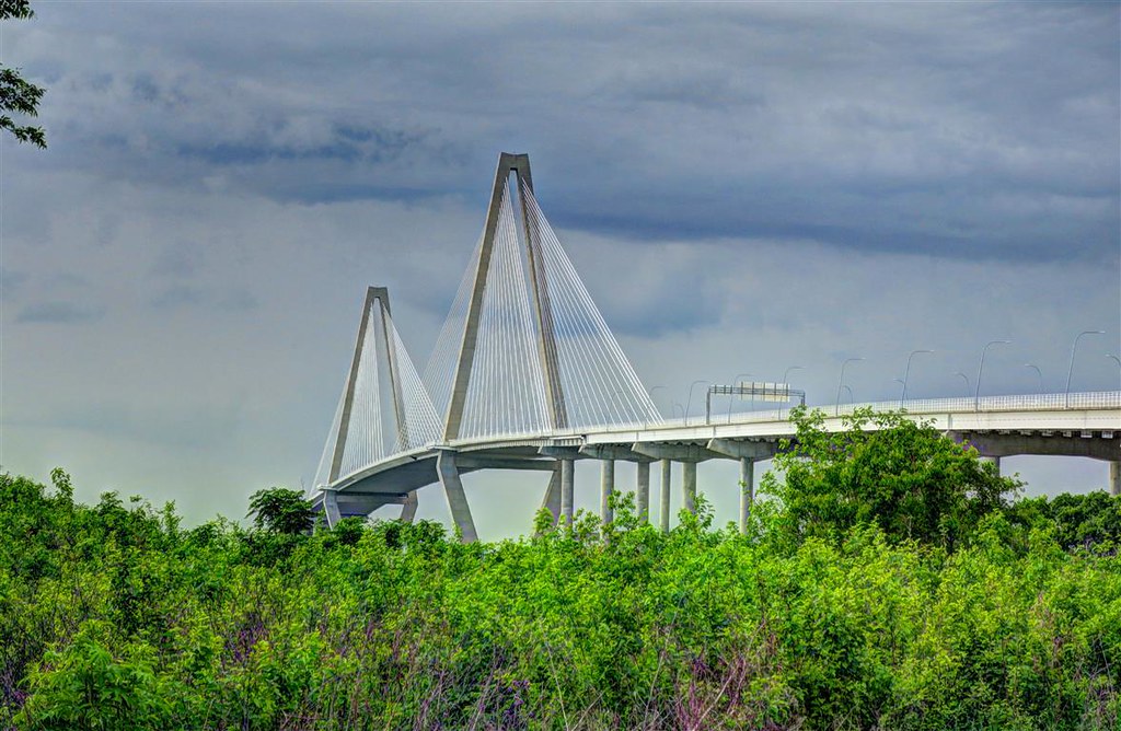
At Charleston SC I cross over the Arthur Ravenel Jr. Bridge.
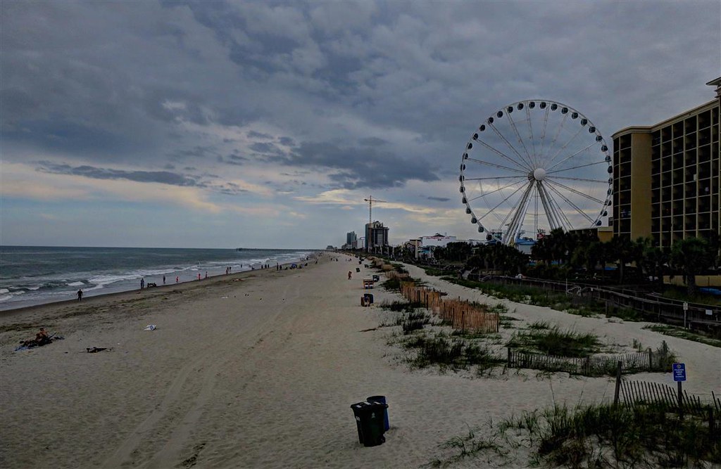
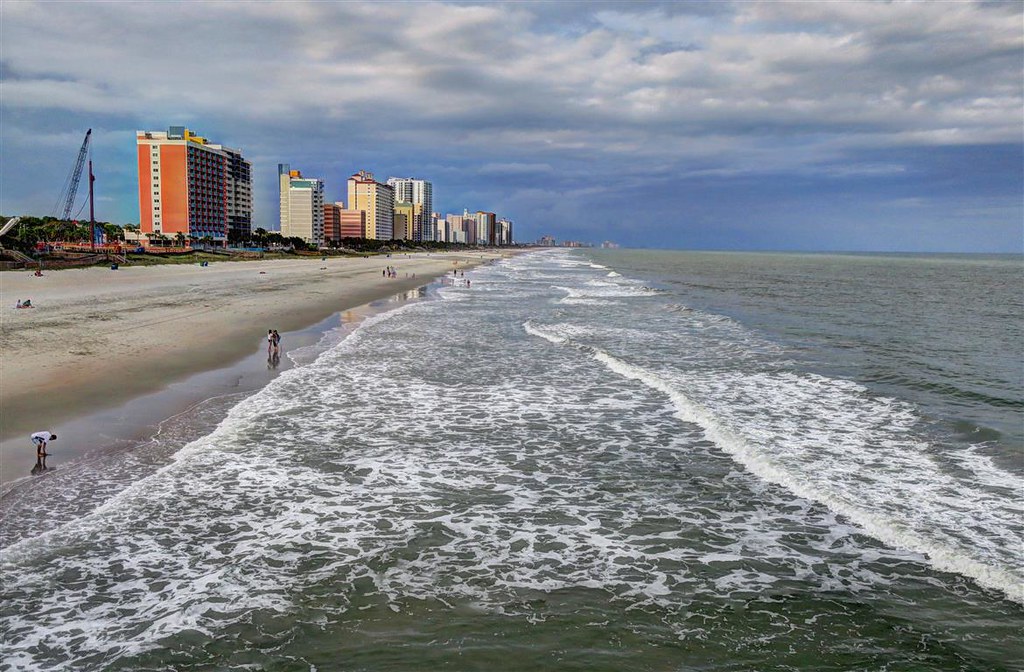
I arrive in Myrtle Beach SC and find a motel with my smartphone. Back in 1968 when I was a young boy my dad was in the US Air Force and was sent to the Air Force Base in Myrtle Beach during the Vietnam War. We lived a mile from the beach. I loved it. It could have been much worse. My dad could have been send to Vietnam for active duty.
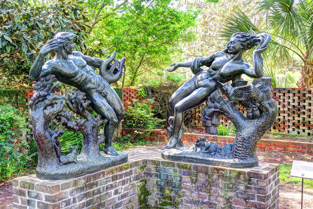
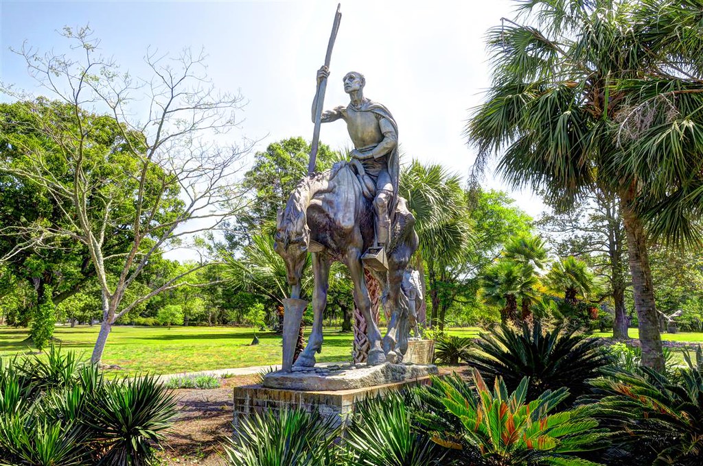
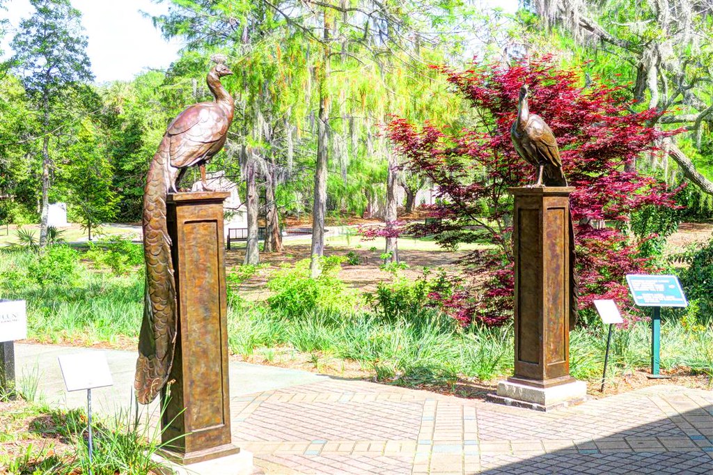
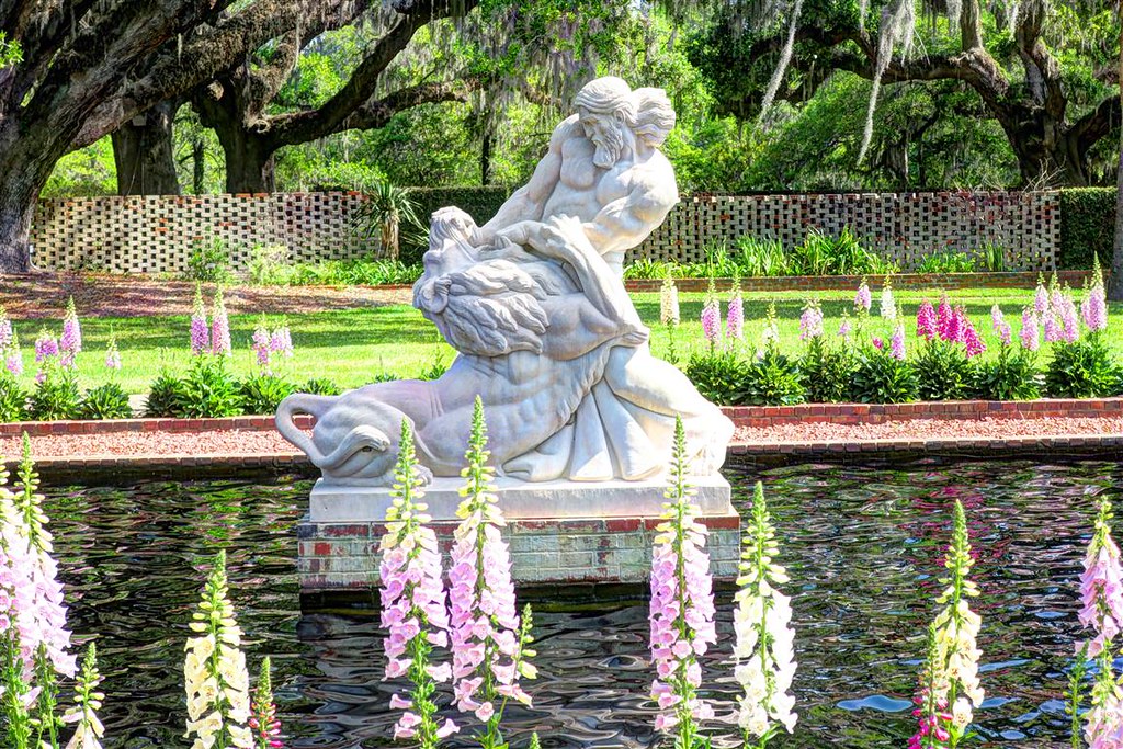
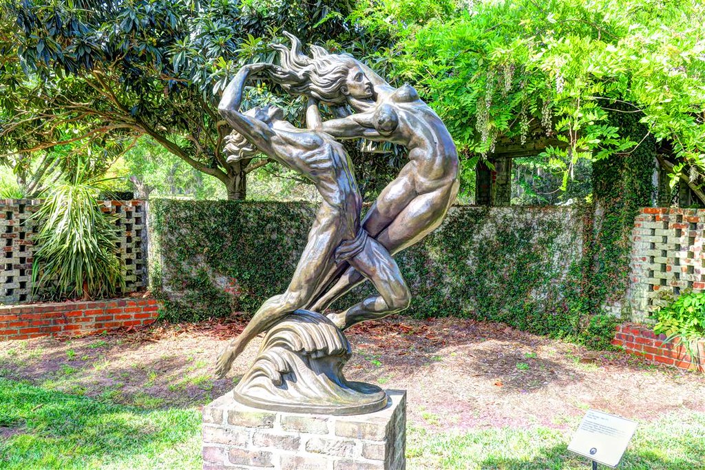
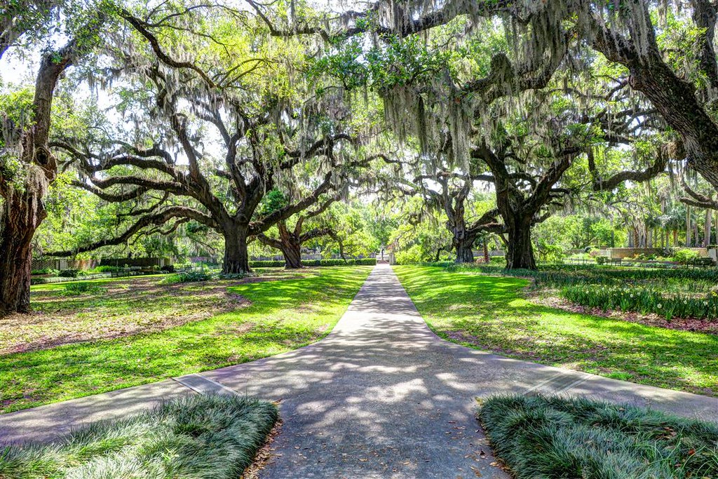
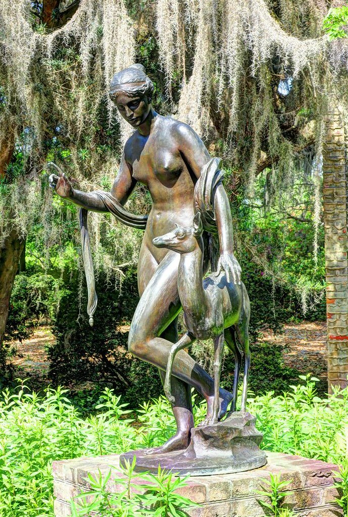
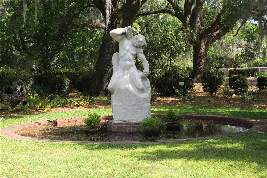
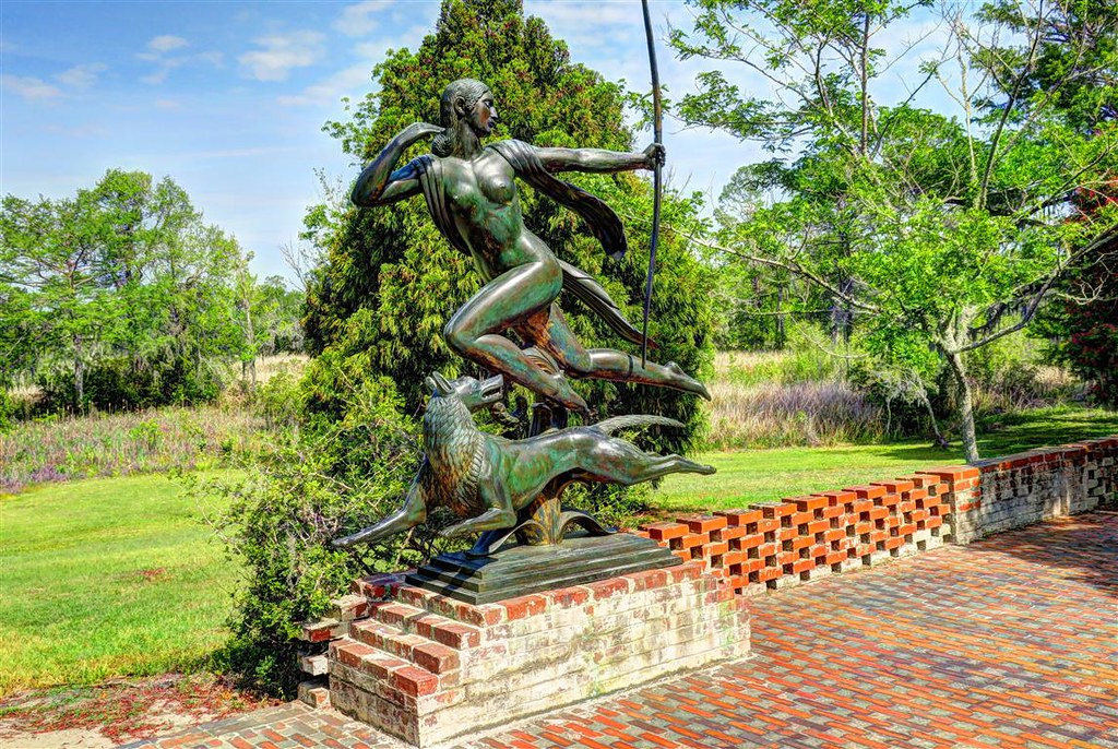
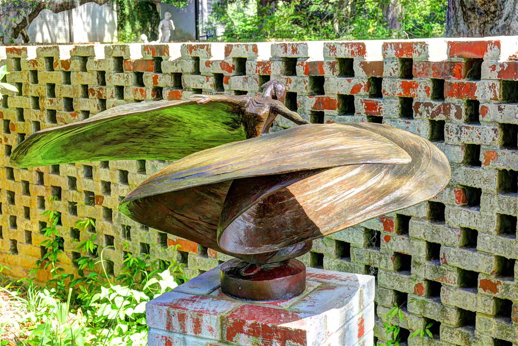
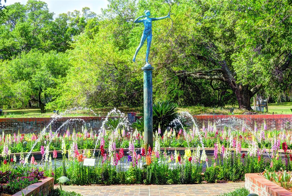
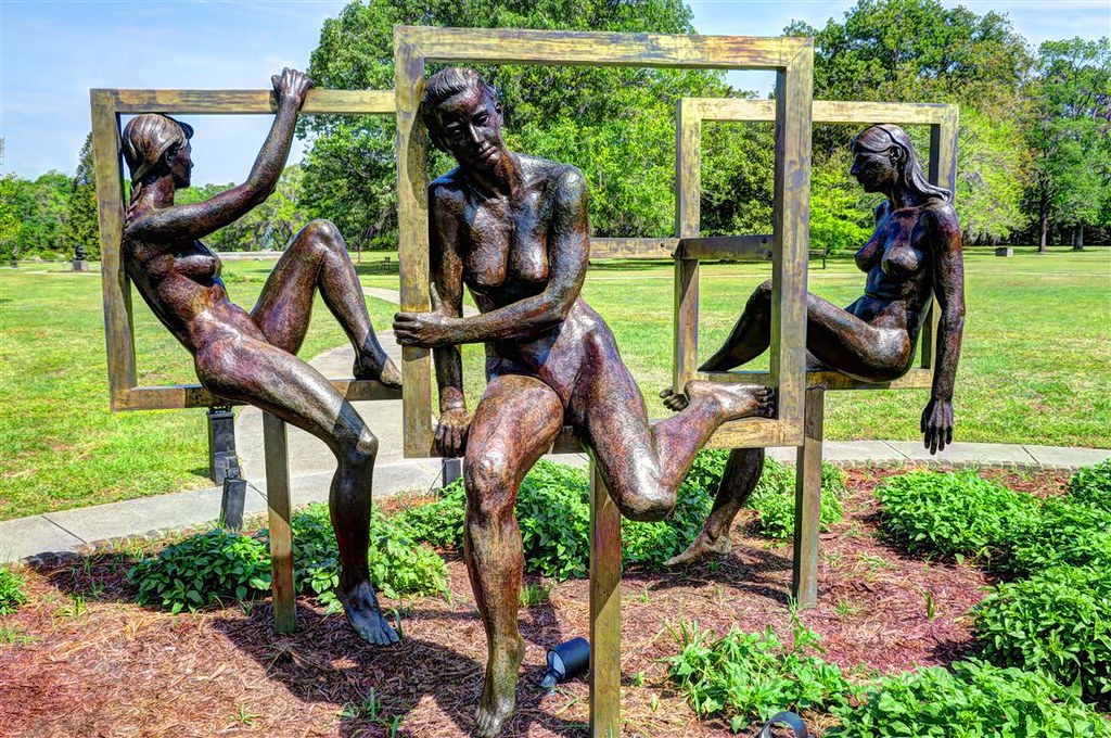
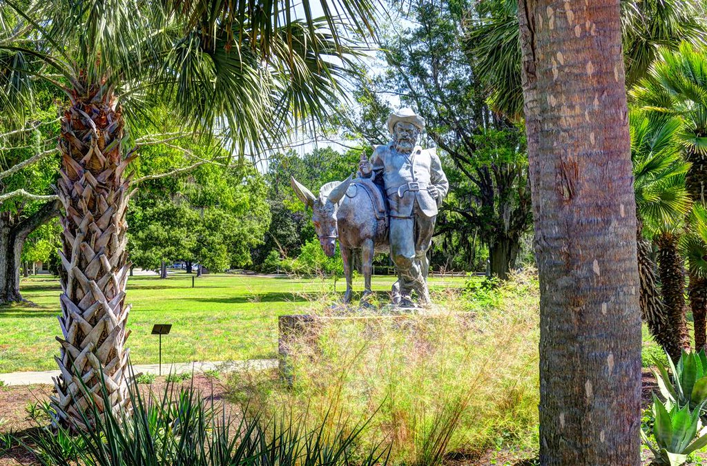
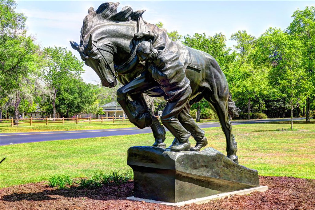
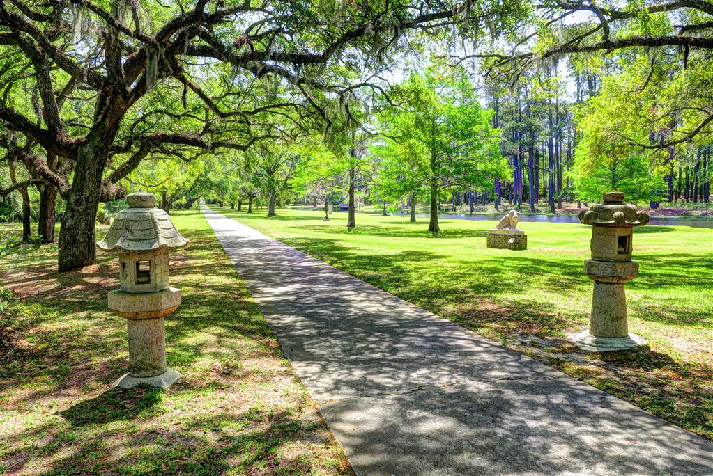
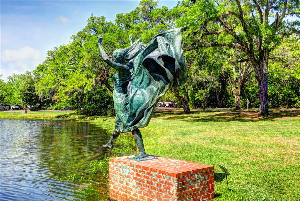
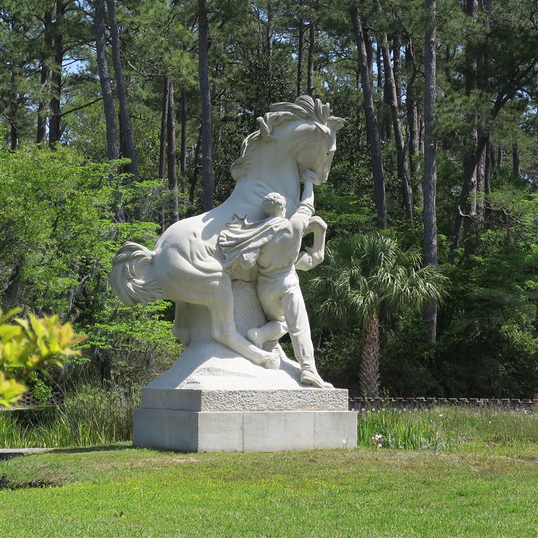
My agenda for the day is to see the sights in Myrtle Beach. After breakfast I head to Brookgreen Gardens.
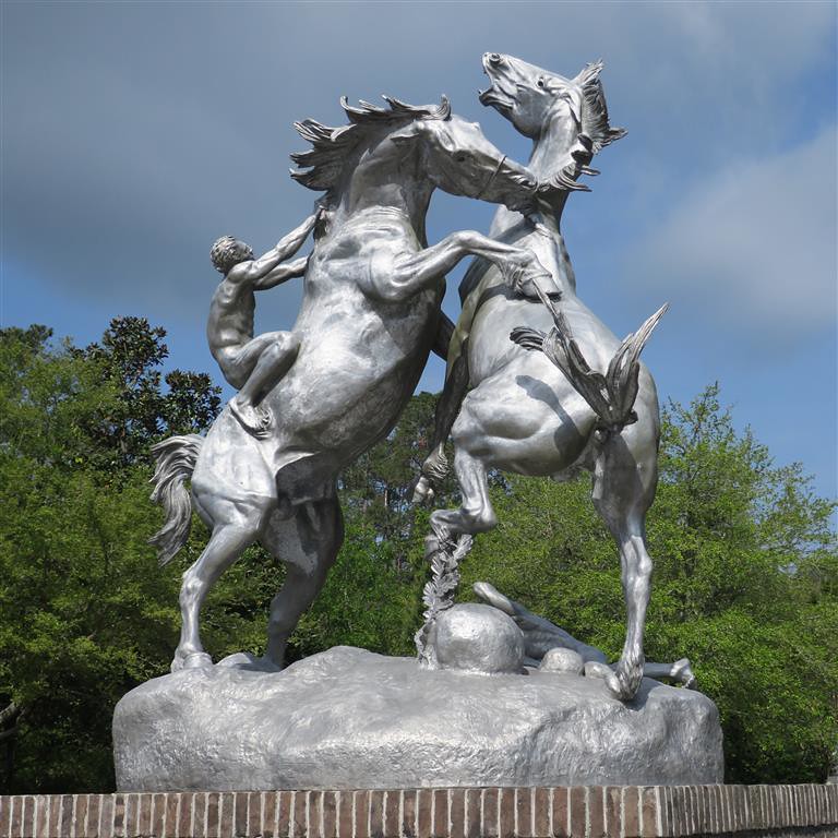
I really enjoyed walking around this place, viewing the sculptures and plants.
Fighting Stallions
Orpheus and Eurydice
Don Quixote
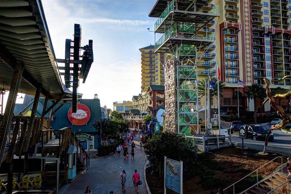
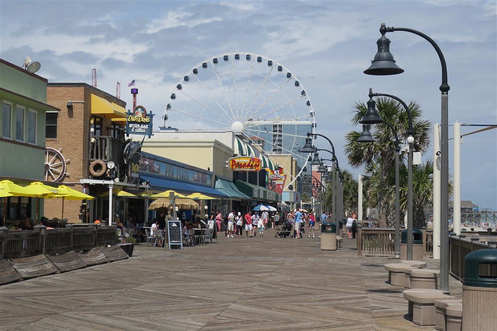
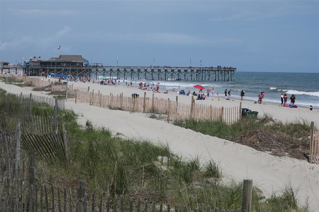
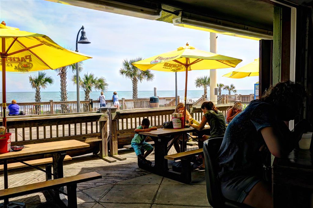
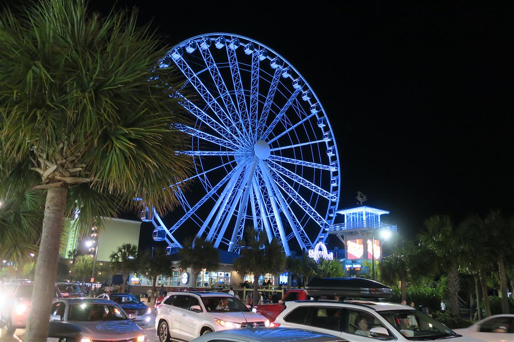
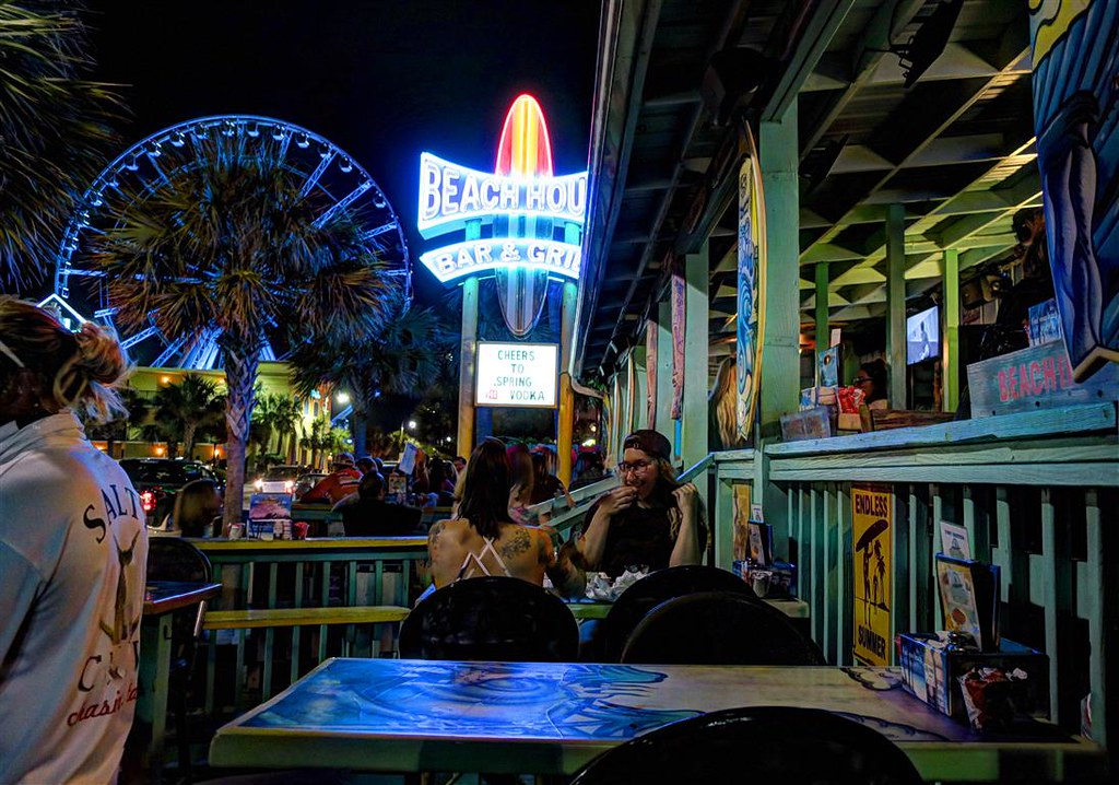
After Brookgreen Gardens I parked my cycle at the motel and walked around Myrtle Beach and its boardwalk.
I left at 6:15 am. I used the GPS on my phone to get out of Myrtle Beach and eventually onto I 95 north.
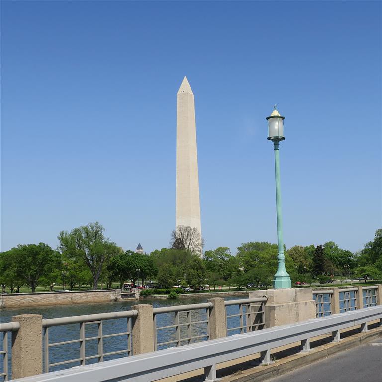
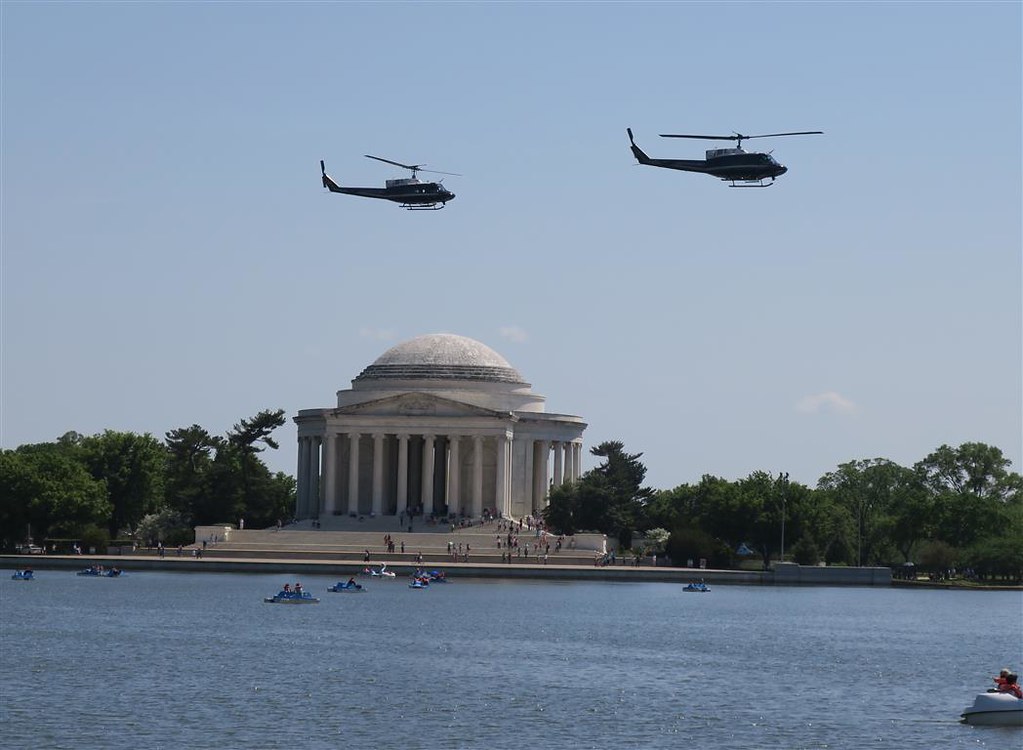
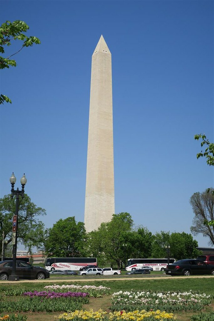
I stopped in Washington DC.
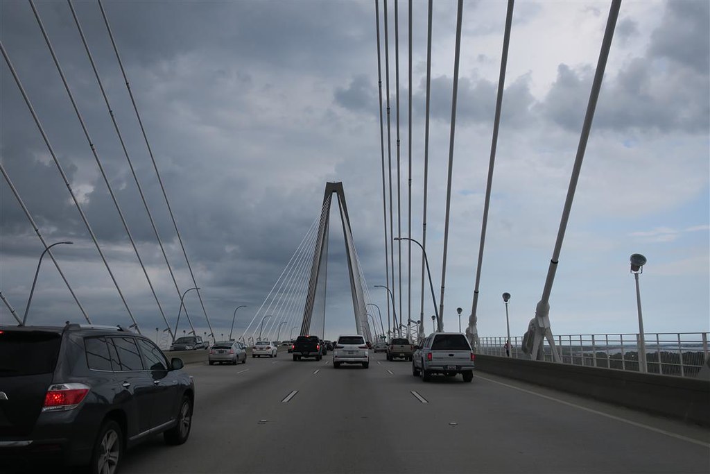
After leaving Washington I had to deal with heavy stop and go afternoon traffic. One option is to get a motel and continue in the morning but the morning rush hour would be even worse. I continued through Baltimore and Philadelphia. I�m paying quite a bit on tolls. You would think that with all the tolls they collect these expressways would be in better shape. The patchwork is never smooth and there are lots of jarring potholes. I decide to ride on past New York City even though that would be a late night of riding. Traffic is now running very fast. This is much better than the heavy traffic earlier in the day. I ride over the George Washington Bridge and view New York illuminated at night. (Sorry no pictures) I continue into Connecticut on Interstate 95. Then the traffic slows to a stop. I get off and when I�m on the overpass I see miles of stopped vehicles. I�m glad I took that exit. If I would have missed it I would have sat for hours. I later learned there was a major accident. There are 3 lanes in each direction and all northbound traffic was closed down.
I checked into a motel in Norwalk CT at 11 PM. I was told the only restaurant still serving food this late was a bar that turned out to be very loud but I didn�t mind. The bar was full of collage kids.
I left Norwalk CT and looped up into Road Island and Massachusetts. It was a wet day. At times there was a mist coming down. It didn�t really rain all day but I still was not drying off. Even the windshield was beading up with water. I was getting more condensation than evaporation. I stopped at a motel in the town of Lee in western Massachusetts.
 04-30-2017, 07:50 PM