Exploring Western Colorado
#1
 10-01-2017, 09:11 PM

The forecast was for winter advisories until 9 am, highs in the lower 40's, rain and snow showers but I didn't see anything in the forecast that would warrant delaying or cancelling my 2 day motorcycle trip.
... as long as I dressed appropriately.
The above forecast is for the mountain passes north of my home in Durango CO. The rest of my route should have warm temps.
I woke up and had a leisure morning and made my breakfast. I didn't want to leave too early since I knew the mountains had bad weather. It was warming up fast and at 9 am I headed out on my Harley all bundled up in layers.
I could see snow on the mountain tops as I drove through Durango.
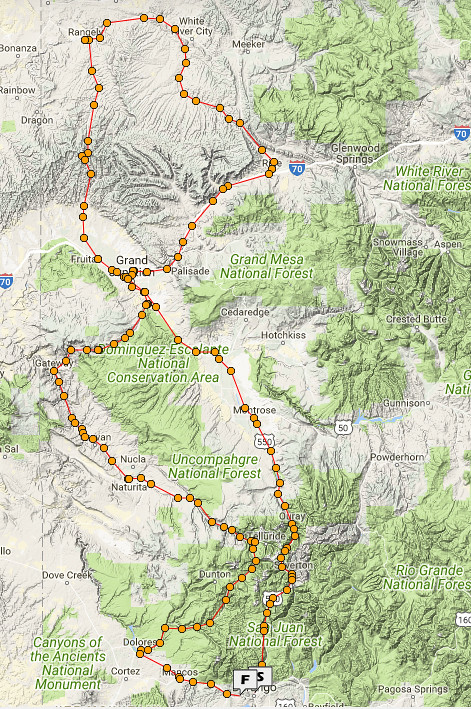
The route I planned formed a figure eight. The GPS route of my trip is mapped out here:
https://spotwalla.com/tripViewer.php...=0&showAll=yes
If you use the above link you can zoom in and out and use the other Google Map features but here's another view. This one is stagnant.
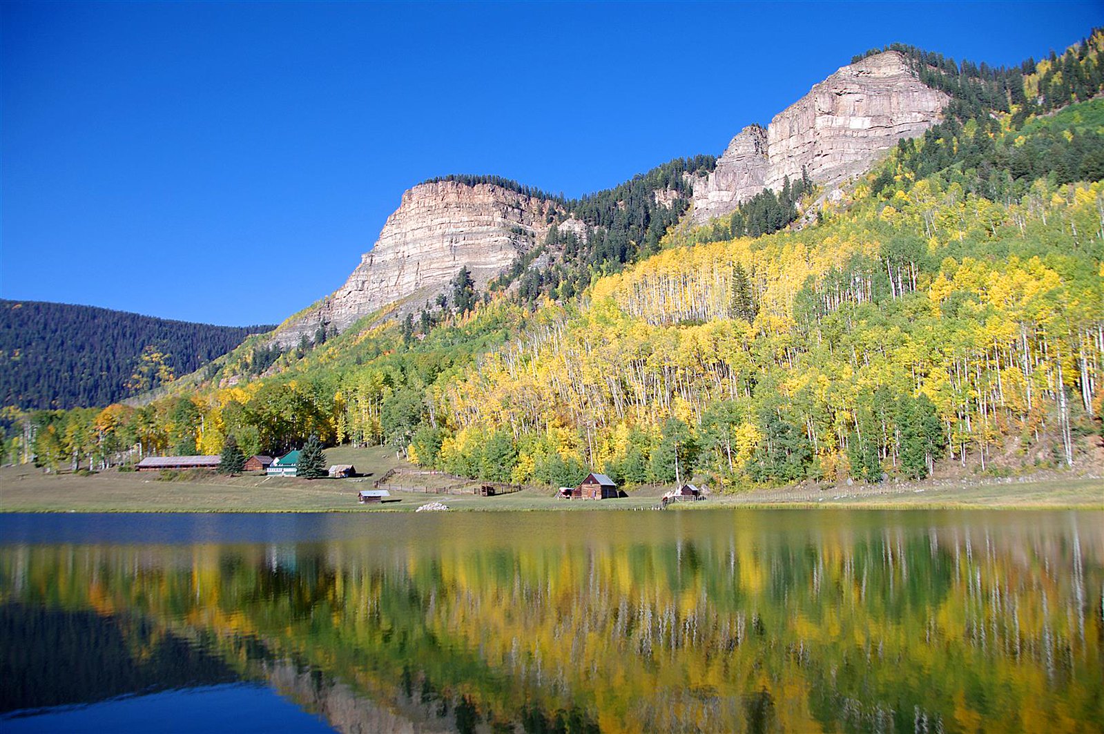
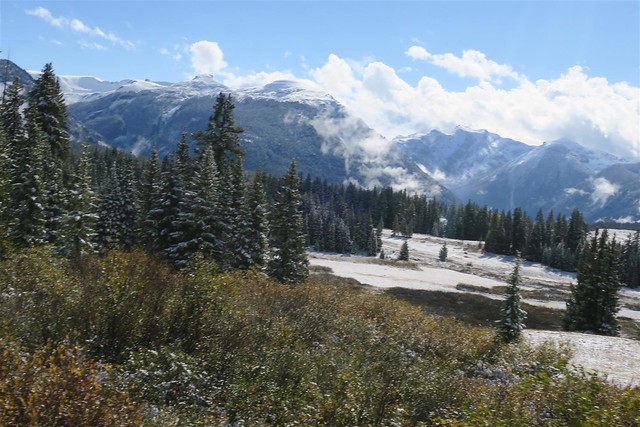
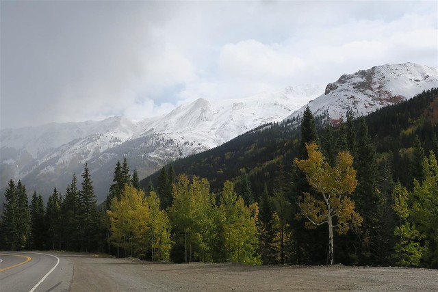
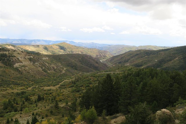
The Aspen were bright yellow.
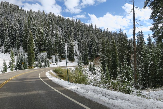
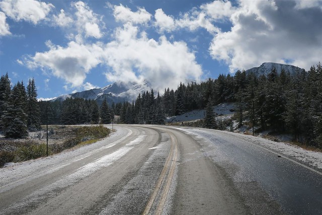
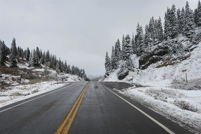
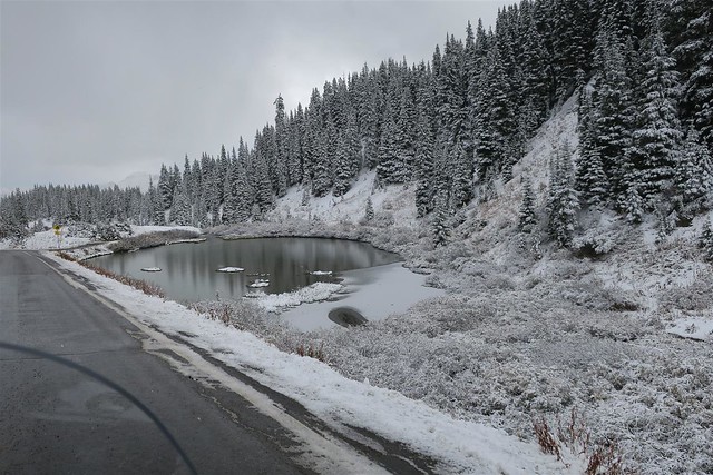
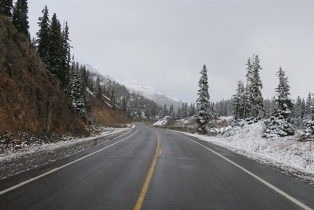
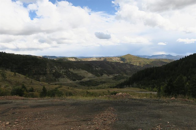
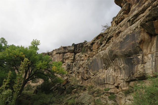
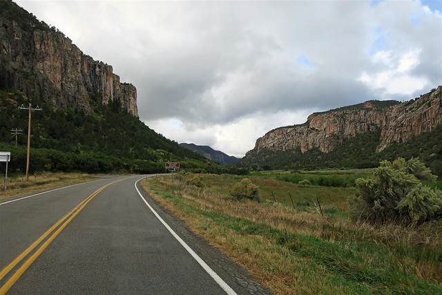
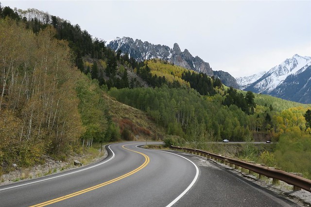
As I approached Coal Bank Pass (10,640 feet) there was snow on the ground. The road was wet and with a few exceptions was not too slippery.
---
I don't think many would like riding these mountain passes in this weather but I love winter and enjoyed riding in this wintry landscape. As I said most of the time I had good traction. When it looked slick I took it carefully. I never really did think I was in much risk of wiping out (nothing in life is perfectly safe).
The temp on these mountain passes was 41�. Some people say I'm crazy to ride in these temperatures. Then the same people will snowmobile when it's 0� out. No matter what you ride you just need to dress according to the weather.
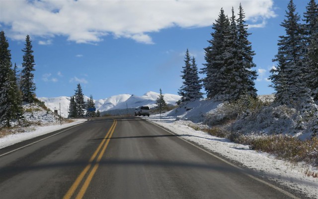
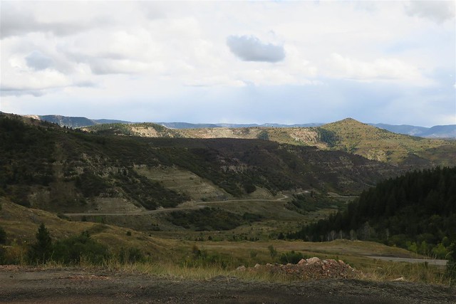
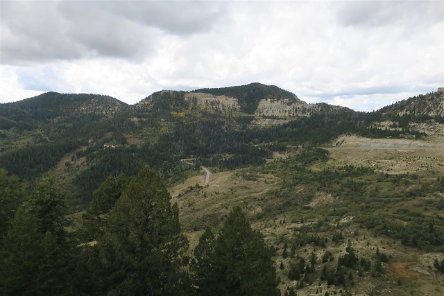
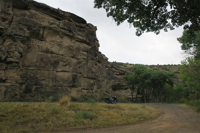
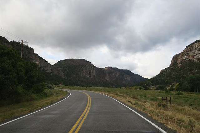
The next mountain pass was Molas Pass at 10,910 feet in elevation.
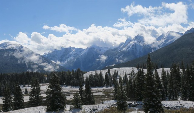
Then I came uppon the town of Silverton at an elevation of 9,318 feet above sea level.
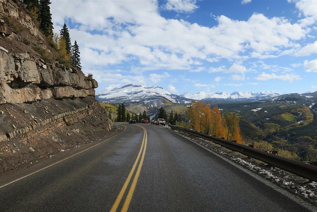
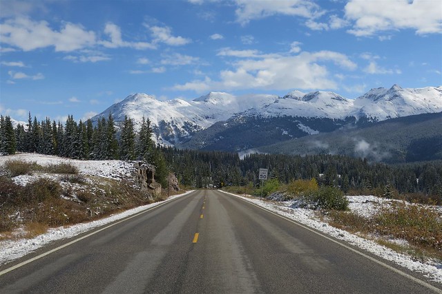
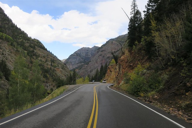
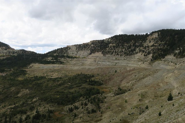
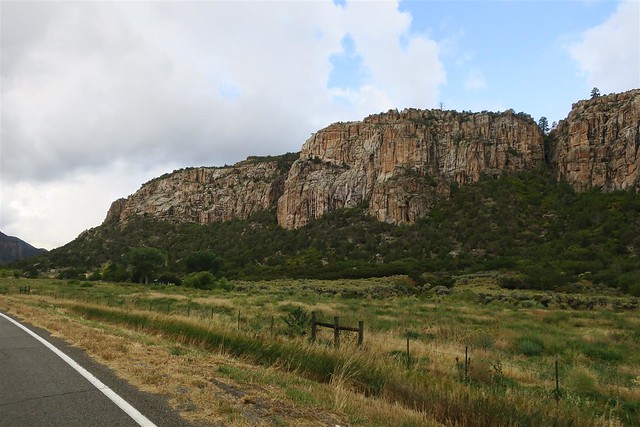
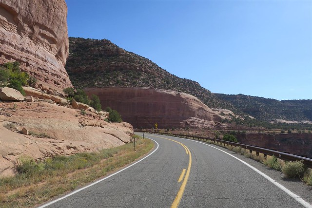
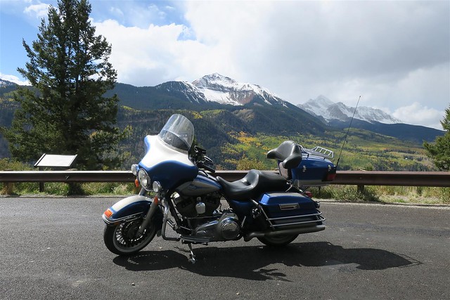
Next I rode over Red Mountain Pass. At 11,018 feet this is the 7th highest paved mountain pass in the United States.
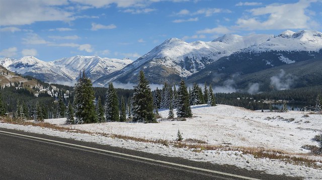
Yes, it recently snowed on these mountains. I checked the forecast. This was no worse than I expected. Before I would reach home I would encounter some weather much worse than expected. Stay tuned for details.
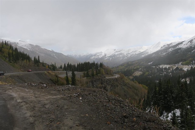
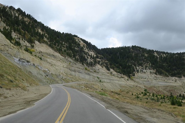
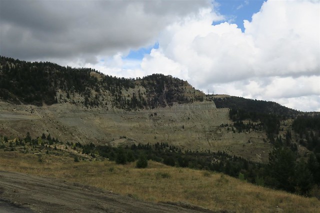
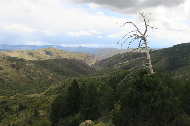
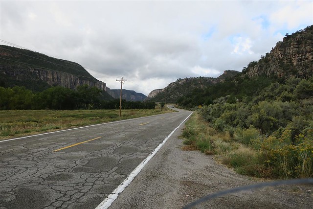
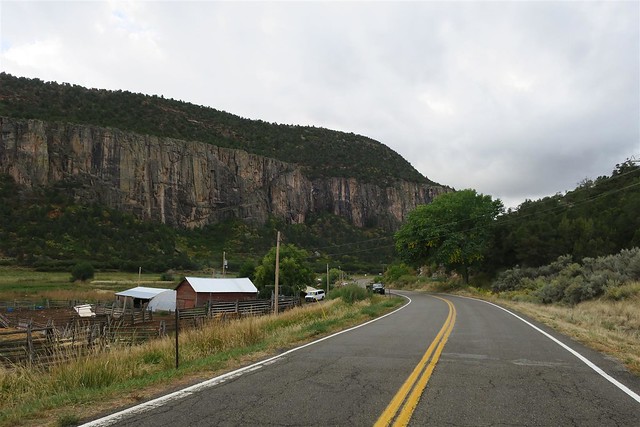
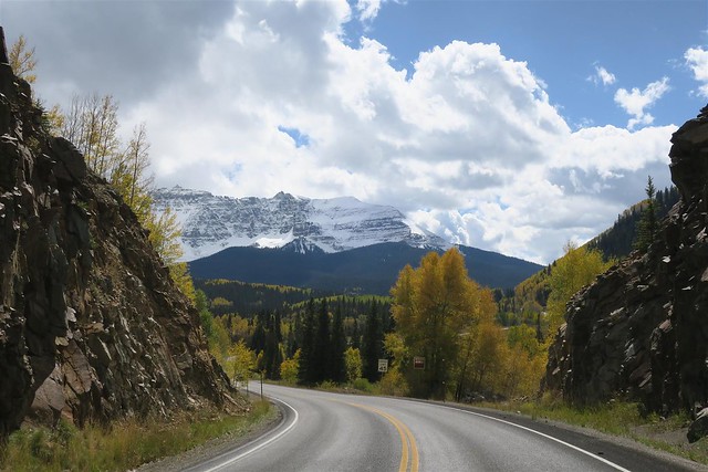
Not long after going over Red Mountain Pass the snow disappeared. This is common. As the clouds rise over these mountains they drop their moisture. The mountain passes often have stormy weather but on the other side of the mountains the weather is fine.
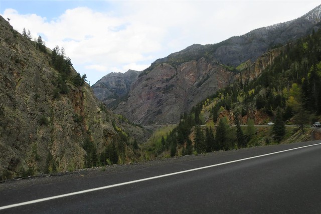
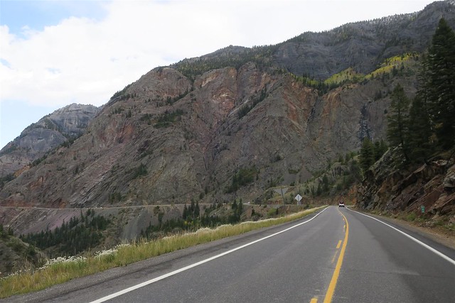
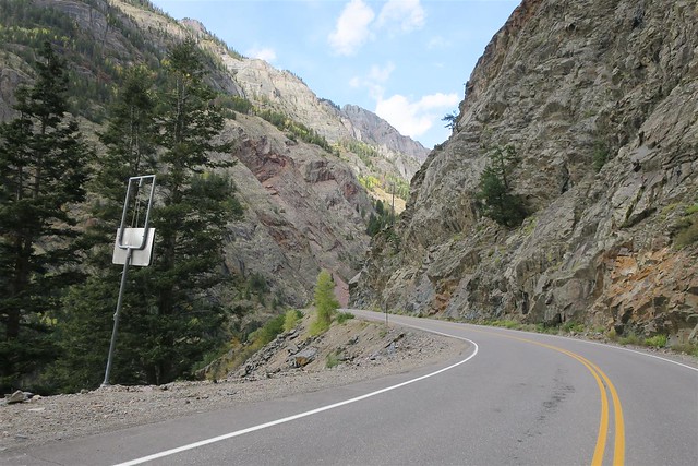
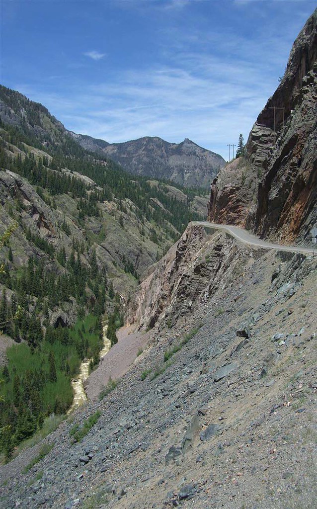
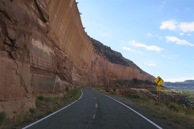
Google the "most dangerous roads in the US" and you will find this section of highway 550 among the top of the list. There are more avalanches in this seciton of highway than any other highway in the USA. Notice there are no guard rails. In this next picture there is a car wreckage down in the bottom of this gorge (you propably can't make it out in this low res image). Cars often go off the road here. There are many cars off these cliffs. If you do see a car don there you can assume it has been down there since the 70's or earlier. Back then they only brought up the bodies. Now they haul up the entire wreckage.
Every once in a while the news paper would have a story about a new wreckage discovered in the gorge. They may suspect that it's a person reported missing a couple of weeks ago but they wouldn't know for sure until they closed off the road so heavy equipment could haul up the wreckage and find out what car and driver it was.
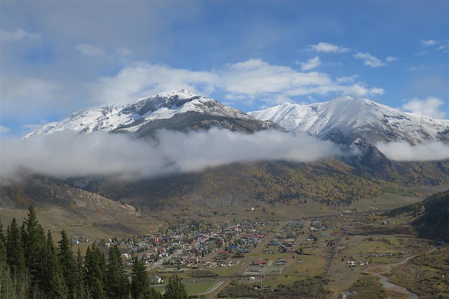
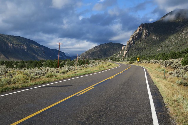
Then I descended into the town of Ouray. Now I felt over dressed. I removed the sweater from under my leather coat.
To be continued ...
... as long as I dressed appropriately.
The above forecast is for the mountain passes north of my home in Durango CO. The rest of my route should have warm temps.
I woke up and had a leisure morning and made my breakfast. I didn't want to leave too early since I knew the mountains had bad weather. It was warming up fast and at 9 am I headed out on my Harley all bundled up in layers.
I could see snow on the mountain tops as I drove through Durango.
The route I planned formed a figure eight. The GPS route of my trip is mapped out here:
https://spotwalla.com/tripViewer.php...=0&showAll=yes
If you use the above link you can zoom in and out and use the other Google Map features but here's another view. This one is stagnant.
The Aspen were bright yellow.
As I approached Coal Bank Pass (10,640 feet) there was snow on the ground. The road was wet and with a few exceptions was not too slippery.
---
I don't think many would like riding these mountain passes in this weather but I love winter and enjoyed riding in this wintry landscape. As I said most of the time I had good traction. When it looked slick I took it carefully. I never really did think I was in much risk of wiping out (nothing in life is perfectly safe).
The temp on these mountain passes was 41�. Some people say I'm crazy to ride in these temperatures. Then the same people will snowmobile when it's 0� out. No matter what you ride you just need to dress according to the weather.
The next mountain pass was Molas Pass at 10,910 feet in elevation.
Then I came uppon the town of Silverton at an elevation of 9,318 feet above sea level.
Next I rode over Red Mountain Pass. At 11,018 feet this is the 7th highest paved mountain pass in the United States.
Yes, it recently snowed on these mountains. I checked the forecast. This was no worse than I expected. Before I would reach home I would encounter some weather much worse than expected. Stay tuned for details.
Not long after going over Red Mountain Pass the snow disappeared. This is common. As the clouds rise over these mountains they drop their moisture. The mountain passes often have stormy weather but on the other side of the mountains the weather is fine.
Google the "most dangerous roads in the US" and you will find this section of highway 550 among the top of the list. There are more avalanches in this seciton of highway than any other highway in the USA. Notice there are no guard rails. In this next picture there is a car wreckage down in the bottom of this gorge (you propably can't make it out in this low res image). Cars often go off the road here. There are many cars off these cliffs. If you do see a car don there you can assume it has been down there since the 70's or earlier. Back then they only brought up the bodies. Now they haul up the entire wreckage.
Every once in a while the news paper would have a story about a new wreckage discovered in the gorge. They may suspect that it's a person reported missing a couple of weeks ago but they wouldn't know for sure until they closed off the road so heavy equipment could haul up the wreckage and find out what car and driver it was.
Then I descended into the town of Ouray. Now I felt over dressed. I removed the sweater from under my leather coat.
To be continued ...
The following 3 users liked this post by Durango Dave:
#2
10-01-2017, 09:12 PM
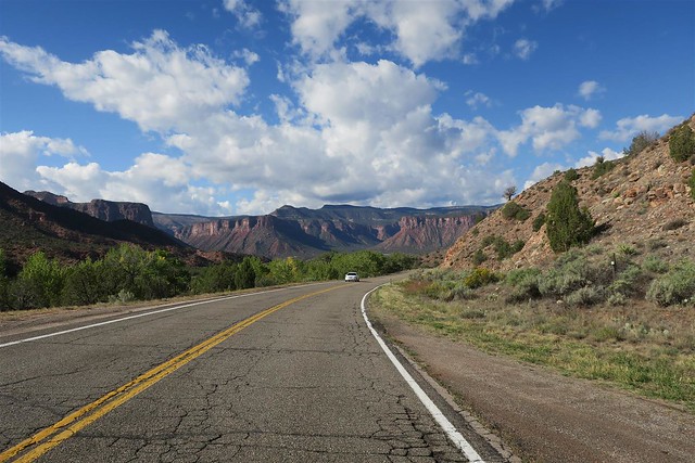
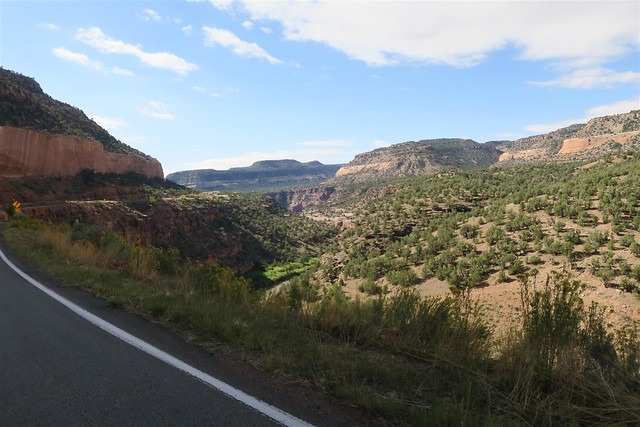
I continued on my path to the north to Ridgeway, Montrose and Delta. Then I went on to Grand Junction. This is where the Colorado River junctions with the Gunnison River. The Colorado river used to be called the Grand River long ago but they changed it's name to the Colorado river to avoid confusion with the Rio Grande. Grand Junction is named after the old name of the Colorado River (otherwise it might have been called the Colorado Junction City).
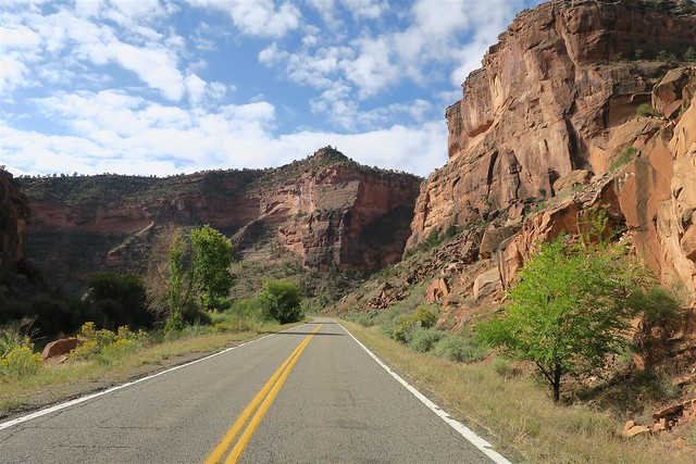
I went to Frutia and then headed north on highway 139. I have never been on this highway but I have heard it's a nice motorcycle road.
It started off very flat and strait but I could see it was heading into some mountains.
I headed over Douglas Pass. I've heard about this pass and I'm glad I headed this way.
----
Looking back the direction I came:
---
At the end of highway 139 I reached Rangely Colorado. From here I headed east on highway 64.
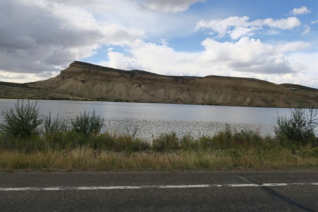
I passed Kenney Reservoir.

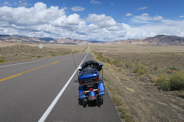
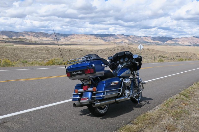
Then I got on I 70 and headed west (actually southwest if you want to be exact)

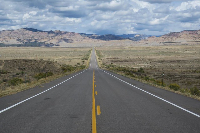
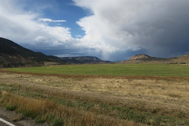
I have reservations in Grand Junction but it's only 5:00. I have extra time and would like to head to Mesa Colorado. My Butler Map shows a nice scenic route to that town up on the bluffs over the Colorado River. There is another nice motorcycle road coming back to I 70. But there are storm clouds to the south. I take the exit to Mesa. I sit there for a minute looking at the clouds and decide that I'd be heading into a storm if I turned south. Instead I head right back onto the freeway toward Grand Junction.
These clouds are moving. The storm is heading north. It looks like I'm going to get wet no matter what I do.
The rain starts coming down. Before long it's really storming. I duck down behind my windshield to avoid the rain that is pelting me hard. I think it's hailing but I don't see any hail on the ground. It's just big rain drops and they hurt.
I take the exit in Grand Junction and roll into my motel. I drip all over the lobby and counter and pretend it doesn't bother me. I get the key to my room and change into dry cloths. The rain soon ends and I head out again for dinner. I eat at The Ale House before heading back to my motel for the night.
To be continued...
I went to Frutia and then headed north on highway 139. I have never been on this highway but I have heard it's a nice motorcycle road.
It started off very flat and strait but I could see it was heading into some mountains.
I headed over Douglas Pass. I've heard about this pass and I'm glad I headed this way.
----
Looking back the direction I came:
---
At the end of highway 139 I reached Rangely Colorado. From here I headed east on highway 64.
I passed Kenney Reservoir.
Then I got on I 70 and headed west (actually southwest if you want to be exact)
I have reservations in Grand Junction but it's only 5:00. I have extra time and would like to head to Mesa Colorado. My Butler Map shows a nice scenic route to that town up on the bluffs over the Colorado River. There is another nice motorcycle road coming back to I 70. But there are storm clouds to the south. I take the exit to Mesa. I sit there for a minute looking at the clouds and decide that I'd be heading into a storm if I turned south. Instead I head right back onto the freeway toward Grand Junction.
These clouds are moving. The storm is heading north. It looks like I'm going to get wet no matter what I do.
The rain starts coming down. Before long it's really storming. I duck down behind my windshield to avoid the rain that is pelting me hard. I think it's hailing but I don't see any hail on the ground. It's just big rain drops and they hurt.
I take the exit in Grand Junction and roll into my motel. I drip all over the lobby and counter and pretend it doesn't bother me. I get the key to my room and change into dry cloths. The rain soon ends and I head out again for dinner. I eat at The Ale House before heading back to my motel for the night.
To be continued...
#3
10-01-2017, 09:14 PM
As I sleep in my motel room I hear the rain outside. It's coming down hard and I'm wondering if it'll clear up by morning. I need to get my sleep so I forget about it and go back to sleep.
When I wake up I looked outside. Everything is wet from the storm but the rain has stopped now. After my shower I get dressed and go out to see what kind of breakfast the motel has provided. Now-a-days when the motel provides a breakfast I expect scrambled eggs, waffles or some other hot breakfast. This Super 8 has cereal and if you want a "hot" breakfast you can toast some bread. No thank you. I pack up and head out looking for a real breakfast.
I use a TomTom Rider GPS. This thing sent me in circles in Grand Junction and then tried to direct me up to Rangley where I was yesterday. If you were paying attention my route is like a figure eight and my motel was at the center of the eight. TomTom was confused about what way I wanted to head next. I realized I was on my own to find my way to highway 141. I've been there before so I wasn't too worried. I need to write up a review of my TomTom, but that'll be for another thread.
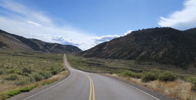
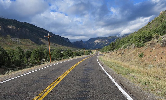
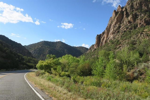
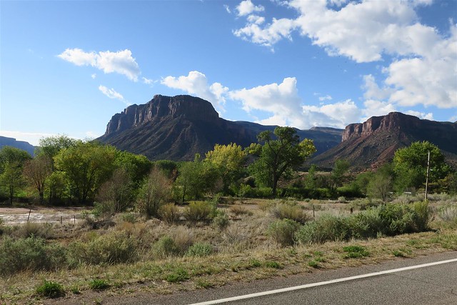
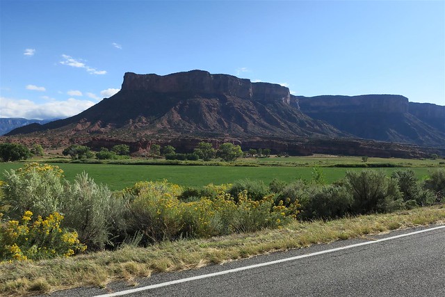
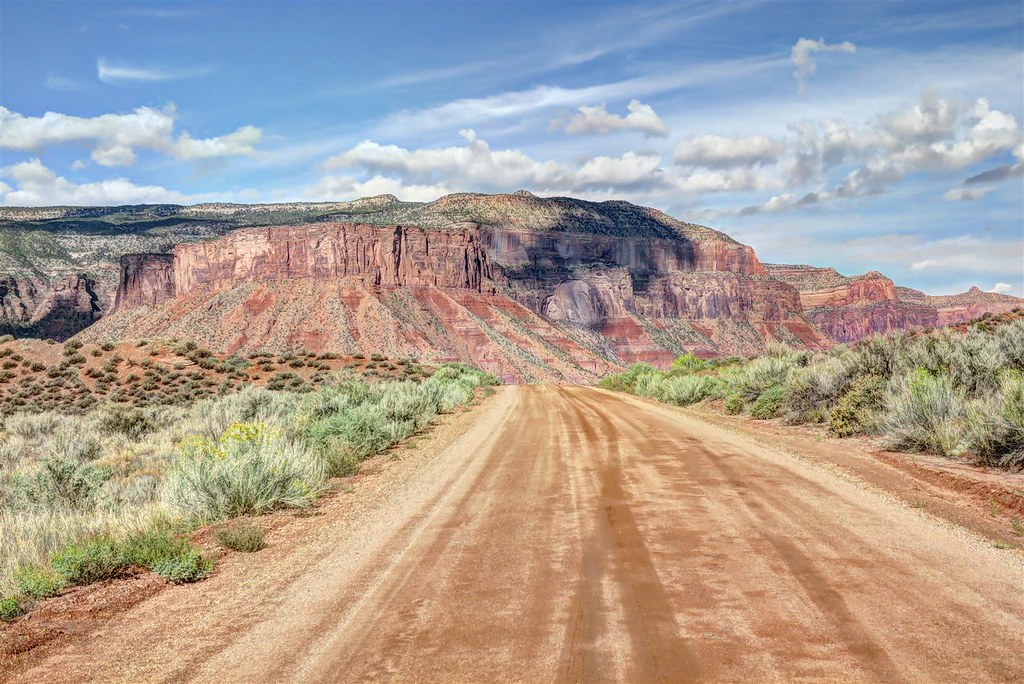
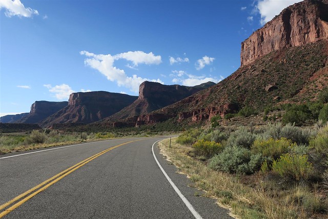
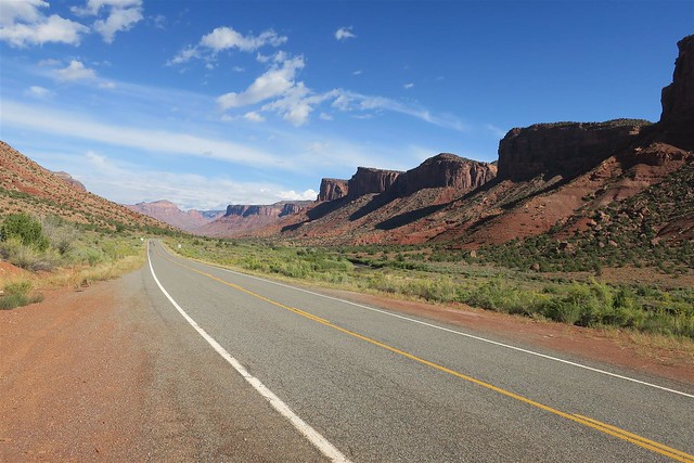
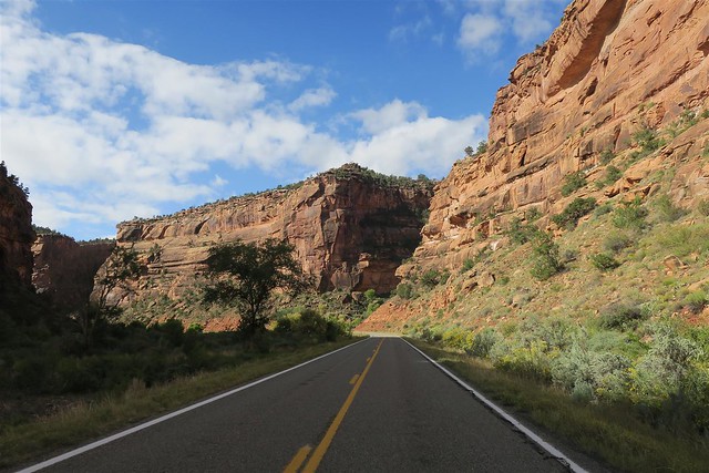
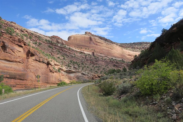
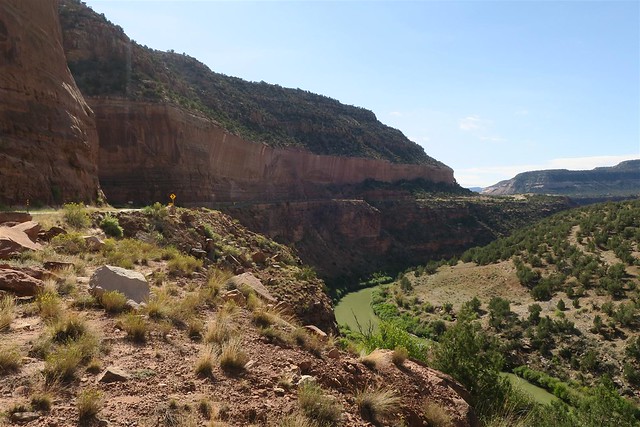
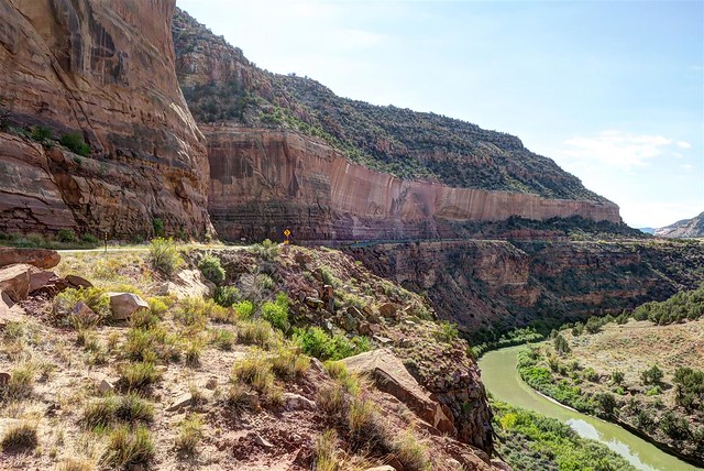
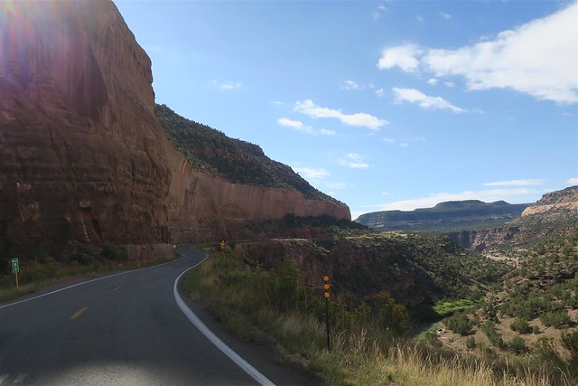
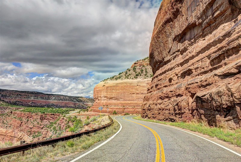
Highway 141 is THE most underrated motorcycle route in Colorado. If you live in Colorado or Utah you need to seek out this road. There is only one gas station on this route and it's in Gateway so I make sure I have plenty of gas.
What torrent of water created this deep canyon? East Creek runs down the canyon and it was dry even after the recent rains. This is called the Unaweep Canyon. The Native Americans called it that. The name means "canyon with two mouths". This is an unusual canyon. The Ancestral Gunnison river cut this canyon 3 million years ago. Then the Colorado River cut off the headwaters of the Gunnison River in what geologist call stream piracy. Now very little water runs through this canyon.

at the risk of redundancy, this is the most underrated motorcycle road in Colorado.

When I wake up I looked outside. Everything is wet from the storm but the rain has stopped now. After my shower I get dressed and go out to see what kind of breakfast the motel has provided. Now-a-days when the motel provides a breakfast I expect scrambled eggs, waffles or some other hot breakfast. This Super 8 has cereal and if you want a "hot" breakfast you can toast some bread. No thank you. I pack up and head out looking for a real breakfast.
I use a TomTom Rider GPS. This thing sent me in circles in Grand Junction and then tried to direct me up to Rangley where I was yesterday. If you were paying attention my route is like a figure eight and my motel was at the center of the eight. TomTom was confused about what way I wanted to head next. I realized I was on my own to find my way to highway 141. I've been there before so I wasn't too worried. I need to write up a review of my TomTom, but that'll be for another thread.
Highway 141 is THE most underrated motorcycle route in Colorado. If you live in Colorado or Utah you need to seek out this road. There is only one gas station on this route and it's in Gateway so I make sure I have plenty of gas.
What torrent of water created this deep canyon? East Creek runs down the canyon and it was dry even after the recent rains. This is called the Unaweep Canyon. The Native Americans called it that. The name means "canyon with two mouths". This is an unusual canyon. The Ancestral Gunnison river cut this canyon 3 million years ago. Then the Colorado River cut off the headwaters of the Gunnison River in what geologist call stream piracy. Now very little water runs through this canyon.
at the risk of redundancy, this is the most underrated motorcycle road in Colorado.
#4
10-01-2017, 09:15 PM
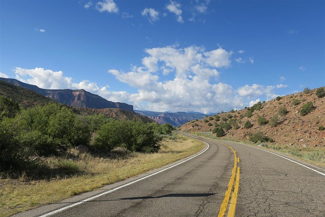
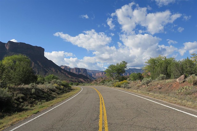
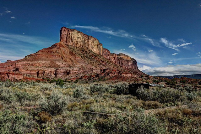
Then I arrived at the "town" of Gateway. It's not much of a town. It has one gas station and a resort. A pretty nice resort I must add.
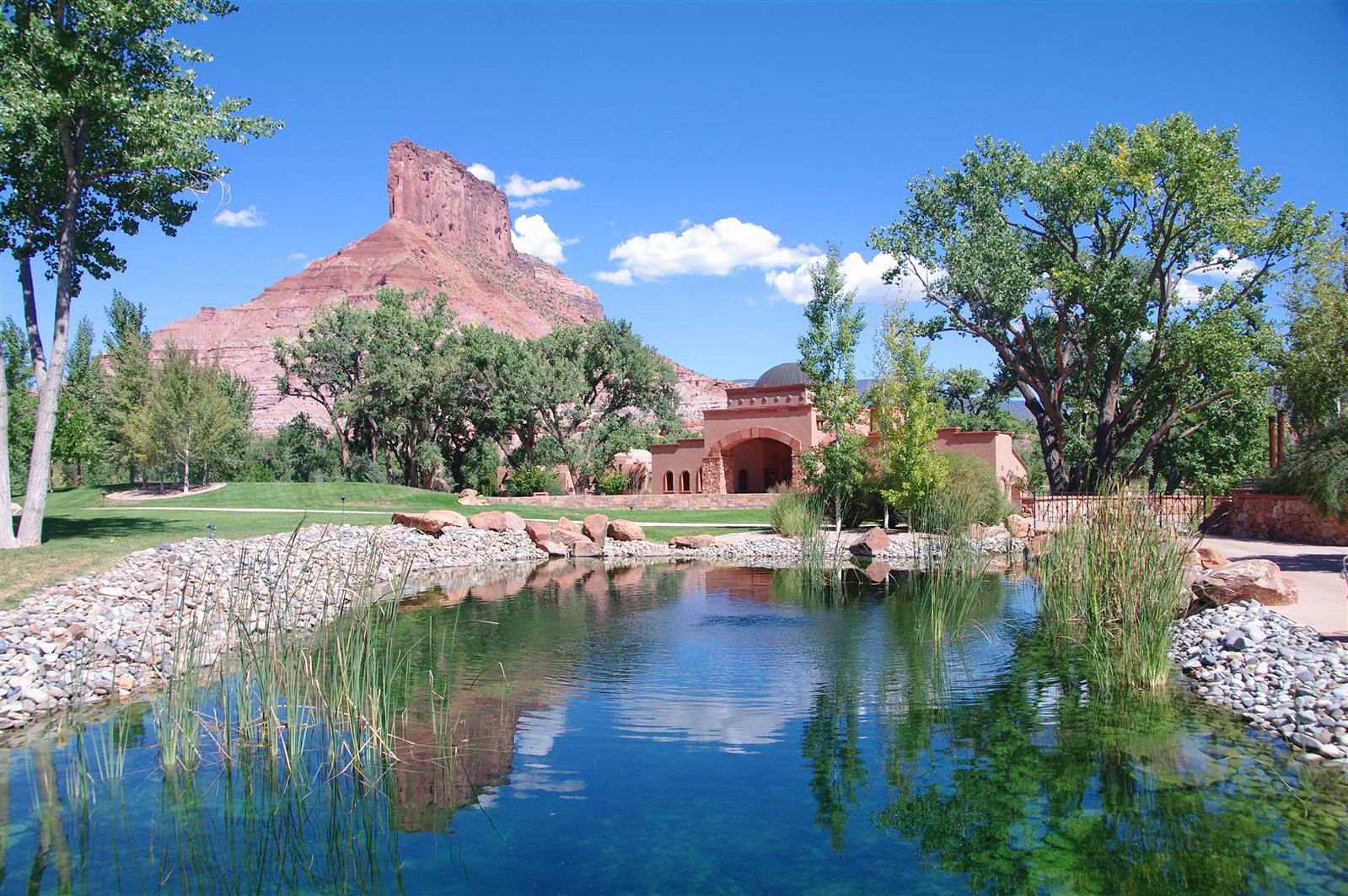

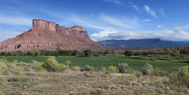
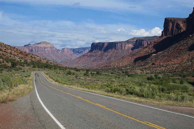
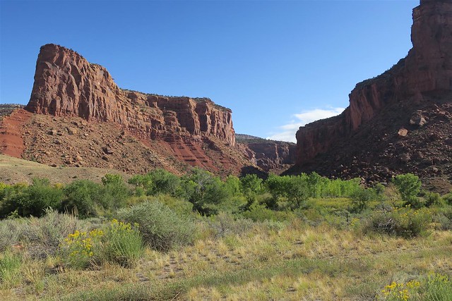
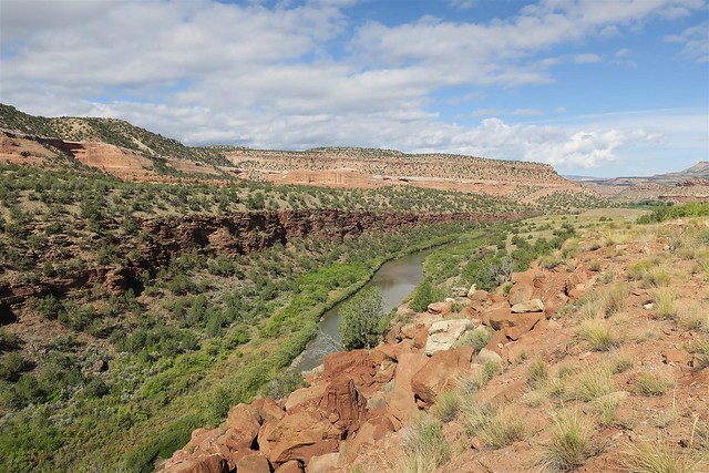
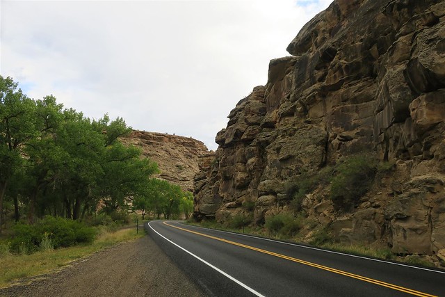
This portion of the canyon is the Dolores Canyon. It might seem like it's all one canyon but before Gateway it was the Unaweep Canyon and after Gateway it's the Dolores Canyon. There is more water in this canyon.
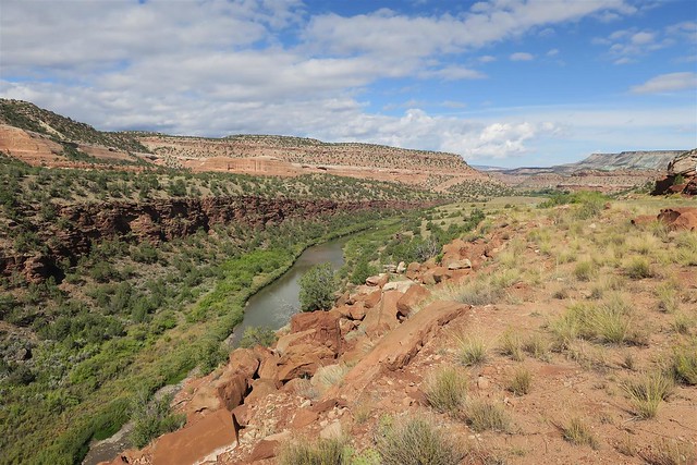


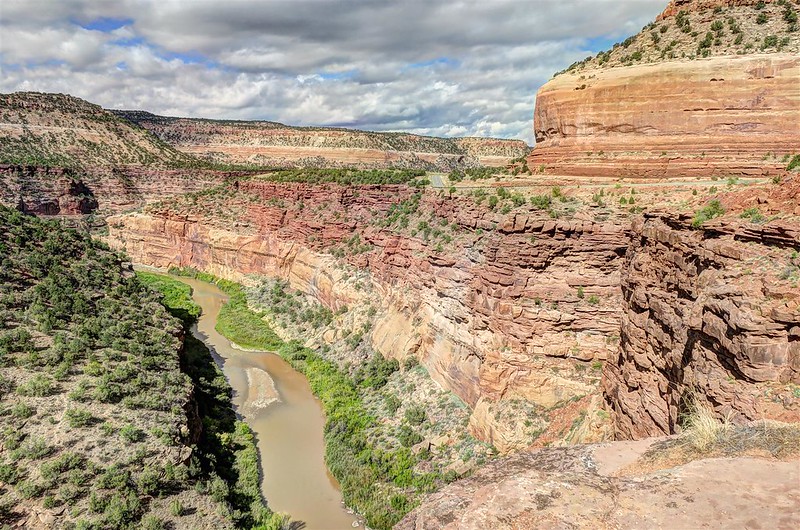
This portion of the canyon is the Dolores Canyon. It might seem like it's all one canyon but before Gateway it was the Unaweep Canyon and after Gateway it's the Dolores Canyon. There is more water in this canyon.
The following users liked this post:
DanDeleted (12-27-2017)
#5
10-01-2017, 09:15 PM
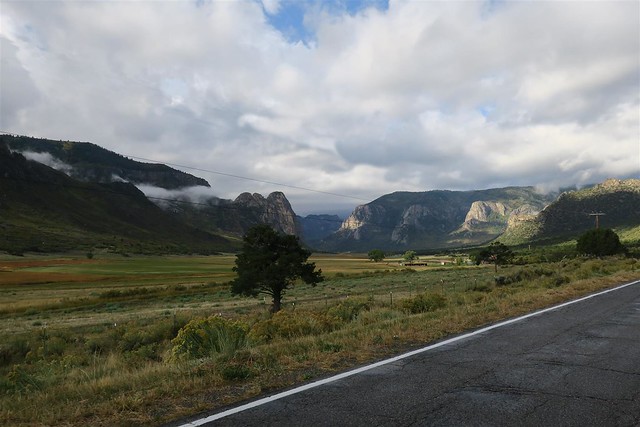
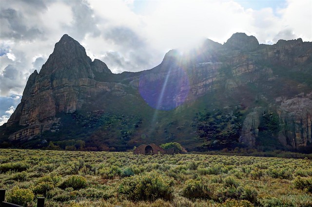
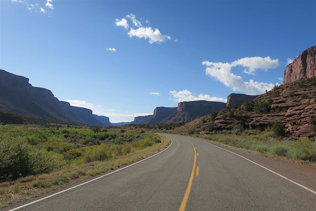
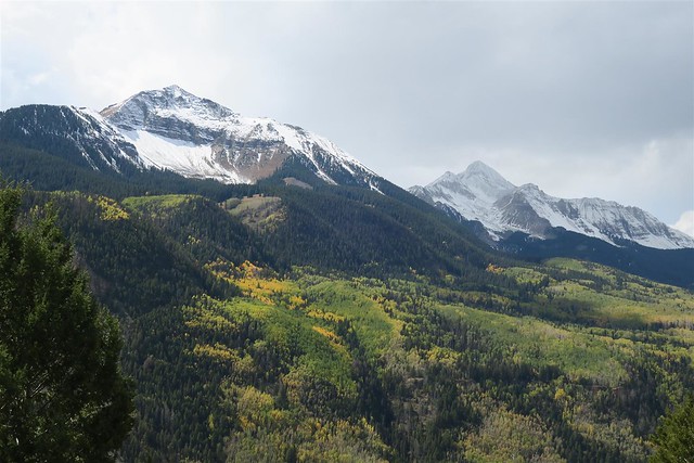
Then I rode past Telluride and into the Uncompahgre National Forest. As an FYI Uncompahgre is a Ute Native American word for hot water, a reference to the hot springs of the area. The Uncompahgre people were Ute Native Americans that lived here for centuries.
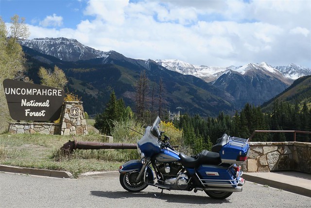
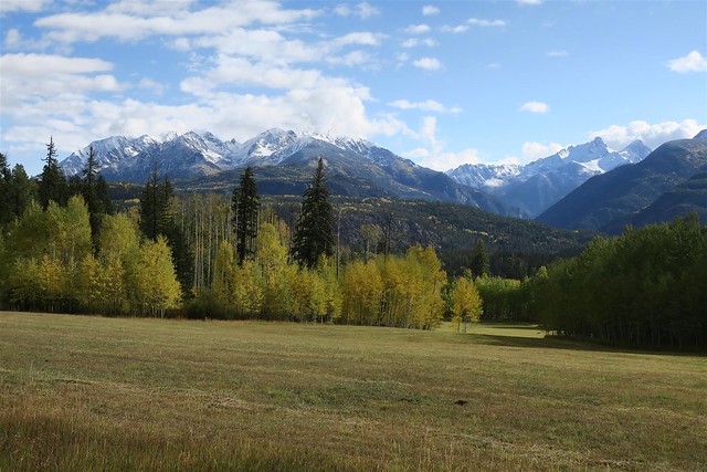
I'm back in the tall mountains.
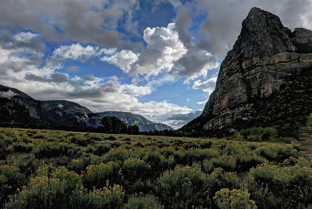
This next mountain is Wilson Peak. It's 14,023 feet high.

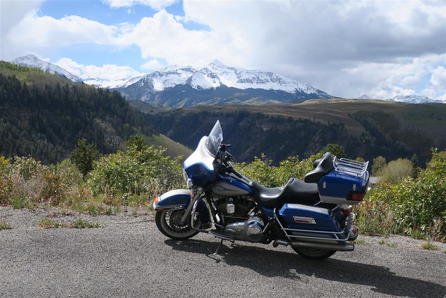
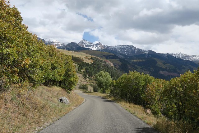
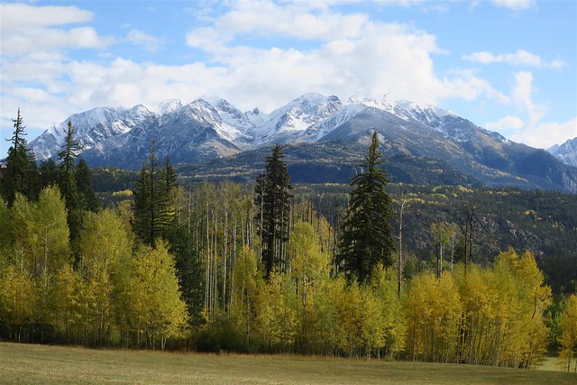
This next picture is Sunshine Mt and Wilson Peak
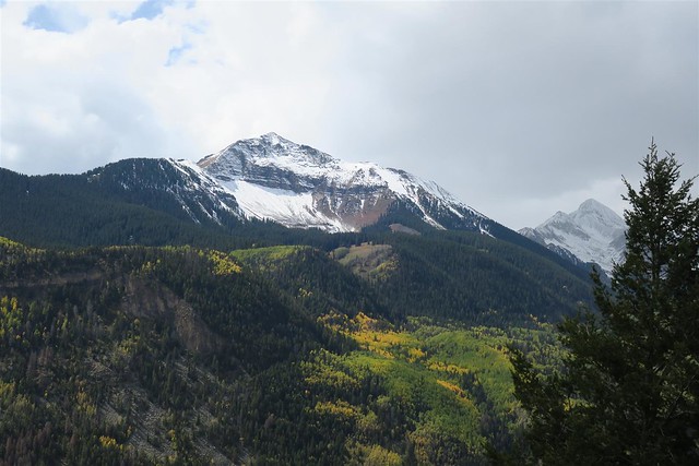
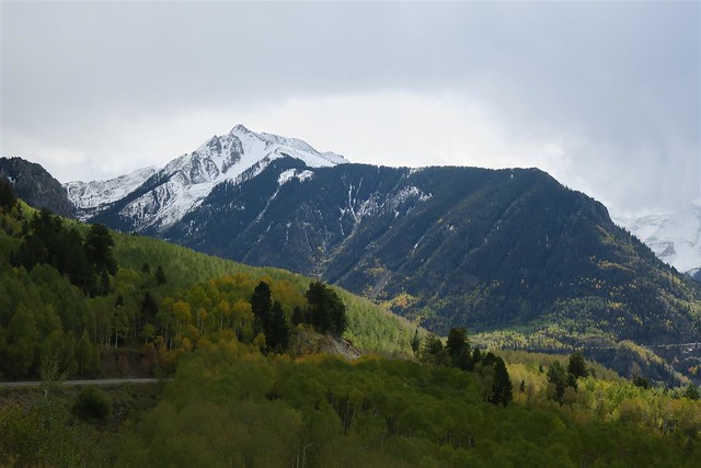
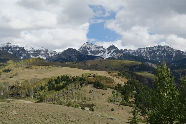
This next picture is the Ophir Needles.
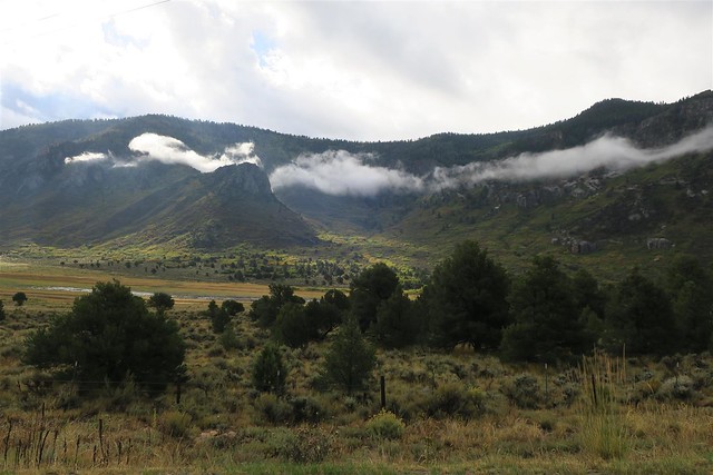
The clouds are moving in again.
As I am riding down highway 146 toward Dolores it starts to rain. Thunder and lightning are all around. While riding in the rain lightning strikes within a quarter of a mile to my left. I have never seen a lightning strike so close to me. It hits with an explosive bang. I looked back to see if it started a fire. I couldn't see anything. I'm thinking a lightning strike takes time for a fire to materialize and build. I ride on hoping noting comes of it.
How far to Dolores? I need to seek cover from this storm. This is taking me longer than expected to reach town. I am hoping to have a long lunch, waiting for this storm to blow over. As I approach Dolores I see a patch of blue sky to the south-east. That's the direction I need to head. I now decide not to stop. Maybe I can ride out of this storm. I turn onto highway 184 toward Mancos. The rain lessens. This is looking good. It's still raining but it's light rain. As I ride into Mancos I see dark storm clouds to the east. That's the direction toward home. I am only 30 miles from home but I don't like the looks of the storm clouds in my way. I stop for lunch/dinner at the Millwood Junction in Mancos. It's not long before the rain stops. I often look out the window. The storm clouds are still to the east.
After spending over an hour eating my meal I head out on highway 160. At Hesperus I pass a long line of vehicles as we climb Hesperus Pass. I pull back into the right lane. Then I see snow, lots of snow. I slow down. I feel like a jerk for passing these vehicles and then slowing down but hey, I've got 2 wheels and you've got for or more. There's 4 inches of snow on the road. I keep to the tire tracks where there's much less snow except for where drivers have changed lanes splashing snow into the tire tracks. This is not good. I take it easy. I'm thinking I can deal with this but how do I get into my driveway. I don't like driving in 4 inches of snow. I approach the turn-off for the road I live on and their is less snow. As I approach my property I realize there isn't any more snow on the ground. Actually the ground is dry at my house. I didn't even get any rain even though I live only 6 miles from the pass that had 4 inches of snow. That's how it is in Colorado. These storms blow over the mountains and dump their precipitation in one spot and have no moisture to drop a mile later.
Well, I'm home safe and had a great time despite the couple of instances of bad weather.
I'm back in the tall mountains.
This next mountain is Wilson Peak. It's 14,023 feet high.
This next picture is Sunshine Mt and Wilson Peak
This next picture is the Ophir Needles.
The clouds are moving in again.
As I am riding down highway 146 toward Dolores it starts to rain. Thunder and lightning are all around. While riding in the rain lightning strikes within a quarter of a mile to my left. I have never seen a lightning strike so close to me. It hits with an explosive bang. I looked back to see if it started a fire. I couldn't see anything. I'm thinking a lightning strike takes time for a fire to materialize and build. I ride on hoping noting comes of it.
How far to Dolores? I need to seek cover from this storm. This is taking me longer than expected to reach town. I am hoping to have a long lunch, waiting for this storm to blow over. As I approach Dolores I see a patch of blue sky to the south-east. That's the direction I need to head. I now decide not to stop. Maybe I can ride out of this storm. I turn onto highway 184 toward Mancos. The rain lessens. This is looking good. It's still raining but it's light rain. As I ride into Mancos I see dark storm clouds to the east. That's the direction toward home. I am only 30 miles from home but I don't like the looks of the storm clouds in my way. I stop for lunch/dinner at the Millwood Junction in Mancos. It's not long before the rain stops. I often look out the window. The storm clouds are still to the east.
After spending over an hour eating my meal I head out on highway 160. At Hesperus I pass a long line of vehicles as we climb Hesperus Pass. I pull back into the right lane. Then I see snow, lots of snow. I slow down. I feel like a jerk for passing these vehicles and then slowing down but hey, I've got 2 wheels and you've got for or more. There's 4 inches of snow on the road. I keep to the tire tracks where there's much less snow except for where drivers have changed lanes splashing snow into the tire tracks. This is not good. I take it easy. I'm thinking I can deal with this but how do I get into my driveway. I don't like driving in 4 inches of snow. I approach the turn-off for the road I live on and their is less snow. As I approach my property I realize there isn't any more snow on the ground. Actually the ground is dry at my house. I didn't even get any rain even though I live only 6 miles from the pass that had 4 inches of snow. That's how it is in Colorado. These storms blow over the mountains and dump their precipitation in one spot and have no moisture to drop a mile later.
Well, I'm home safe and had a great time despite the couple of instances of bad weather.
The following 3 users liked this post by Durango Dave:
#6
10-01-2017, 09:51 PM
Stellar HDF Member
#7
10-04-2017, 06:10 AM

Trending Topics
#8
10-13-2017, 04:35 PM

I relocated from Iowa to Denver a few years ago (locked into the metropolis as that's where my company's customers are), and I like it well enough. However, when I can, heading out to Western, and especially Southwestern, Colorado is my favorite. Something about me just loves the look and feel of the southwestern US.
