10 Great Routes in Middle America (Central Time Zone)
Whether you are looking to cruise a straight stretch of road, or wind your way through a twisty parkway, the Central Time Zone offers some of the nation's finest scenery.


Roads Ranging From Mild to Wild Are Ready For Riding in The Central US
This is the third of four posts listing some of the best rides in each region of the United States. You could divide the country into a bunch of different regions, or even do each of the 50 different states, but for the sake of brevity, each one is roughly going to cover one of the four time zones. This piece will feature the Central Time Zone consisting of North Dakota, South Dakota, Nebraska, Kansas, Oklahoma, Texas, Louisiana, Arkansas, Missouri, Iowa, Minnesota, Wisconsin, Illinois, Tennessee, Mississippi, Michigan, Kentucky, Indiana and Alabama.
If you are looking for rides anywhere in the world, a good site to start at is Best Biking Roads. The first article, with rides out west, can be found here. Similarly, the second installment of the best rides back east can be found here.
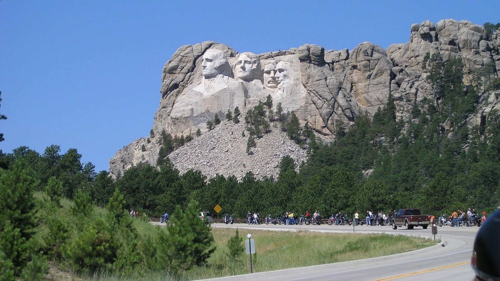
1. Keystone, SD - Central Hills Loop - 60 miles
Although it is one of the shorter motorcycle riding loops to make the list, the Central Hills Loop just outside of Keystone, South Dakota is considered by many to be a motorcyclist's dream. This ride will take you through the picturesque Custer State Park and past the famous Mount Rushmore National Memorial in stunning fashion. While the route is a short 60 miles, the fantastically smooth roads provide incredible elevation changes, tight switchbacks, numerous pigtails, and a number of delightful tunnels that will limit speed and provide extended time in the saddle. If you are ever headed to the Sturgis Rally, be sure to check this one out!
From Keystone's Iron Mountain Road, take Highway 244 west towards Mount Rushmore for roughly 10 miles. Highway 244 comes to an end at Highway 385. Take 385 south for a few hundred yards before exiting at Highway 87 towards Custer State Park. Continue on Highway 87 for approximately 20 miles, making sure to avoid the Junction 89 "Y" 5 miles in. Highway 87 will run into Highway 16, where you will want to take a left (east). Highway 16 will run and additional 8 miles before you will once again turn left onto Iron Mountain Road and ride your way back into the town of Keystone (15 miles). You can follow the route on this Google map.
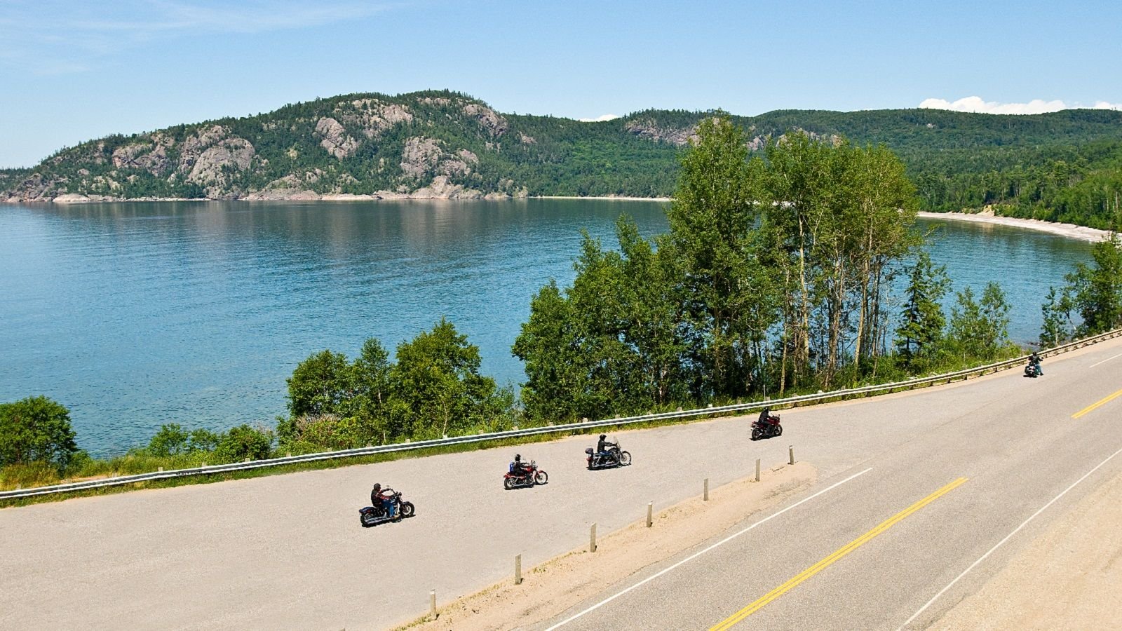
2. Duluth, MN - The North Shore Loop - 144 miles
A long, straight stretch of highway may seem about as boring of a ride as they come, but mix in some fabulous scenery and a variety of roadside amenities, and you have one magnificent route. The city of Duluth, MN is quite a location in its own right, with its abundance of natural settings and wealth of historical museums; however, heading up Highway 61 will provide endless shoreline views of Lake Superior. Continuing north to the Canadian Border will take you past a number of state parks, rivers and waterfalls, all while offering both elaborate restaurants and casual small-time eateries. With incredible lodges and cozy cabins sprinkled around the area, this route can be enjoyed over the course of a weekend or as a single day trip.
Beginning in the city of Duluth, head north on Highway 61 until you reach the US/Canadian Border. It is a straight shot with some gentle curves. For those looking for a few more curves or additional nature/wildlife, consider side routes of Highway 1 or Gunflint Trail.
- Highway 1: Exit Highway 61 past Illgen City and to hit Highway 1 west. Follow Highway 1 for approximately 60 miles to the city of Ely.
- Gunflint Trail: Heading east on Highway 61, turn left onto 5th Avenue W. Ride a half mile onto 5th Avenue W before turning left onto Gunflint Trail. Gunflint Trail will run up to the National Forest campground and Gull Lake before looping back to Highway 61.
Here's a Google map of the area.
3. Dubuque, IA - Iowa River Run - 75+ miles
The Iowa River Run offers a delightful ride alongside the northern parts of the Mississippi River. The route provides a scenic view of Iowa's vast agriculture and dairy farms established along The Old Blue as well as some jaw-dropping views of various river bluffs. The roads do not get much better for motorcycling with an abundance of elevation changes and twisty turns in a serene environment. Not to mention it offers a birds-eye view of the numerous river towns and boats/barges that the Mississippi River has long been known for.
From the city of Dubuque, take Route 52 north for 40 miles to the town of Guttenburg. Jump off of the highway by making a right onto 3rd Street and subsequent left onto Clayton County Road 56. Road 56 will eventually run into the town of McGregor (founded by the descendants of Rob Roy MacGregor) where one has the option of taking Route 18 to Route 52 and eventually back to Dubuque, or hopping onto Route 35 or Route 26 (aka The Great River Roads) for an additional 100+ miles of riding along the river. Here's a Google map of the whole area.
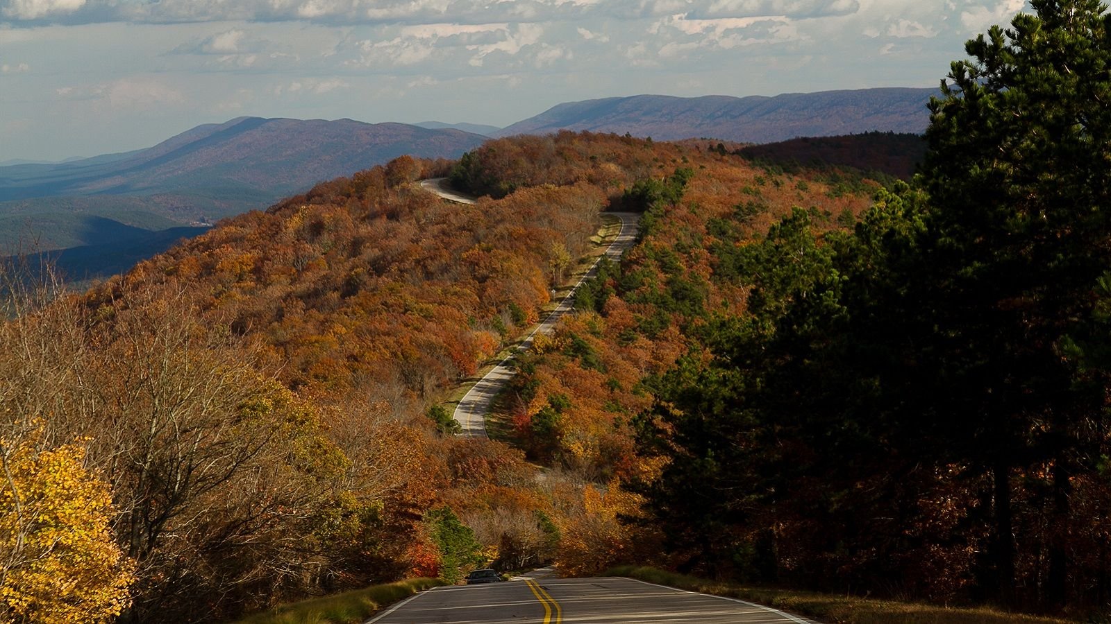
4. Talihina, OK/Mena, AR - Talimena National Scenic Byway Loop - 120+ miles
A rider searching for sharp curves and regular elevation changes combined with excellent scenery need not look any further than the Talihina, Oklahoma to Mena, Arkansas loop along the Talimena Scenic Byway. These winding roads are at some of the highest elevation points between the Appalachian and Rocky Mountains, and much of it within the Ouachita National Forest. Being a scenic route, cross-traffic is non-existent to allow one to cruise without worry, most people in a hurry take one of the less scenic routes to the north or south. Although, since it isn't a major road, the byway is said to have an occasional pothole. Speed limits are relatively slow, but that just allows travelers the enjoyment of seeing breathtaking valleys and vistas. Many agree that this route is best traveled in the fall when the tree leaves begin to change color and a cool breeze is present.
Head north east from Talihina on US-271 to State Route 1. Continue on Oklahoma Route 1 through Queen Wilhelmina State Park as the road changes from Route 1 to Arkansas Route 88 when crossing into Arkansas. The scenic route ends in Mena, AR where you have the choice to loop back to Talihina using Route 8 or continue on Route 88 through Pine Ridge and eventually into the heart of Ouachita National Forest/Lake Ouachita. The map of the region can be viewed here.
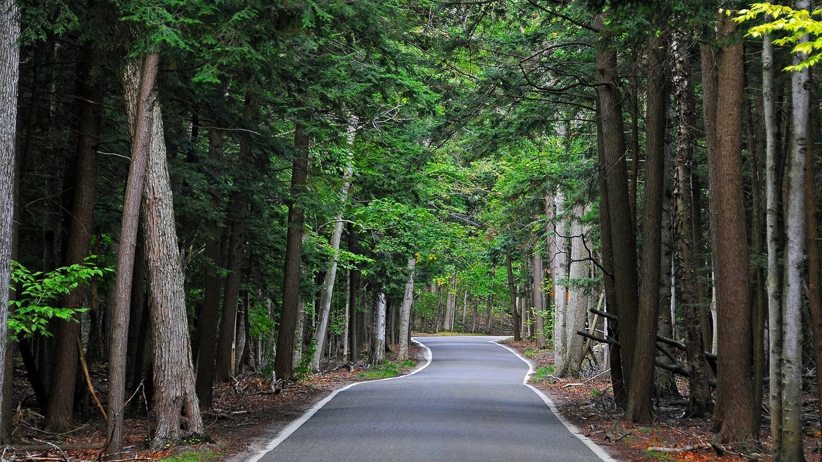
5. Harbor Springs, MI - Tunnel of Trees - 27 miles
Bordering the Central & Eastern time zones is arguably one of the best forest routes in Michigan, if not the entire US. Route 119 along the Eastern shoreline of Lake Michigan, known as The Tunnel of Trees, guides the rider through a winding road of dense forestry. Although the road is fairly narrow, the surface is superb and often frequented by motorcyclists. While glimpses of the lake are regularly seen through the tree line, many argue that the unique feeling of being encapsulated makes for a spectacular experience. Couple the ride with the unique shops and restaurants around Harbor Springs or Petoskey, one of Ernest Hemingway's favorite spots as a kid.
From Petoskey, ride north onto Route 31 (Bay View Rd). Travel 3 miles before turning left onto the M-119. Continue on the M-119 through Harbor Springs and onto the Tunnel of Trees Scenic Route. The route can be ridden in its entirety before turning back to Harbor Springs/Petoskey, or one can continue east to Interstate 75. The map of Michigan is here.
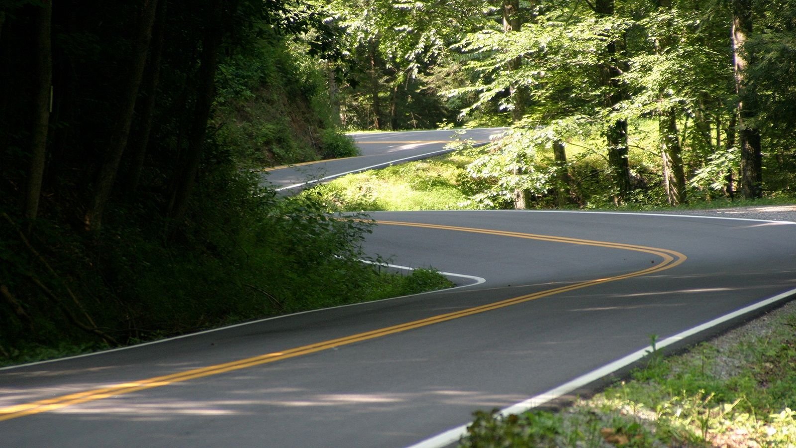
6. Cherohala Skyway, TN/Deals Gap, NC - 70 miles
While technically in the Eastern time zone, the Cherohala Skyway to Deals Gap ride in Tennessee didn't fit in that article, and it would be a crying shame to leave it off of the list. The Cherohala Skyway begins in Tellico Plains, Tennessee and sweeps its way through spectacular untouched forestry, including the Joyce Kilmer Memorial Forest and Citico Creek Wilderness. The route has limited access and no roadside amenities, so fill you tanks and you will enjoy worry-free riding on this smooth, twisty road with little traffic. The Skyway can be ridden in its entirety to Robinsville, NC, but for the ultimate treat, a quick detour will take you up the famed "Tail of The Dragon" route in Deals Gap, NC. Tail of The Dragon features 381 corners in an 11 mile stretch of road that draws bikers from all over the country to test their skills. Although both of these routes are amazing when ridden independent of each other, it makes for a truly epic experience when taken in a single dose. This area is so popular with bikers there is a motorcycle specific campground in Tellico Plains called Hunt's Lodge.
Beginning in Tellico Plains, take Highway 165 east. When crossing the border into NC, the road will change to Highway 143. You have the choice to remain on the Cherohala Skyway or take the National Forest Road, both of which run into Route 1127 (Santeetlah Rd/Jack Kilmer Rd). Follow the road until you hit Highway 129, which you can then take north all the way up to Deals Gap and the Tail of The Dragon. Consult the Google map for more specifics.
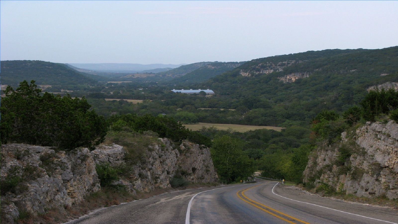
7. Medina, TX - The Three Sisters - 130 miles
Most riders feel the scenery in Texas is rather bland with its abundance of plains and lowlands, but a day's ride on The Three Sisters (aka The Twisted Sisters) will have you reevaluating your perception of riding in the Lone Star State. The "sisters" are three rural ranch roads, namely routes 335, 336, and 337. What this ride lacks in civilized amenities, it more than makes up for with a mixture of beautiful scenery including mountains, river crossings, ranches, and valleys. If the view alone is not enough, the technical roads feature a number of sweepers, switchbacks, sharp climbs, and speedy descents. Many feel this road is best suited for seasoned riders, as there is little run-off area if a crash were to occur. Also, be sure to keep an eye out for the occasional cow and cattle guard crossings as this is open range territory.
From Medina, TX (which is a good 40 miles from Medina County), head west onto Route 337 for 36 miles until you reach the town of Leakey. Head north on Route 83 for approximately 1 mile before taking a left onto Route 336 heading north. Route 336 runs 36 miles into Highway 41. Take a left onto Highway 41 and ride an additional 15 miles to Route 335. Exit Highway 41 to Route 335 south. Route 335 runs 30 miles along the Nueces River before merging into Highway 55 and eventually meets back up with Route 337 5 miles later. Route 337 can be then be taken back through Leakey and into Medina. Check out this Google map.
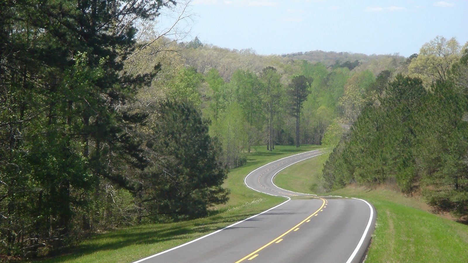
8. Natchez, MS - Natchez Trace Parkway - 430 miles
For those looking to forgo the winding curves in place of a more relaxed ride where a cruiser can eat up the miles, consider the Natchez Trace Parkway ride. With no commercial traffic allowed, the parkway offers steady speeds on smooth roads with no stop signs. Many prefer this route's scenery and vast wildlife to the more contemporary interstate routes. The US Department of Transportation named the Natchez Trace Parkway route as one of America's elite roads, as it follows the path of an 8,000 year old route traveled by Native Americans, Spanish conquistadors, and early American settlers. Not to mention, one can easily exit the Parkway and hit a number of major cities and tourist attractions, like Jackson and Tupelo, MS, or Florence, AL that are only a stone's throw away.
In Natchez (north of Baton Rouge, LA) enter the Natchez Trace Parkway at Liberty Road heading north. The route will continue in its entirety as it snakes its ways northeast to Leiper's Fork, Tennessee, just outside of Nashville. Numerous highways parallel and cross the Parkway at various points, allowing one the opportunity to easily jump off route to hit their desired destination. The start of the ride can be seen on this Google map and you can scroll up to Tennessee.
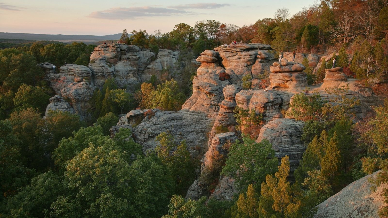
9. Carbondale, IL - Shawnee National Forest Loops - 100 miles
The 100-mile trek through and around the Shawnee National Forest offers numerous sightseeing opportunities among the Illinois Ozarks. Those who have traveled this route make note of the awesome monolith limestone slabs and bluffs, graceful waterfalls, and even a tranquil marina along the Ohio River. If afforded time off of the bike, you can visit attractions such as the Super Museum (in Metropolis, IL naturally) or test your luck on one of the riverboat casinos, like Harrah's. This is an all-around fun route that provides quality roads for riding as well as numerous activities and sightseeing opportunities.
From Carbondale, IL, you have the choice of heading south on US-51 or east on state highway 13 to Interstate 57 south, either of which will lead you to state highway 146. Head east on route 146 across Interstate 24 before exciting north onto state route 147. Highway 147 will lead you into Shawnee Forest and eventually turn into highway 145. When you reach Mitchellsville, take Highway 34 back through the heart of the national forest before rejoining highway 146. Route 146 can then either be ridden back to our starting point, or you can hop onto route 145 south down to Metropolis and the Ohio River. From Metropolis, US-45 can be ridden north to highway 146 before working your way back to Carbondale. Here's a map for you.
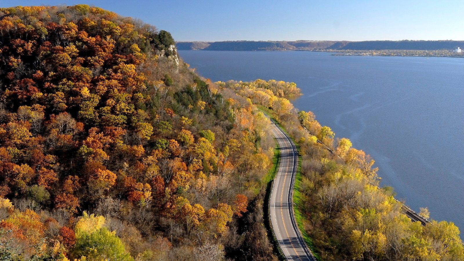
10. Tri-State (MN, IA, WI) Mississippi River Run - 175 miles
The Mississippi River provides great roads, scenery, and amenities, and the Tri-State River Run cashes in on these features. Similar to the Iowa River Run, this lengthy ride stretches along the Mississippi River, but will take you through 3 states (Minnesota, Iowa, and Wisconsin) in a matter of hours. Many claim that the Wisconsin and Minnesota areas of the route provide the best motorcycling roads with a variety of sweepers with equally good scenery. Wisconsin Highway 35 offers a peaceful two-lane road with various shops and restaurants sprinkled in along the way. Overall, riders agree that this is definitely a route to hit if you are in the north-central area of the USA.
The route can be accessed from a variety of locations as it utilizes US Highway 61, and state routes 35, and 26 along the Mississippi River. The loop stretches south down to Lansing, IA and north all the way up to Red Wing, MN, where the boots come from, where you can visit their museum. From Red Wing, take Highway 35 south across the Interstate 90 before joining highway 14. Highway 14 south will once again run into highway 35 which will take you all the way down and across the river to state route 82 west to Lansing. From Lansing, ride highway 26 north until it joins with US Highway 61. US-61 will hug the river until you arrive in Red Wing, MN. You can study the maps here.
If you have a favorite ride in the central part of the country leave the suggestion in the comments, or join the conversation in this forum thread: 10 Great Routes in Middle America (Central Time Zone). Also, to keep your bike in tip top shape for racking up the miles, check out the HDForums How-To section.