When you click on links to various merchants on this site and make a purchase, this can result in this site earning a commission. Affiliate programs and affiliations include, but are not limited to, the eBay Partner Network.
Trying to get some quality mc maps to backup the GPS....I always prefer paper to digital...Anyone recommend a good MC map brand? Ive read a bit about Butler and America Rides Maps...anyone have a preference? Thanks.
I have used mad maps for many years now. Good quality, water proof, and they have scenic rides outlined on them also for the areas of the map. The only downside is I think that they are kinda pricey, but if you buy one they start sending emails to you with up to 25% off your order. Then I�ll buy a few more. Just my two cents.
About every other year I send email requests to the Department of Transportation of all 48 lower states and request an official state road map. Sometimes ya gotta drill down through their website to find where you can request a map.
Trying to get some quality mc maps to backup the GPS....I always prefer paper to digital...Anyone recommend a good MC map brand? Ive read a bit about Butler and America Rides Maps...anyone have a preference? Thanks.
Macvan Maps in Colorado Springs. I use them exclusively. I buy one for every state I plan to be in. They are tough and waterproof.
Just print your map of ride using Google and save a bunch of money.
I do this on long trips, one sheet per day, of the ride
Me too. Although I will do blowups of junction and turn points.
That being said, I did order a Butler map of the Ozarks region for my trip this summer. Also, these days alot of states have free motorcycle route maps they will send you. My state, Virginia, also has a "scenic byways" map they will give you for free. Most of those "byways" are great motorcycle roads.
Sumpin' else I do is to plot out a route in Google Maps, then I take screen shots of the different sections. I also do one of the overall trip, or cut it into a couple different sections if it's a long/big route. I use PhotoShop to save them as huge JPGs...usually about 20 inches wide at 300 dpi. Last, I save them to my Android phone. They are pretty big files, but I've got 64 gig of space on the phone. No problem-oh.
Ya can't get a big overall look at it on the cell phone screen, but with those dimensions and the higher dpi you can zoom in and see plenty of detail to help you find out where you are...or where you aren't, as the case may be. Makes it quick and easy to pull over and check things. Ya don't even have to get off the bike! Plus, a cell phone doesn't fly away on a real windy day on the Kansas/Colorado border just west of Coolidge KS like a paper map does. Don't ask me how I know that.
Ooh! Ooh! It's a good idea to use your graphics app to put fairly large logos on each map indicating which leg of the trip it is. When you're trying to open one for a specific leg of the route, but you have a dozen little thumbnails from which to choose, it is hard to tell what each one is. They all look alike without a label when they're that small. Don't ask how I know that, either. Here's a low-res example:
I use a mix of Butler maps, the free maps provided by AAA, and prints of google maps. My bike has GPS, and it's helpful for getting to a specific address, but I prefer to do my trip planning on paper.
Slideshow: Jason Momoa's latest restoration project blends 1920s Harley-Davidsons with modern electric technology, creating some of the most unusual hybrid motorcycles ever built.
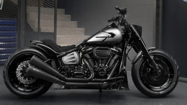
Harley-Davidson Fat Boy Becomes a Dark, Decepticon-Inspired Custom
Slideshow: Killer Custom's latest build relies on styling changes rather than performance upgrades, giving the cruiser an entirely different personality.
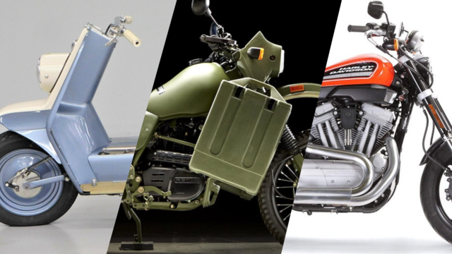
7 Surprising Harley-Davidson Products that Are Not Motorcycles
Slideshow: The bar-and-shield logo shows up on far more than motorcycles, some of the company's most unexpected products have nothing to do with riding.
Slideshow: From the troubled AMF years to modern misfires, these bikes earned reputations for reliability issues, questionable engineering, or disappointing performance.
Crazy Bunderbike Build Looks Amazing, But Is It Impossible to Ride?
Slideshow: The Swiss custom shop has taken a Harley Softail and stretched it into something so long and low that it looks closer to a rolling sculpture than a conventional motorcycle.