


Zion Nat'l Park
Thread Starter
|
Outstanding HDF Member
Joined: Jun 2006
Posts: 2,812
Likes: 0
From: Ak-Tenn
Hi Folks- Some buds and I are planning a trip where we'll all meet in Moab, Utah and then scoot over to Zion National Park. Any do's and don'ts to be had out there? Motels in the Park area. Is it as beautiful as we've heard? Thanks-AK
Grand HDF Member


Joined: Oct 2004
Posts: 3,842
Likes: 502
From: Northern WV
What month are you going? May would be nice, July and August are very hot, except for the higher elevations.
FWIW from Moab I would head down 191. Take the short side road out to Needles Overlook. Then continue down 191 to 211 , and another short side road to Newspaper rock. Below Blanding take 95 to Hanksville. From there, 24 to Torrey. BTW there's not much in the way of lodging in between Blanding and Torrey. Highway 12 from Torrey to 89, and down 89 to Zion. Make sure you take your hiking shoes and take a hike up to Angles Landing, in Zion, and report back!
FWIW from Moab I would head down 191. Take the short side road out to Needles Overlook. Then continue down 191 to 211 , and another short side road to Newspaper rock. Below Blanding take 95 to Hanksville. From there, 24 to Torrey. BTW there's not much in the way of lodging in between Blanding and Torrey. Highway 12 from Torrey to 89, and down 89 to Zion. Make sure you take your hiking shoes and take a hike up to Angles Landing, in Zion, and report back!
Tourer

Joined: Feb 2009
Posts: 318
Likes: 0
From: Houston area
Definitely take in Arches Nat Park while in Moab. Depending on which way you go, Bryce Canyon is on the way and worth the stop.
If you take ridewva's advice and do go down to Blanding, you're not too far from the Fours Corners. Not much around it but it's the only place in the U.S. where you can stand in 4 states at once (UT,CO,NM,AZ) good photo op. Again, depending on route, Monument Valley, (not far from 4 corners) where all the old John Wayne westerns were filmed is pretty neat to see.
Went to Zion last May from Texas and hit 4 corners and came through Monument Valley on 163 (north to south), pretty awe inspiring. On down through Page, AZ good sized dam there/pretty scenic ride, into Kanab UT southeast of the park where we stayed and stashed the gear. Plenty of motels/camping and only about 20 mi from Zion.
Be advised, no vehicles allowed in the park itself past the visitor center. Due to heavy traffic, they banned vehicles several years ago and to see the various sights in the park you have to take the free shuttle bus which you can get on and off at will.
Great riding all around there and the park is something to see. Make sure you come through the east entrance Hwy 9, which you should coming from Moab. Great twistys, tunnels and view points.
Again, don't know about your time frame or if you've been there but Zion to the N. Rim of the Grand Canyon is an easy ride (about 100 mi) and well worth the trip on great roads. However, the road down to the rim from Jacob Lake, AZ usually doesn't open till the 2nd or 3rd week of May due to snow etc. Also, as you might guess it can be cold as its aorund 7,000 ft.
Enjoy the ride, wish I was going back!
Thread Starter
|
Outstanding HDF Member
Joined: Jun 2006
Posts: 2,812
Likes: 0
From: Ak-Tenn
We'll be there in mid-July, packing lots of water I think, and have plans to also go down/over to 4-corners for the obligatory photos of spanning 4 states at once. Thanks both of you guys for the detailed input!!
I think due to time constraints I'll ship my bike down this time to Seattle but then ride it back home.
I think due to time constraints I'll ship my bike down this time to Seattle but then ride it back home.
Tourer
Joined: Jul 2006
Posts: 403
Likes: 0
From: Antioch, CA
For hotels at Zion, your best bet is outside the west entrance. Arches NP outside Moab is a must see. Also between Bryce Conyon and Zion you will pass through Red Canyon State Park. Definitely worth a stop and short walk about.
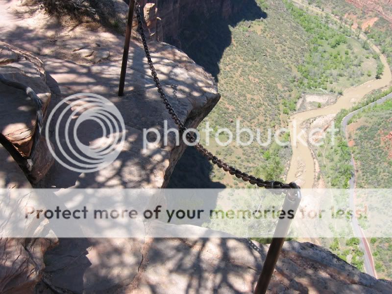
Angels Landing...not for the faint of heart or those with acrophobia (fear of heights). Plan on an early start, take lots of water, and food with you and allow at least 4 hours. Walters Wiggles are an adventure in their own right.
Angels Landing...not for the faint of heart or those with acrophobia (fear of heights). Plan on an early start, take lots of water, and food with you and allow at least 4 hours. Walters Wiggles are an adventure in their own right.

Advanced
Joined: Aug 2008
Posts: 70
Likes: 0
From: SE Texas
Dittos on Arches NP (don't miss Delicate Arch), Needles Overlook (I was here early in the morning and no one else was there for at least a couple of hours, it was GREAT), Monument Valley (going to have to take this with a guide, road is a soft sandy road), and North Rim Grand Canyon (less crowded than South Rim, beautiful drive). I would like to add Dead Horse Point, Island in the Sky, and if you get down near Page, AZ., Antelope Canyon is great. I was out there several years ago (in my pick-up, no scooter then), didn't make it to Zion, But I'm going to go back out there someday soon, I hope! Would like to go up your way someday also!

Outstanding HDF Member
Joined: Sep 2006
Posts: 2,380
Likes: 14
From: Atlanta
The guys above know much more about the area than I do, but I can only add this: it is actually much more beautiful than you imagine! 
Trending Topics
Grand HDF Member
Joined: Oct 2004
Posts: 3,842
Likes: 502
From: Northern WV
HD Forum Stories
The Best of Harley-Davidson for Lifelong Riders

7 Surprising Harley-Davidson Products that Are Not Motorcycles
Verdad Gallardo
8 Best Harley-Davidson Motorcycles Ever
Pouria Savadkouei
10 Worst Harley-Davidson Motorcycles Ever
Pouria Savadkouei
Killer Custom's Jail Break Is The Breakout That Refused to Blend In
Verdad Gallardo
Crazy Bunderbike Build Looks Amazing, But Is It Impossible to Ride?
Verdad Gallardo
Harley-Davidson Reveals Super Cool Cafe Racer Concept
Verdad Gallardo
Engraved Rebellion: Inside Bundnerbike's Glam Rock II
Verdad Gallardo
10 Motorcycles You Should Never Buy
Joe Kucinski
10 Things Harley-Davidson Needs to Fix in 2026
Verdad Gallardo
Road Master
Joined: Oct 2007
Posts: 894
Likes: 3
From: Wyalusing, PA
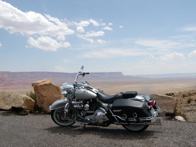
Make a note...12th annual Thunder on the Mountain Rally in Brian Head, UT July 17-18 and just up the road from Zion. You can count on about any kind of weather in those parts. You're on a high desert plateau and it can be hot as blazes around Page, AZ and chilly with rain/hail up closer to the mountains.
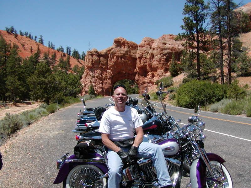

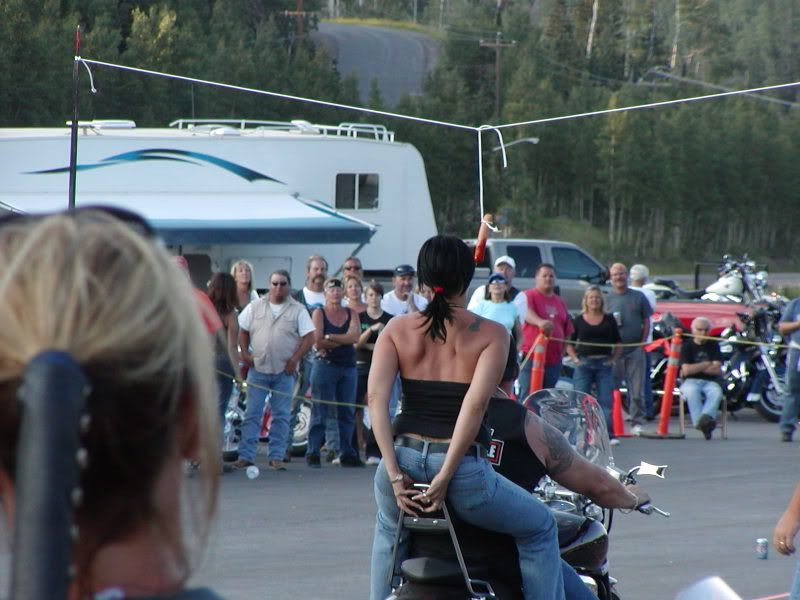
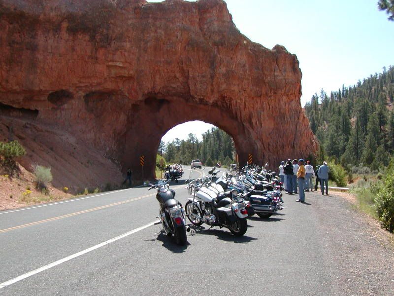
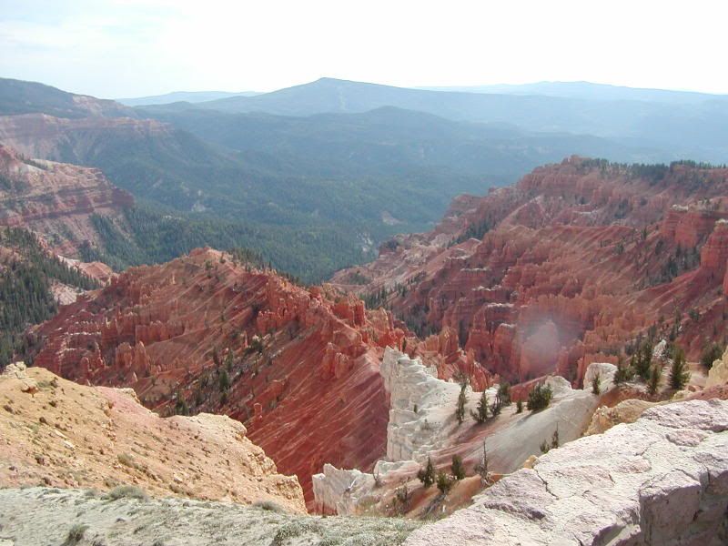
Some Rally Photos
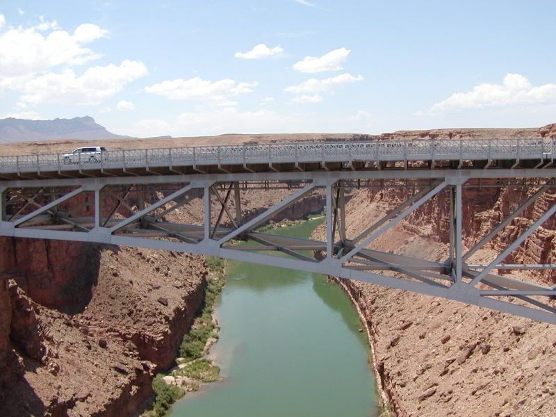
Navajo Bridge over the CO River just below Page, AZ and the Glen Canyon Dam
This is looking across the CO River Basin south of Zion and north of the Grand Canyon.
Zion Natl Park
Some Rally Photos
Navajo Bridge over the CO River just below Page, AZ and the Glen Canyon Dam
This is looking across the CO River Basin south of Zion and north of the Grand Canyon.
Zion Natl Park
Road Warrior
Joined: Jun 2007
Posts: 1,600
Likes: 2
From: Windsor, CO
Jim's given some great shots ... but it's better in person. I live in Cedar City, UT, so I get to ride this area all the time. Biggest thing I'd tell you is that in July the ride to Hanksville and to 4 corners can be awfully dang hot. Look for temperatures into the 100 range. Biggest problem is the super low humidity (under 10% most days), which means that you'll lose water fast.
Here's a few shots to help as well. This first one is just off Highway 12 near Boulder, UT (elevations over 8500 feet in many spots) ...

If you're going to run from Moab then you'll likely want to cut over on Highway 12 at some point to Highway 89. Just in case, though, if you do decide to come west on I-70 before cutting back south then here's a shot of one of my favorite spots south of I-70 on Highway 89 ...
This is the original Big Rock Candy Mountain (yeah, the one in the song) ...

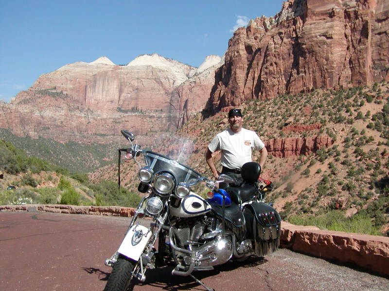
This next one is a short off Highway 14 which runs from 89 over Cedar Mountain into Cedar City (where I live) ... you can see from here into Zion National Park in the background ...

Here's another shot just off Highway 14 east of Cedar City ...

I think this next one is near Marysville, UT, which is on Highway 89 (you'll be around here as you come off Highway 12) ...

As for hotels/motels ... the prices are usually not too bad. We've got LOTs of places here in Cedar that will run you from around $35/night to $100+/night. Major chains and some mom and pops. Prices near Zion will higher since it's obviously drawing more tourist.
There can be a huge difference in temperature in just a few miles. For instance, the St. George area (on the UT/AZ border) is only at 2000 to 2500 feet in elevation, so the temps will be scorching hot (high 90s) in July.
Zion is a higher elevation, so average temps in July will be lower 90s.
Cedar City, just 45 miles north of St George, sits at 6000 feet with peaks east of me running up to 11,000 feet. Average difference in temp between St George and Cedar is 15 degrees. Temps at 9000+ will drop another 15 degrees easily.
Here's a few shots to help as well. This first one is just off Highway 12 near Boulder, UT (elevations over 8500 feet in many spots) ...
If you're going to run from Moab then you'll likely want to cut over on Highway 12 at some point to Highway 89. Just in case, though, if you do decide to come west on I-70 before cutting back south then here's a shot of one of my favorite spots south of I-70 on Highway 89 ...
This is the original Big Rock Candy Mountain (yeah, the one in the song) ...
This next one is a short off Highway 14 which runs from 89 over Cedar Mountain into Cedar City (where I live) ... you can see from here into Zion National Park in the background ...
Here's another shot just off Highway 14 east of Cedar City ...
I think this next one is near Marysville, UT, which is on Highway 89 (you'll be around here as you come off Highway 12) ...
As for hotels/motels ... the prices are usually not too bad. We've got LOTs of places here in Cedar that will run you from around $35/night to $100+/night. Major chains and some mom and pops. Prices near Zion will higher since it's obviously drawing more tourist.
There can be a huge difference in temperature in just a few miles. For instance, the St. George area (on the UT/AZ border) is only at 2000 to 2500 feet in elevation, so the temps will be scorching hot (high 90s) in July.
Zion is a higher elevation, so average temps in July will be lower 90s.
Cedar City, just 45 miles north of St George, sits at 6000 feet with peaks east of me running up to 11,000 feet. Average difference in temp between St George and Cedar is 15 degrees. Temps at 9000+ will drop another 15 degrees easily.